1971 Summer Geology Programme – Gwynn Davies
The 1971 summer season geological programme in the northern part of Palmer Land was a continuation eastwards of the 1970 Season, which included Mount Edgell and along the south side of the Fleming Glacier to the Eternity Mountains.
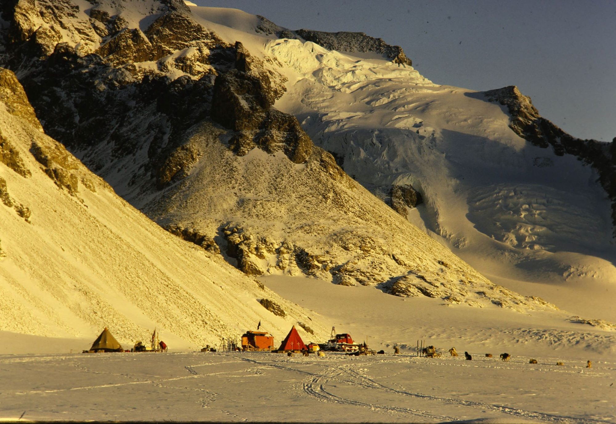
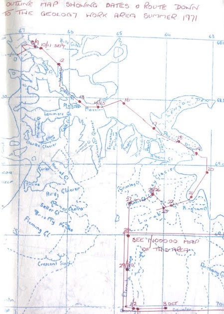
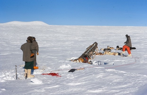
Due to the very soft snow surfaces and slow progress on the plateau during the 1970 journey to the work area, a decision was made to travel to Palmer Land via the east coast. Sledges Delta (Nick Culshaw with the Terrors and Neil Macalister with the Debs) and Alpha (Gwynn Davies with the Ladies and Jim Woodhouse with the Players) set out from Stonington on 8 september 71 and travelled to the work area via Sodabread, the Beehive, Wyatt Glacier, Gibbs Glacier, Mercator, Larsen Ice Shelf, Hollick Kenyon Peninsula, and the Lurabee Glacier.
Unfortunately, half way up the latter we encountered extensive crevassing hidden under large sastrugi and after two incidents took a long way round via Hogmanay Pass, Sunfix Glacier, Davies Top, Charity and on to the Deumlar depot which was reached on 3 October.
The journey of 279 miles took a total of 26 days with 7 lie up days.
At the Duemlar depot we found that 50 nutty boxes out of the 80 had blown away, with no sign of them and it was decided that Sledge Alpha would continue the work programme in the area while Sledge Delta travelled to Fossil Bluff to restock until the plane arrived in December. Whilst returning from Fossil Bluff to the East Coast work area, Sledge Delta met with Glaciologists from the Bluff who had discovered fossils at Carse Point in King George VI Sound and stayed to map the area; on completion Sledge Delta took the specimens collected back to the Bluff to be flown out at a later date. They then made their way back to Duemlar Depot via the Otter Glacier, Castle Rock, St Valentines Depot and Charity Depot and continued working the area and conducting a reconnaissance for the next season.
Meanwhile Gwynn Davies completed the geological mapping of the Eternities Range, Mount Sullivan and Engel Peaks and Jim Woodhouse provided the continuation of the Plane Table mapping which Rod Pashley had completed the year before.
Total miles covered in the area was 672.8 over a total period of 97 days with 41 days of lie-up.
Details of the geology and mapped areas for the 1970 and 1971 seasons are included in BAS Scientific Report No 103, The Geology of Part of Northern Palmer Land as below:
Gwynn Davies Report Plane Table Maps by Rod Pashley and Jim Woodhouse
Gwynn Davies, Geologist, Stonington 1970 and 1971