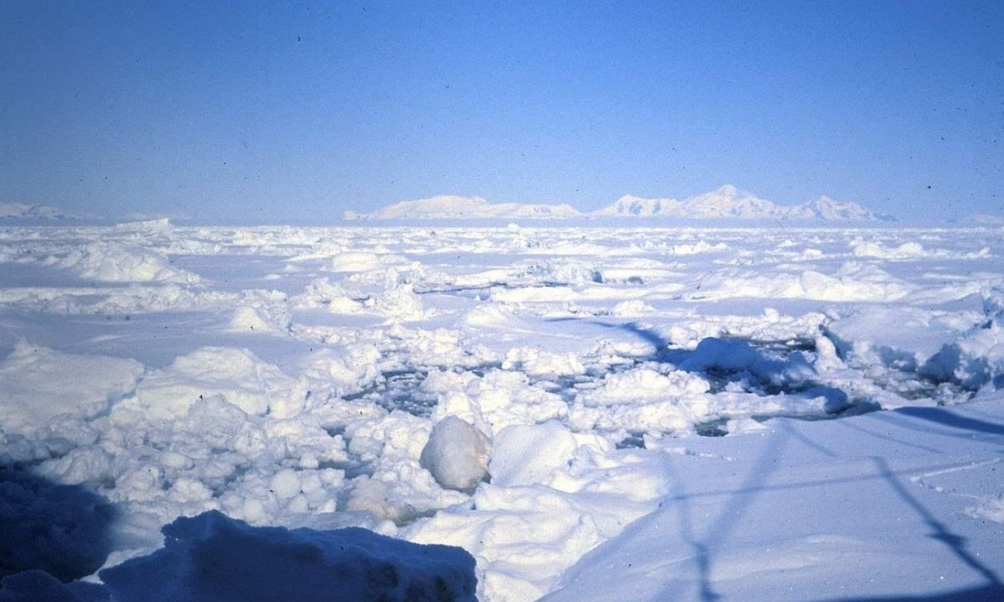
Header Photo: The Most Beautiful Place on Earth (Photo: Keith Holmes)
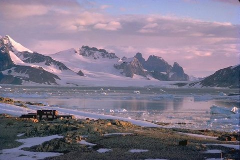
Marguerite Bay and Stonington Island – Jonathan Walton
British Graham Land Expedition – 1934-37
The story of BGLE is fully recounted in John Rymill’s book “Southern Lights” (recently republished by UKAHT). It is very much a bridge between the “Heroic” era of Antarctic exploration, up to about 1922 and the modern age (from 1939 onwards).
BGLE was both an exploratory and a scientific expedition and was the first expedition to make use of modern communication, having radio communication with the rest of the world throughout its 2 year duration. It set a pattern of living and working in the Antarctic which influenced all the expeditions that followed, especially Operation Tabarin and FIDS. Indeed, many aspects of their field work are still followed today by BAS, more than 80 years after BGLE returned home.
Transportation to the Antarctic was in an elderly three-masted sailing ship christened the Penola, which had an unreliable auxiliary engine. The expedition spent 2 winters in Antarctica. The first was in the Argentine Islands, further North on the West coast of the Peninsula.
When they realised it was impractical to dismantle this hut and re-erect it for their second winter they quietly nipped up to the abandoned whaling station in Deception Island and “borrowed” some timber that had been left in neat piles on the foreshore. They then sailed South and built the base for their second winter in Marguerite Bay – on the Debenham Islands, about 5 miles North of Stonington Island.
USASE – Stonington Island “US East Base” – 1939-41
Tiny Stonington Island has played an important role in the exploration of the Antarctic Peninsula since the early 1940s. It was named after the small port of Stonington in Connecticut, the home of Nathaniel Palmer who was a very influential early Antarctic sealing captain in the early 1820s.
In 1939, America built “East Base” on the island which was occupied until early 1941 and was commanded by Captain Richard Black. This was the sister base of “West Base” on the Ross Ice Shelf, commanded by Admiral Richard E Byrd. Both Bases were established as a part of the United States Antarctic Service Expedition.
They carried out a lot of interesting work and two of their number. Finn Ronne and Carl Eklund achieved a massive unsupported sledging journey across Marguerite Bay’s sea-ice to George VI Sound’s ice shelf, discovered a few years earlier by BGLE. They also recce’d a route inland from their base and across to the East Coast of the peninsula. They sledged the whole length of this Ice shelf as far as what is now known ad “Eklund Island” at nearly 73deg South. They were the first to prove conclusively that Alexander I land, named after a Russian Czar by Thaddeus Von Bellingshausen in the early 1820’s should be correctly named Alexander Island.
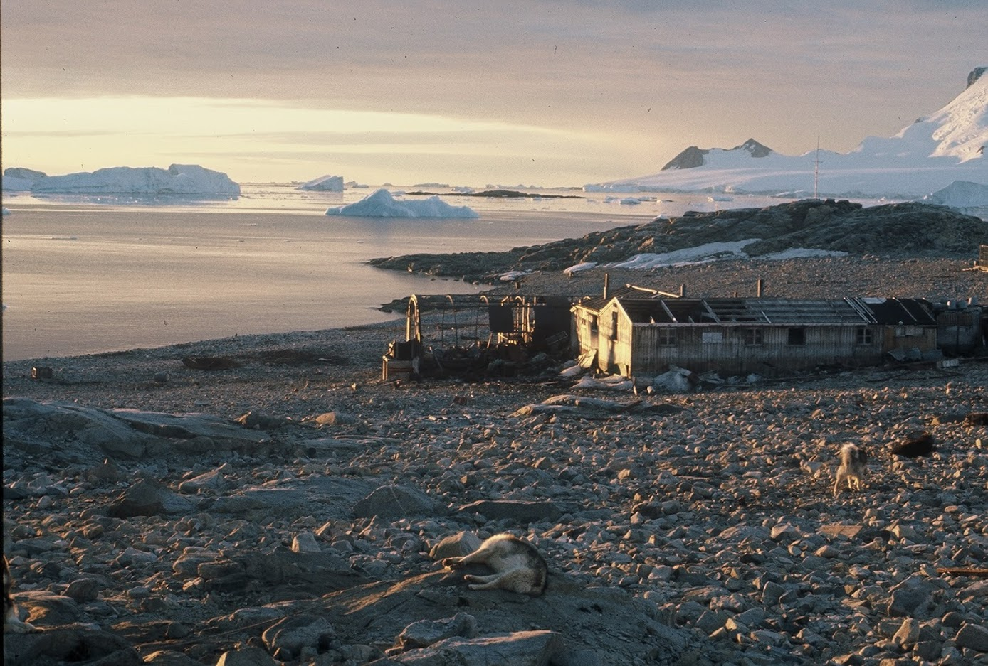
The base was abandoned in a hurry in 1941. The firsts FIDs appeared in this area in February 1946 having been given firm instructions to build another building on this tiny island. While it seemed crazy to have two bases only a few hundred yards apart, Stonington had the unique distinction of being the only location along this stretch of coast from which one could travel straight on to the mainland without requiring any sea ice. When FIDs arrived it was clear that East base had been “gone over” by various visitors since it had been abandoned – they had left doors open and generally created quite a mess. This meant that East base in January 1946 was full of snow and ice and totally uninhabitable.
See the full story of USASE HERE
In addition, the story “The Dogs of East Base”, sent in by Neil Marsden, relates in detail the sad story of the USASE dogs at Stonington in 1941. Neil was intrigued by a paragraph in Jenny Darlington’s book, “My Antarctic Honeymoon” plus a brief sentence in Kevin Walton’s book “Two Years in the Antarctic” relating to the dogs of the USASE in 1941.
Further research unearthed the comprehensive report by Joan Bryner. This is quite a long report and worth persevering with; however the evacuation of Stonington begins on page 37 and details the fate of the dogs – Read on HERE“
FIDS – Stonington – “Base E” – Winter 1946 and 1947
The ship Trepassey arrived at Stonington Island on 22nd February 1946. The small vessel was grossly overloaded and in due course everything was delivered ashore. First task was to de-ice and clean up the American huts so that all the FIDs could shelter there while they were building their own base. At this stage it was still “Operation Tabarin”.
This temporary occupation meant that Trepassey could be released for work elsewhere as soon as possible – it also meant that building work could progress despite the vagaries of wind and weather. It was sited about 200 yards from the American buildings and “moving-in” day was in late March. They continued to make good use of the spacious American building as a sledge building and tent repair workshop making sure it was kept in good order.
Sadly in early 1947 warships belonging to both Chile and Argentina visited base E, the crews were let ashore and “The American huts were reduced to a state far worse than that in which we had found them a year before” (Walton, Two years in the Antarctic).
Ronne Antarctic Expedition – Winter 1947
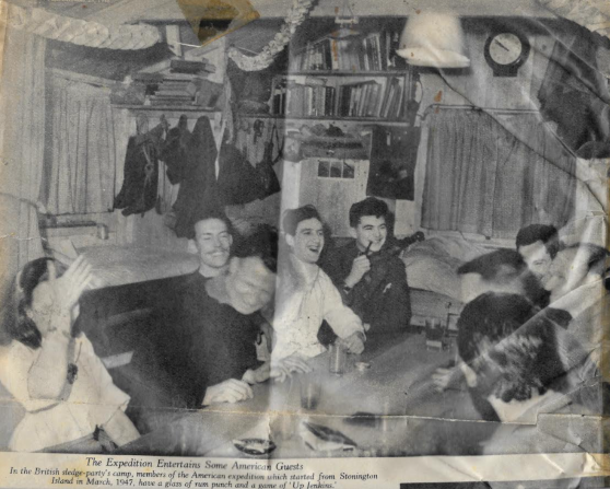
This expedition arrived at Stonington in March 1947, expecting to occupy East Base. This group included 2 women, married to the leader and deputy leader respectively, who were to be the first females to spend a winter in Antarctica. Their Leader Finn Ronne refused to believe that it was not the British that had created havoc in the base and life became rather difficult with a “no fraternization” order applied by Ronne. When he visited the British hut, he stated that their base was so clean and tidy that it was clear that they hadn’t lived in it for the last year but had been occupying the East Base – an observation that the FIDs accepted as a great compliment. However, harmony resumed and the Americans with their considerable air support and the FIDs with their well established overland travel capability worked together very effectively for the year.
US – UK Cooperation – Picture Post Magazine, 1948 – Kevin Walton
“The most difficult part of one’s return from Antarctica is to convince people that life down South, with its very generous allowance of cold and snow, is not now full of the hardship and discomfort connected so rightly with such names as Scott and Shackleton. And the purpose of this article is to pay tribute to men of all nations who were there before us, whose carefully recorded experience has laid the foundations of modern Polar life.
Two and a half years of life cannot be compressed into a few paragraphs, so I intend to try and answer several questions typical of many that I have been asked. We were eleven men in a base, in a hut that we built ourselves in the Antarctic, and the answers can come from there. How was it, people say, that the cold and rigour of the climate did not affect you as much as it did others in days gone by?
Stonington – FIDS – Winters 1948, 1949
These 2 winters were under the leadership of Vivian Fuchs, the new Director of FIDS. Unfortunately the sea ice meant that in 1948 it was impossible for the relief ship to reach the base so the FIDs were stuck for an additional winter – this meant that for some of them they were in the Antarctic for 3 successive winters. Because of the vagaries of the sea ice and the uncertainty of being able to relieve the base each year it was considered inadvisable to keep Stonington open any longer so in 1949 the base was closed.
1961: Base re-opens
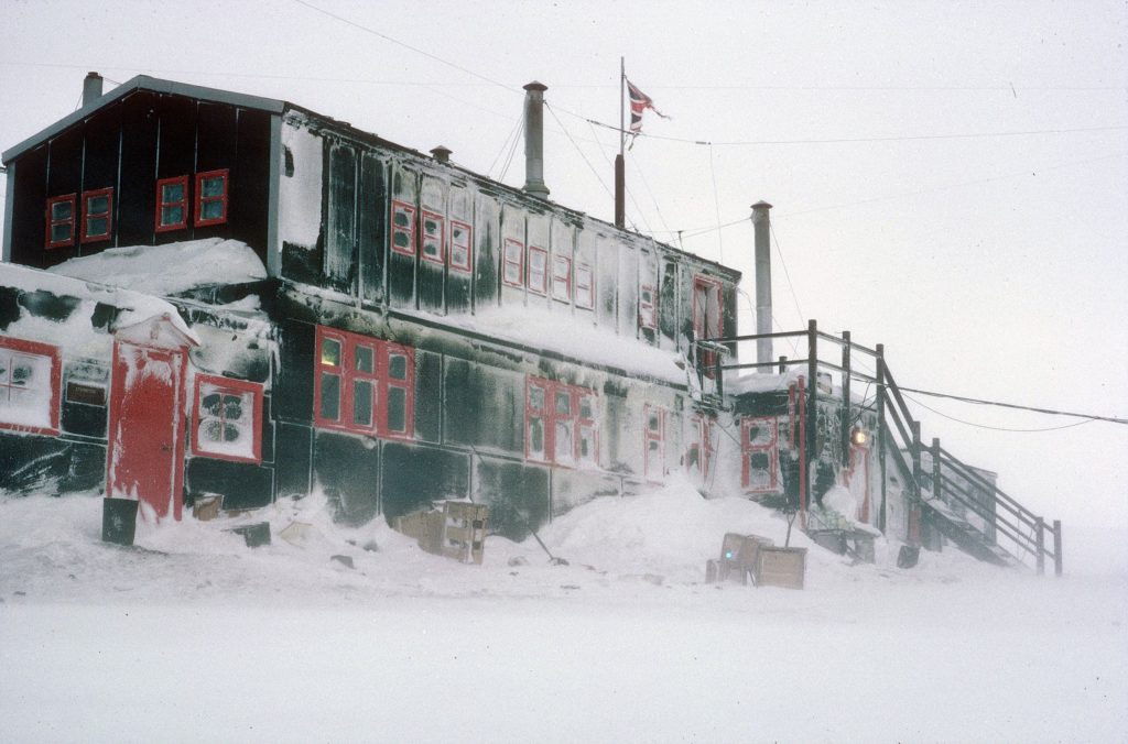
The station was re-sited when a new main hut was erected in March 1961. The new hut was the first two-storey building to be erected by FIDS. Two single-storey extensions were added, one in 1965, and another begun on 27 Jan 1972. Buildings from East Base were also used as workshops and stores. These were known as Passion Flower Hotel, Jenny’s Roost and Finn Ronne. The Base hut was cleaned up and repaired in 1992, and apparently the UKAHT counted the paperbacks there!!
Historic sites
A protected area on the island consists of the buildings and artifacts at East Base (with their immediate environs) that were erected and used during the two US wintering expeditions. The size of the area is about 1,100 yards (1,000 m)north-south, from the beach to Northeast Glacier adjacent to Back Bay, and 550 yards (500 m) east-west. It has been designated a Historic Site or Monument (HSM 55) following a proposal by the US to the Antarctic Treaty Consultative Meeting (ATCM). Base E is also considered to be of historical importance in relating to both the early period of exploration and the later BAS history of the 1960s and 1970s, and it has been similarly designated a Historic Site or Monument (HSM 64) following a proposal by the United Kingdom to the ATCM.
1960s and 1970s
The Story of Sodabread
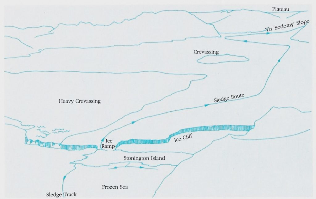
Stonington during the 1960s and 1970s was the base for exploration to the South, and two routes existed to reach the geological, geophysical and topographic survey areas – over the sea ice, or via the Antarctic Plateau.
The route to the Plateau from Stonington was via the Northeast Glacier, and up the glacier icefall commonly known as Sodabread.
In Sir Viv’s book (“Of Ice and Men”) he wrote that Sodabread Slope was a name used by BGLE in 1946, substituted from “Sodomy Slope”, and that Sodomy Slope was a pseudonym for “an even ruder name”.
However, Keith Holmes (Stonington, 1965 and 1966) writes:
For some reason, Sodabread remains an unofficial name, despite its huge significance in the exploration of the Antarctic Peninsula, but, in his definitive account of Antarctic Place-names,[1] Geoffrey Hattersley-Smith did quote Kevin Walton’s retrospective use[2] of Sodabread Slope. Dick Butson also used it the published version of his 1947 diary[3]. Sodabread, (and Soda Slope[4]) were, in fact, euphemisms for the colloquial expression Sodomy Slope,[5],[6]. Read on….
And, Roger Scott (Stonington, 1973 and 1974) writes:
The name always seemed a bit odd for what is a very steep slope for access to the plateau. What has a steep snow slope to do with bread made without yeast?
As far as I can remember I was told the ‘potential’ origin of the name from Kevin Walton on Bingham’s BGLE in the winter of 1936. I say ‘potential’ as I cannot think of anyone else of my acquaintance who would have had any knowledge of the slope and its name. I used to visit Kevin regularly during the time he was putting together the words and photographs for “Dogs and Men”.
Winters:
1946
| Bingham, E.W. (Ted) | Base Commander |
| Freeman, R.L. (Reg) | Surveyor |
| Joyce, J.R.F. (John) | Geologist |
| Mason, D.P. (Douglas) | Surveyor |
| Pierce-Butler, K.S. (Ken) | WOM |
| Sadler, W.M. (Mike) | GA |
| Salter, W. de C. (Willoughby) | Meteorologist |
| Slessor, R.S. (Stewart) | Medical Officer |
| Tonkin, J.E. (John) | GA |
| Walton, E.W.K. (Kevin) | GA |
Topograhic Survey
Freeman and Mason
The surveyors established a 17 star position line fix at Stonington, mapped the island at 1:2,000 and carried out sledge wheel and compass survey of adjacent mainland coast and peaks. Nov 1946 Doug Mason travelled north on Plateau to 66.5S and concluded Plateau weather and topography was unsuitable for triangulation and air photo control. March 1947 a route over the plateau to the Larsen Ice Shelf was proved and mapped at 1:250,000
From a baseline on the sea-ice, Reg Freeman observed and beaconed a triangulation scheme for a local map at 1:20,000 scale, including soundings through the sea-ice.
Richard Barrett – Survey Stonington 1974
“Arrivals and Departures” – Kevin Walton
It was March 25, 1946 and midday, the sun was high in the northern sky for we were well South of the Antarctic Circle. It was stllly calm and in actual fact not very cold. Our expedition ship MV Trepassey sounded her farewell on the foghorn and nosed her way out of her sheltered anchorage, headed for the open sea, passed behind the point of Neny Island and was gone.
There we were, 10 men and 35 dogs – now entirely on our own. We were truly and utterly isolated.
In fact, in that year we were the only people planning to overwinter South of the Antarctic Circle and on the continent itself. In our area on the West side of the Antarctic Peninsula we did not have the same sense of vastness as those parts of the continent connected with the historic names of Amundsen, Scott and Shackleton. We had no huge glaciers stretching into the distance with a hint of high mountains on the far horizon; we had no miles and miles of floating ice shelf thousands of feet thick with 100ft ice cliffs that made getting ashore almost impossible.
In spite of this the sheer scale of things was for me as great as I have ever experienced in the world before or since.
It was austere, it looked very cold and to my eyes, very wonderful. 12 miles to the East was the main spine of the Antarctic Peninsula; a plateau some 6,000ft high filled the horizon from North to South. From our island base we had our own glacier that appeared to provide a smooth easy highway right up to the plateau. (How wrong we were in fact about the easiness of the route to the plateau for the glacier was a treacherous highway full of crevasses and it formed a funnel for hurricane force winds that would rise in minutes out of a clear blue sky lifting snow and drift, making life impossible and then depart just as quickly). To the West it was all open water flecked with white specks that were floating icebergs and the dark underside of the clouds indicated that this open water stretched many miles beyond the visible horizon.
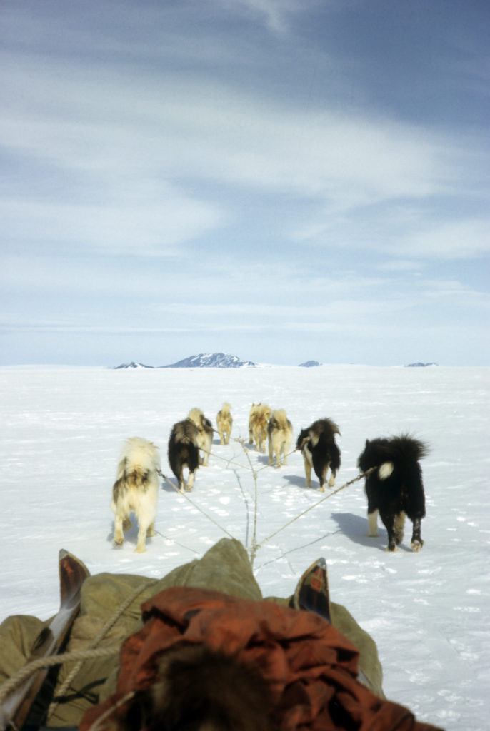
We were a group of men who were voluntarily isolating ourselves on this small island connected rather precariously to the Antarctic mainland; alone that is to say apart from the 35 huskies that we had brought with us; a motley collection, largely untrained and often misfits that had been picked up in ones and twos from the Inuit or trappers of Labrador who, in many cases were glad to be rid of them for reasons of their own.
‘Rover’ and the ‘Orange Bastards’ – Kevin Walton
Under Ted Bingham’s guidance, I chose ‘Rover’ as my lead dog for the ‘Orange Bastards’ and took him out regularly with ‘Darkie’ so that he became familiar with the sound of the commands and what they meant. Learning to steer a compass course was a vital stage in the training procedure: while shouting “Irra” (left), I would flick a 40 foot whip out a few feet to his right, and this made him instinctively veer to the left. With care and constant practice he learnt to hold a course with only occasional prompting, for miles and hours on end.
Lessons from Accidents – Kevin Walton
Some days in Antarctica were especially memorable and such days invariably involved the dogs. These two stories are brief records of two accidents, both of which could easily have been fatal, which taught us lessons we never forgot. One must never walk ahead of a dog team on a glacier and the other was one in which the training of the dogs to drive on a bearing was the reason for the successful outcome of what normally would have had a bad ending.
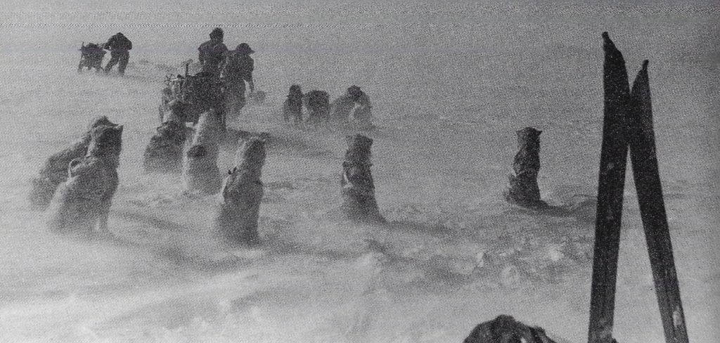
On August 27th 1946 we were ferrying loads up the Northeast Glacier from Stonington Island to a dump four miles away. Loads were not heavy, there was new snow heavily cut about by the wind, crevasses were well covered and there was no track to follow.
We were only a few hundred yards up the ramp that took us from the Island on to the glacier. The usual line skirted the heavy crevassing on the left and passed about 100yards above the 50ft ice cliff in “Back Bay”. There were 3 teams, with John Tonkin and Ted Bingham in the lead and the day was fine. John’s dogs heard the howling of the dogs on base and as there was no track to follow they decided it would be more fun to bear to the right and take the direct route home.
Early Days at Stonington Island, “Base E”- Kevin Walton (in 1996)
It must be remembered that Stonington Island was only named in 1941 and the term “Base E” was only used from 1946 onwards when FIDS built their base on the island. In the text of “Of Dogs and Men” the chapter on the use of huskies on earlier Antarctic expeditions ended in 1937 with the BGLE. No mention was made of the United States Antarctic Service Expeditions of 1941-42. This omission was intentional for in 1945 when the first of the FIDS expeditions went South there were no records available about what the Americans had achieved. All we knew was that 2 bases had been established, one on the Ross Ice Shelf on the other side of the Continent, near to their 1928/34 bases of “Little America” and one on Stonington Island, on the Antarctic Peninsula, 6 miles South of the Southern base of the BGLE.
When we headed South in Trepassey in 1946 we found the 1941 huts on Stonington still standing
and, apart from being filled with blue ice where doors had been left open, they were in a remarkable
state of preservation. Much of the American equipment was lying around and it was clear that the
place had been “gone over” by visiting ships before we arrived – which explained why the doors had
been left open.
‘Darkie’ – Kevin Walton
(Photo: Kevin Walton)
Trained by Ted Bingham, ‘Darkie’ was the very first team leader at Stonington. He was a ruffian of a dog to look at, with a torn ear, and must have seen a lot of fighting in his youth. But it soon became very apparent that he had excellent eyesight, was very sensitive, and very, very intelligent. Once he was trained to Bingham’s satisfaction, it was relatively easy to use him to teach other leaders. He set a remarkably high standard for them to follow. In 1949 Vivian Fuchs inherited him as a leader. He wrote in his journal that year:
“It was interesting to observe Darkie’s technique when he sensed danger. He advanced cautiously, somewhat in the fashion of a heraldic lion or leopard, each paw each paw extended as far as possible to test the surface in front of him. In this way he found every crevasse and successfully crossed the majority, whereas those behind went blundering into them in spite of the obvious holes he had made. Others would suddenly dash sideways to avoid an imaginary crevasse which was no more than a surface marking in the snow, which Darkie had ignored. Indeed with him ahead, whether be it on glacier on thin sea-ice, I can move forward with the greatest of confidence….”
‘Mukluk‘ – Kevin Walton
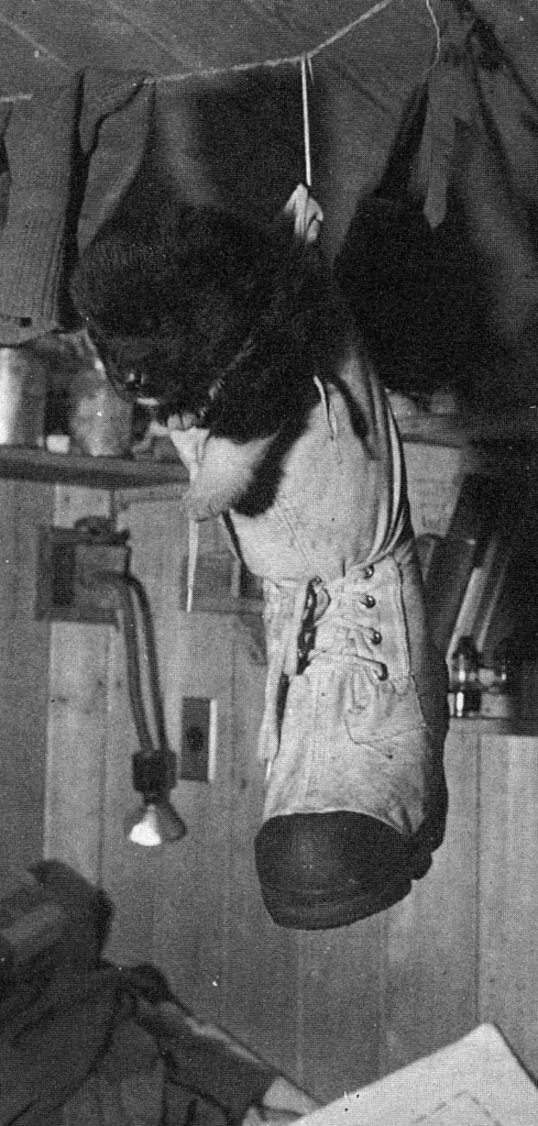
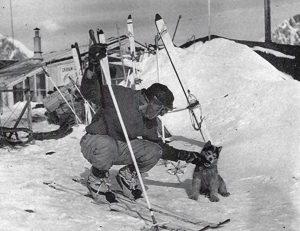
Naming as many as 30 puppies a year was a difficult task and frequently became the cause of fierce arguments.
This one was easy enough, though! She was born unexpectedly in a blizzard, and when we found her she was very cold. We popped her into one of our mukluk boots and hung it above the stove.
“Mukluk” grew up to be a splendid, though timid, breeding bitch.
Kevin Walton, GA – Stonington, 1946 & 1947
1947
Base Commander – K.S. Pierce-Butler
| Butson, A.R.C. (Dick) | Medical Officer |
| Freeman, R.L. (Reg) | Surveyor |
| Jones, H.D. (David) | Air Fitter |
| Mason, D.P. (Douglas) | Surveyor |
| McLeod, K.A. (Ken) | Handyman |
| Pierce-Butler, K.S. (Ken) | Base Commander |
| Randall, T.M. (Terry) | WOM |
| Stonehouse, B. (Bernard) ** | Meteorologist |
| Thomson, W.H. (Tommy) | Pilot |
| Tonkin, J.E. (John) | GA |
| Walton, E.W.K. (Kevin) | GA |
Topographical Survey
Freeman and Mason with RARE
In March 1947, the private US Ronne Antarctic Research Expedition under Finn Ronne reoccupied the old USASE buildings at Stonington and after some discussion instigated a RARE/FIDS survey party under Doug Mason.
The 4 man party supported by RARE planes sledged down the east coast from 68s to nearly 75s where the Bowman Peninsula meets the edge of the Ronne Ice Shelf, travelling 1930km in 105 days. Exploratory surveying by sledge wheel and compass with sun azimuths at camp sites and minor details fixed by compass bearings. Aneroid heights were supplemented by sea level reading in rifts in the ice shelf. Panoramic photographs were taken at survey stations which proved invaluable when plotting the maps back in the UK. Features on the existing maps were found to be up to 80km in error.
Dec 1947 Reg Freeman led a party to Three Slice Nunatak to meet the Francis party, sledging and surveying south from Hope Bay, and led them back to Stonington.
(The RARE aerial photography was not made available to BAS until 1957.)
Richard Barrett – Surveyor, Stonington 1974
A typical day at Base E, 1946/7 – Kevin Walton
The relationship between dogs and men in the Antarctic is inextricably linked with the quality of life that exists at the base. The closeness of living, particularly with only the wooden walls of the hut separating the men from the dogs outside is part of life.
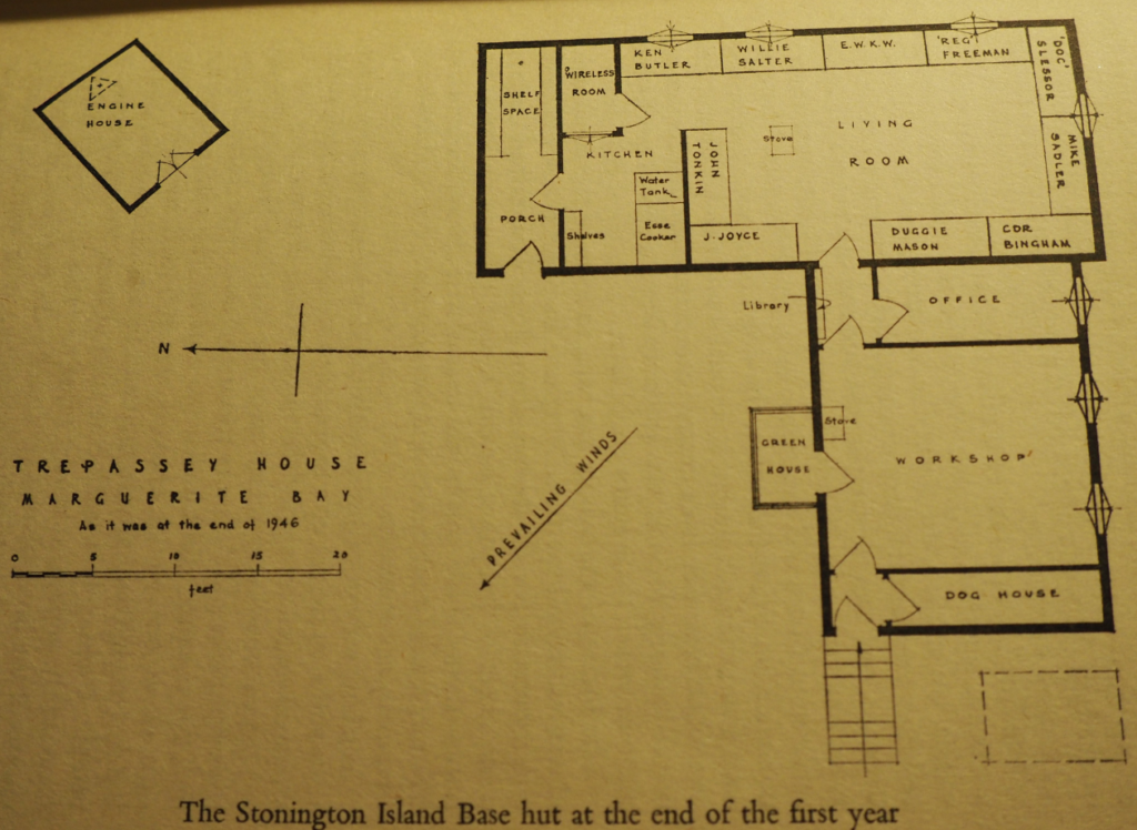
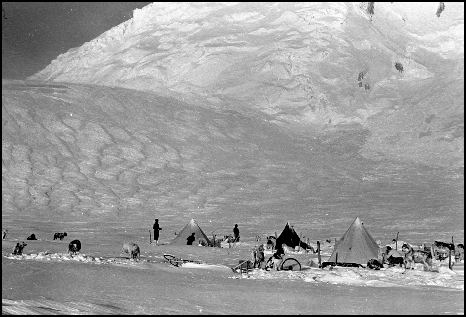
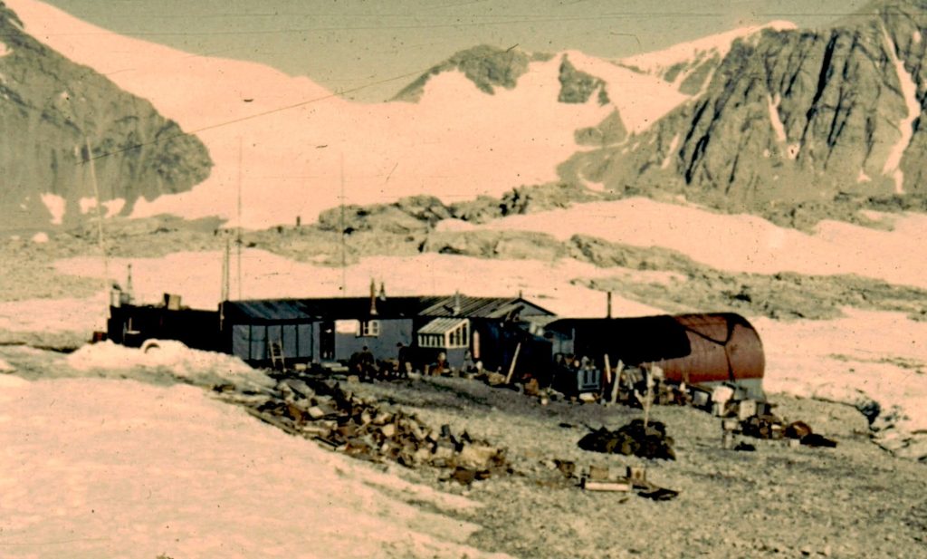
The Stonington Island base was typical of any of the other FIDS bases. The island was perhaps 200 yards long and in area about 8 acres; there was very little flat ground and the highest point of “Flagstaff Hill” was about 30ft above high water.
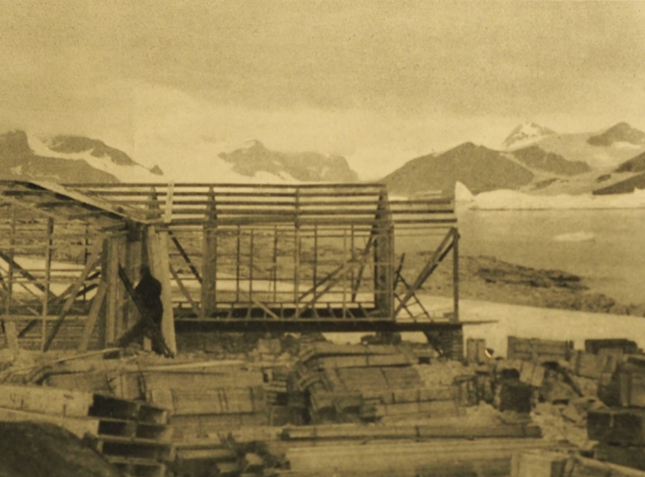
The first hut was build downwind of a rounded ridge where it was hoped it would not cover too deeply with drift snow or blow away in the Katabatic wind from the glacier. The hut was 18ft by 30ft and apart from an entrance porch was open plan with 10 bunks set against the walls and a kitchen space at one end. Under the same roof was a small workshop with a separate outside door and a lean to extension reserved for dog equipment.
There was no personal privacy, a feature of all the earlier FIDS huts, no private cabins or indeed anywhere where one could go to get away from the others. Until the base covered up with drift snow most of the dogs tethered outside were in sight from the hut windows. All clean activities from eating, writing up notes, plotting out survey records, sewing or splicing ropes centred around the table which served as a dining table for all meals. The hut was warmed by a single anthracite burning stove and lit at night by paraffin pressure lamps.
Bernard Stonehouse was born in Hull on May 1, 1926. Joining the Fleet Air Arm in 1944, he trained as a pilot, and in 1946 joined FIDS, travelling to Stonington Island on the ‘Trepassey’, as a naval pilot seconded to the Falkland Islands Dependency Survey (FIDS). He also served as a meteorologist, dog driver and, ultimately, biologist.
On September 15, 1947 Stonehouse was deputy pilot when the base’s Auster aircraft took off to mark out a safe landing spot for a larger American twin-engined aircraft which was about to undertake an extensive aerial survey. On the return flight, however, bad weather forced themto make an emergency landing on the sea ice, and the aircraft turned on its back after one of its skis hit an ice hummock. The three men emerged unscathed but were forced to pitch camp on the ice. They had only a small “pup” (two-man) tent, Read on
Who’s Who – Keith Holmes
In 2011, I visited Heather Tonkin, in Melbourne, Australia, and she allowed me to photograph a remarkable document that her late husand, John, had compiled on Stonington Island when FIDS found themselves sharing it with the American Ronne Antarctic Research Expedition.
It is a light-hearted vignette of the men and women who were at FIDS Base E, and at the former USASE East Base, probably in early-1948 as it includes the FIDS party from Hope Bay. I don’t recall any reference to it in the published accounts of Kevin Walton, Jenny Darlington, Finne Ronne, Jackie Ronne, or Tommy Thomson, and this is probably the only surviving version of it.
John’s daughter, Jane Storey, most kindly donated it to BAS Archives last year, along with a lot of other excellent archive material.
The booklet comprises 41 pages of faded brown paper, stiff-bound in red material, with a title page bearing a photograph of the two bases, two summary pages recording how long the formal parties spent on the island, and typescript entries for 38 individuals as follows:
For the edited photos of all the pages, see here:
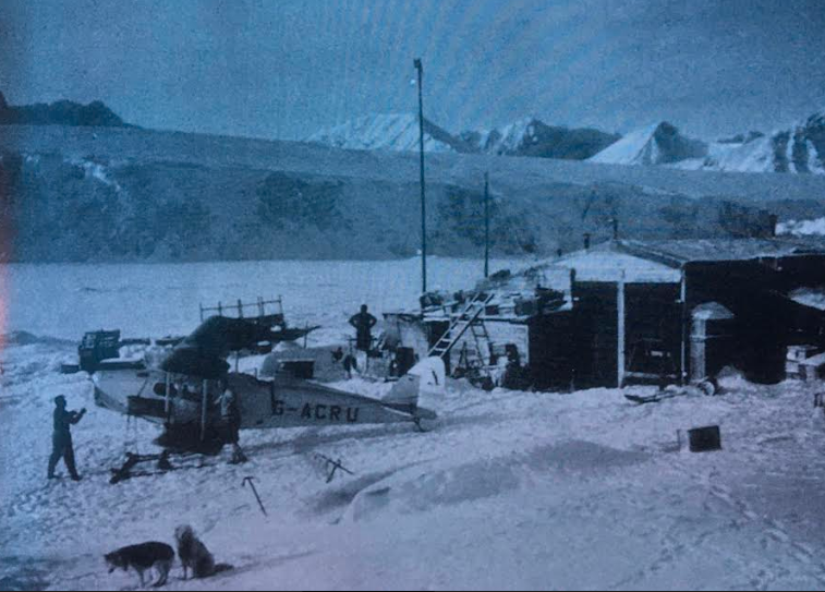
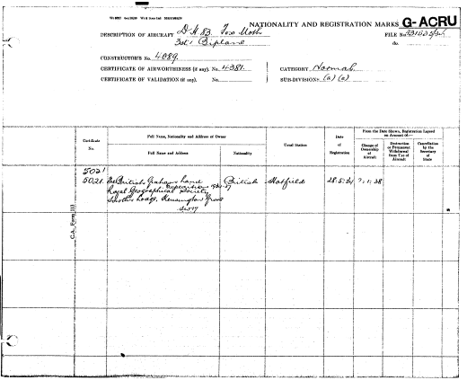
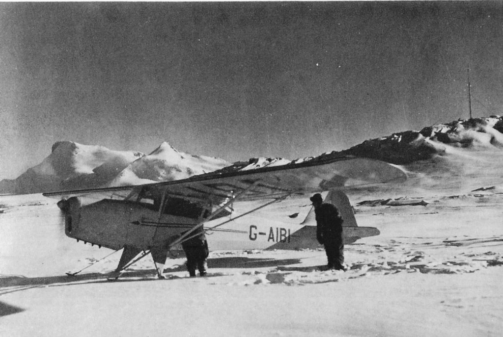
Aircraft G-AIBI – Auster Autocrat (“Ice Cold Katy”) – Keith Holmes
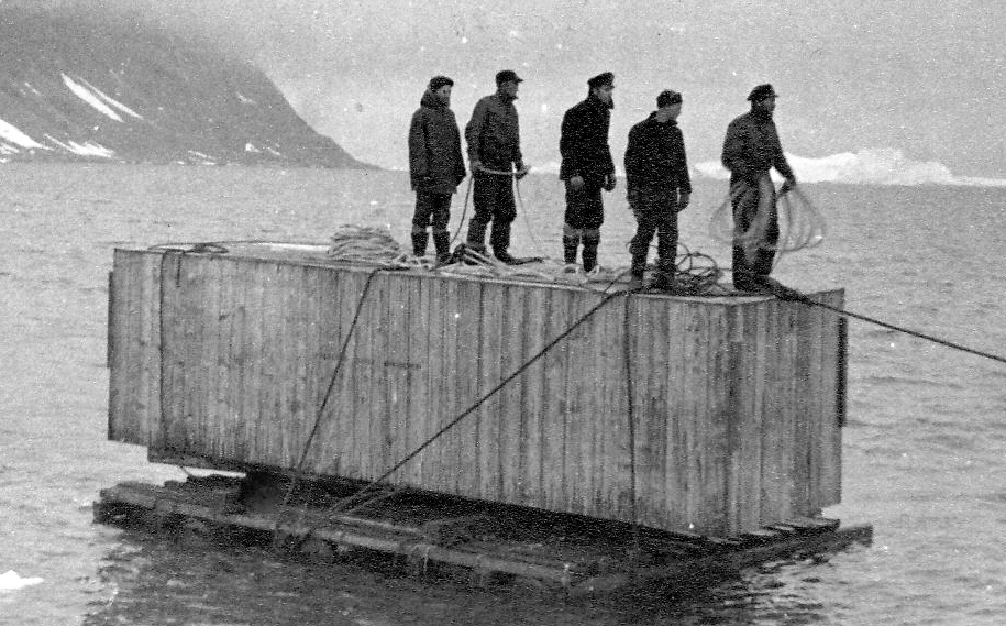
GA-AIBI was purchased in 1946 by FIDS, and fitted with skis, but for some reason the tail skid was replaced, in England, by a tail wheel. Better known as ‘Ice Cold Katy’, the aircraft was shipped from Stanley to Stonington. The new Auster J/1 Autocrat aircraft, which had been registered in Britain as G-AIBI, arrived off Stonington Island, in a crate, aboard MV Trepassey on February 5th. John Tonkin photographed it being rafted ashore the following day, and noted that it weighed thirty hundredweight[1].
The aircraft had been accompanied by a pilot, Bill ‘Tommy’ Thomson, and by David Jones, an Aircraft Engineer. ‘Tommy’ kept a diary of what he did with the aircraft [2] and later published an autobiography which looked back on his experience[3]. David also wrote a formal report on the aircraft’s performance. In retrospect, both men were, by and large, satisfied with how it performed. There were, however, early set-backs. Read more here.
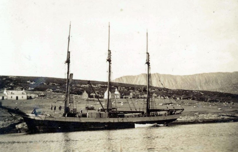
MV Trepassey’s Newfoundland Crew – Brian Hill
The m/v Trepassey was out of St. John’s, Newfoundland on her 2nd Antarctic trip. Newfoundlanders are quite adept at towing things around on rafts. Read more about the Newfoundland Crew here….
Operations & Incidents with ‘Ice Cold Katy’ – Reg Freeman
Reproduced by Permission of BAS Club – Newsletters 23 and 24
(Photo: Kevin Walton)
The story as experienced by the party later in the winter, working to lay depots for the winter journeys. It became an epic incident, resulting in the journey by the three crew to return to Stonington, with no dog teams or other transport, rivalling some of the more well-known and publicised epic journeys. It is an enthralling read of Reg Freeman’s journal, with photos added from the book by Kevin Walton “Two Years in the Antarctic”.
Grab a dram and settle down to read.
Mount Tricorn at approximately latitude 74°S, longitude 62°W, was anticipated as being the most southerly point which would be reached by the proposed sledging party. (Later it was proven that the estimated position of Mount Tricorn was 50 miles in error!).
Journey to the East Coast and Bill’s Gulch – Dick Butson
Starting March 2nd, 1947, Dick Butson took part in a 40 day trip up North East Glacier, up Sodabread slope and over the Plateau to the cliffs overlooking Bill’s Gulch.
This description taken partly from his diary and partly written from memory 40 years later describes a very frightening episode which was part of the autumn reconnaissance. The camp from which the story starts was on the plateau about 4 miles from the cliffs overlooking Bill’s Gulch 60 miles from home on the East coast.
8th April
A wonderfully clear day. Set off with Dougie and John with his team to recce the route leading towards Bill’s Gulch. Horizon after horizon appeared deceptively near. After about six miles we had a wonderful view of the glacier, the lower half from about 3,000 feet being in cloud. We were at about 5000 feet having travelled down a narrowing valley which we identified as the start of Bill’s Gulch. As we climbed back out of the shelter of the valley we realised that in travelling down wind we had not realised just how much the wind had increased. The drift was intense coming full in our faces. Using both our prismatic compasses we went back on the reverse of our outward journey. The wind had completely obliterated our outward tracks and was so strong that the dogs would not face it by themselves. With John and Dougie in front on snowshoes, each with a prismatic compass, and me on the sledge with the sledge compass as an extra check we kept reasonable course with the dogs following the men in front and me following the dogs. As the wind and drift increased I could barely see the dogs and only very occasionally the two men ahead. We stopped and conferred on two occasions..
Reminiscences – Dick Butson
Friday April 25
It had been noticed that Hugh was in trouble with diarrhoea for some days and I noticed this morning that he had not even touched his meat from yesterday. He was definitely ill and listless. I dosed him with castor oil at 1130. By 1800 he was distinctly worse and he made no attempt to resist examination. We brought him into the workshop, he had 168 pulse and rectal temperature around 100.7. His intestines were rock hard and there was evidence of peristalsis. He had only managed one small watery stool since his dose of castor oil. We decided that he had probably got a piece of bone stuck in his intestines and laparotomy was decided upon as he was going down hill very fast. We started to prepare to operate at 2030 and started at 2130. Ken Butler administered the anaesthetic, ethyl chloride followed by ether.
The rectus, linea alba and peritoneum were divided with no bleeding. The gut was found to be hyperaemic and a 9 inch long intussusception was found in the small gut and this was reduced by gentle traction and there were no signs of adhesions. The invaginated portion of the gut was back to its normal colour except for a small segment about 1/4 inch long. I warmed this with a pad soaked in warm water and it quickly recovered colour. I closed up the abdomen with continuous catgut and the skin with silk sutures. The whole operation lasted 45 minutes. He came round about midnight, and passed a watery stool in the coal bucket and remiained indoors for two days and recovered in about ten days. (Hugh did very well and worked for the next two years and sadly had to be put down when Stonington Island Base was abandoned in 1950).
Dick Butson – Medical Officer – Stonington 1947
1948
Base Commander – Vivian Fuchs
| Adie, R.J. (Ray) | Geologist |
| Blaiklock, K.V. (Ken) | Surveyor |
| Brown, C.C. (Colin) | Surveyor |
| Dalgliesh, D.G. (David) | Medical Officer |
| Fuchs, V.E. (Vivian) | Geologist |
| Huckle, J.S.R. (John) | GA |
| Jones, H.D. (David) | Air Fitter |
| Randall, T.M. (Terry) | WOM |
| Spivey, R.E. (Bob) | GA |
| Stonehouse, B. (Bernard) | Meteorologist |
| Toynbee, P.A. (Pat) | Pilot |
Earth Sciences
Vivian Fuchs applied for a position as Geologist, was interviewed and offered the job of overall Field Commander of all the Antarctic activities, based at Stonington.
Fuchs and Ray Adie were the Geologists on the expedition, two of 27 Fids to travel to the Antarctic in December 1947, and they were given the freedom to plan the scientific programme for the duration of their stay. At Stonington, eleven men lived in cramped quarters and Fuchs quickly became the natural, as well as the appointed, leader of the group. Between 1948 and 1950 the men made a series of expeditions south from their base on the Peninsula. Read on
Topographic Survey
Brown and Blaiklock
Colin Brown carried out exploratory survey of the coast south from base to Cape Jeremy, positioned the islands in southern Marguerite Bay and the NE coast of Alexander Island.
Ken Blaiklock surveyed the islands in northern Marguerite Bay and the east coast of Adelaide Island as far as The Gullet where there was open water and discovered the emperor penguin rookery on the Dion Islands. He surveyed the fjord area running closed traverses around the major islands.
In mid-winter 1949 Blaiklock visited the Faure Islands and carried out an astro-fix but the sight of open water brought a hasty conclusion to the work.
Between major journeys the surveyors continued the local triangulation started by Reg Freeman.
From 1952 to 1954 Ken Blaiklock was employed as a surveyor at Base D, Hope Bay. In 1955 he served on the MV Norsel as a surveyor and helped to set up two bases on the Peninsula.
Later, Ken was part of Fuchs’s Commonwealth Trans-Antarctic Expedition in 1956-1958 that completed the first overland crossing of Antarctica. He was leader of the advance party which set up Shackleton and then he was part of the crossing party during which, with Jon Stephenson, drove dog teams to the South Pole for the first time since Amundsen. Ken completed the Antarctic crossing by reaching Scott Base aboard the Sno-Cat “County of Kent”. Read more about Ken and TAE here….
From 1959 to 1961, Ken joined the second Belgian Antarctic Expedition with Captain Bastin which failed to reach the South Pole. In 1965 he worked for BAS on Adelaide Island and on the Peninsula. He did more survey work in the Antarctic and for Decca in the North Sea before retiring in 1996.
Ken Blaiklock was awarded the Polar Medal with three bars along with many other awards.
Richard Barrett – Surveyor, Stonington 1974
Heading Home with the Choristers – Bernard Stonehouse
Over fifty days after leaving base, we were on our way home. Three nights and two days of gale had held us down, giving us the lie-up we needed after a week’s hard running. Now we were ready to move on. That morning the wind had dropped, tent canvas no longer flapped, drifting snow was stilled, and the sun shone warmly through the peak of the tent. We emerged to a glorious day — calm, clear and brilliant.
Alert to our movements, the dogs rose as we did, popping up from the snowdrifts that had built up around them, stretching, yawning, shaking ice from their matted fur, greeting us with warmth and wagging tails. They watched as we dug out tents, boxes, sledges and traces, growling sotto voce to each other, from time to time setting up the chorus of song that bonded them as a community — three teams of nine, offering friendship without question to the four men who moved among them. Harnessing brought them to a crescendo of excitement. As the first team moved off, those remaining leapt in their traces. I had often wished I could raise even half their blessed enthusiasm at the start of the hard day’s sledging.
My team was the Choristers, a nickname earned by their penchant for bursting into song. From time to time I sang to them, and during the ten-minute breaks they sang to me and to each other. I sang Hymns Ancient and Modern, Handel, Gilbert and Sullivan, Schubert, and a Bing Crosby-Andrews Sisters medley.
Arrivals and Departures – David Dalgleish
Our ship lay at the edge of the unbroken sea-ice, 4 to 6 feet thick, too much for our small vessel. We gazed to the East at a steep sided 2000ft high island which lay between us and our destination, a mere 30 miles away. It was surrounded by this flat unbroken white plain, behind which stretched the 6000ft high Graham Land Plateau. It was a sunlit scene on indescribable beauty, silent and awesome. Absorbing all this we waited for the ice breaker that would lead us in and then saw distant specks which materialised into two sledges with a man apiece, each pulled by nine dogs. They skimmed over the white plain – such energy, such control and such assurance. Mutual greetings were shouted upon their arrival.
Later on we were near the shore of our future home and for the next hours we accompanied these men and their teams landing many tons of stores until late into the night – although of course the sun was still shining! How could one possibly learn to control 9 dogs with such assurance – the suddenly I heard “just take my team back please” and we had to learn the hard way.
At last all was complete, goodbyes and emotional departures for the outgoing dog-drivers – but what a wonderful legacy they left us.
Aircraft VP-FAE – de Havilland DH.87B Hornet Moth
Purchased by FIDS as a readily-available, urgent replacement for their Auster J/1N Autocrat G-AIBI ‘Ice Cold Katy‘ destroyed in an accident September 15th, 1949 (see ‘Ice Cold Katy’ above). Re-registered as G-ADMO on November 26th 1947, it was crated and shipped from Southampton on ‘John Biscoe‘ to Deception Island, arriving there on February 2nd, 1948. Although unloaded onto the beach there was no point unpacking it because, due to a loading oversight, no skis had been sent with the aircraft!!
And so, for some, their third consecutive winter!
1949
| Adie, R.J. (Ray) | Geologist |
| Blaiklock, K.V. (Ken) | Surveyor |
| Brown, C.C. (Colin) | Surveyor |
| Dalgliesh, D.G. (David) | Medical Officer |
| Fuchs, V.E. (Vivian) | Cdr FIDS, Geologist |
| Huckle, J.S.R. (John) | GA |
| Jones, H.D. (David Jones) | Air Fitter |
| Randall, T.M. (Terry Randall) | WOM |
| Spivey, R.E. (Bob) | GA |
| Stonehouse, B. (Bernard) | Meteorologist, Zoologist |
| Toynbee, P.A. (Pat) | Pilot |
Back Row from L to R: Bernard Stonehouse, John Huckle, Bob Spivey, David Jones, David Dalgliesh, Colin Brown
Seated from L to R: Terry Randall, Ken Blaiklock, Vivian Fuchs, Pat Toynbee, Ray Adie
(Photos By Bob Spivey via Una Spivey to Keith Holmes)
Topograhic Survey
Brown and Blaiklock
The good sea ice of 1949 which had allowed the surveyors to complete historic journeys displayed on the maps for a generation of Marguerite Bay Fids, now failed to go out and allow the relief. The Stonington Fids became “The Lost Eleven” of news headlines.
The powers that be allowed some amateur surveyors, geologists Fuchs and Adie, to survey the southern coast of Alexander Island and in the area of Buttress Nunataks on their journey to Eklund Island. Brown accompanied this party down the King George VI Sound to Ablation Point to link up his 1949 work with BGLE surveys. Blaiklock went north and surveyed Bourgeois and Bigourdan Fjords.
The decision was taken to close Stonington and the RRS John Biscoe arrived and closed the base in Feb 1950.
Stonington and Many Other Occasions Since – Ken Blaiklock
I was looking up at the stars one clear winter’s night and could see Sinus, the brightest star in the constellation of Canis Major. Sinus the Dog Star. One word suggested another and brought a new train of images. Sirius the Dog Star – alpha Canis Major – a Husky dog called Major – and then dog sledging down South.
All sledgers will have their memories of dog sledging days in Antarctica. Days of drama, such as the rescue of an American in a crevasse in North-East Glacier by the 1947 FIDS at Stonington Island base; or arriving by dog-team at the Amundsen-Scott base at the Pole. Days of danger and fear – a sledge breaking through thin sea ice and floundering in the slushy ice; or dogs down a crevasse and you hope you can haul them up before they wriggle out of their harnesses and fall to their death. Days of discomfort such as on a late autumn depot-laying trip with heavy loads, short hours of daylight, the wind blowing drift snow into your face, and you are cold and tired and miserable.
But the days always remembered best are the days of delight, when everything seems perfect and you are exhilarated with joy, contentment and achievement.
It was such a day’s sledging I recall with David Stratton. A couple of weeks beforehand we had been flown from the base in the Otter aircraft to the western end of the Shackleton Mountains. We had been sledging eastwards and that morning looking out of the tent we found a brilliant clear sky, an absolutely calm and crisp feel in the air although the sun was already warming the tent. The dogs stirred and gave us an early welcome and soon we had the tent down and the sledge loaded and lashed. Off we went up a long smooth gentle slope with low flat-topped hill on either side. It was an excellent surface for sledging on firm hard snow with no sastrugi and crevasse-free, and a lightly loaded sledge. The miles ticked by on the sledge wheel counter and we had almost made the rest of the pass by lunchtime. As we later approached the pass summit, the tops of mountain peaks began to appear, and then a whole new range came into view. Peak after peak ahead stretching to the horizon and all uncharted and unvisited. Down we sledged in a glorious run to a bluff some miles away. We camped after a run of 27 miles. Not the longest distance achieved on one day by any means, but very satisfying.
Sitting on a ration box outside, tired but happy, I could look at all the mountains ahead, while waiting for the inside man to cook dinner. To cap the end of a memorable day, we went out after our meal to watch a total eclipse of the sun. The moon moved over the sun’s disc and when the sun was totally covered, the sun’s corona was visible for a few minutes. The dogs all raised their heads and started to bay in unison, with their haunting moan.
Many sledgers will have such Dog-Day memories of 10,20,30 and even 40 years ago. But it all seems like yesterday.
Ken Blaiklock – September 1995
Aircraft VP-FAC AUSTER MK. 5
VP-FAC departed (crated) on ‘John Biscoe‘ from Southampton on October 12th, 1949, for Deception, where it was unloaded, assembled and then air-tested on December 18th, 1949. Flown as a floatplane from there to the Argentine Islands to rendezvous with (and be based on) ‘John Biscoe‘. Piloted by Flt. Lt. John Lewis, it reconnoitred open sea routes around ice floes and clear water areas close to Stonington Island in Marguerite Bay, Graham Land before the 11 Fids marooned on Stonington were rescued in three groups by the Norseman VP-FAD (see below) and ‘John Biscoe‘ between January 30th, 1950 and February 2nd, 1950.
Aircraft VP-FAD NORSEMAN MK.5
VP-FAD was the last Norseman ever built. Purchased in 1949 by Fids, it was configured as a Seaplane and fitted with floats. It was shipped to Deception Island for assembly and then joined VP-FAC in operating from ‘John Biscoe’ during the relief (rescue mission) of Stonington, arriving there on January 30th, 1950. Hired to Falkland Islands Government in 1951 prior to sale to them.
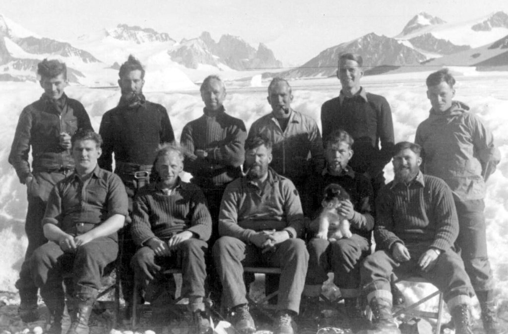
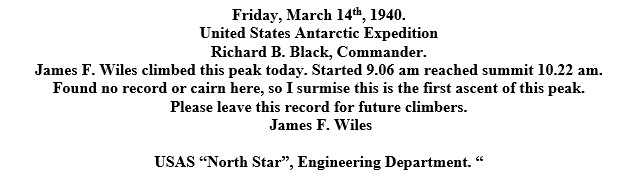
The First and Second Ascents of Neny Island – Keith Holmes
On January 24th, 1950, the F.I.D.S Journal recorded [1] that John Huckle and Vivian Fuchs climbed Neny Island, and at the summit found a glass jar containing the following message:
From the top, Fuchs drew a sketch of the Northeast Glacier, showing its snout extending to the shore of Neny Island, as seen also in an aerial photograph later published by Ray Adie.[2]
1958
Base Commander – Peter Gibbs
| Forster, P. D. (Peter) | Surveyor |
| Gibbs, P.McC. (Peter) | BL, Surveyor |
| Hoskins, A.K. (Keith) | Geologist |
| Procter, N.A.A. (Nigel) | Geologist |
| Roberts, B.R. (Brin) | Radio Operator |
| Wyatt, H.T. (Henry) | MO, Physiologist |
Stonington Reoccupied – (8 March 58 to 7 March 59) – Peter Gibbs
When the Biscoe landed the 6 of us and 3 dog teams (from Horseshoe Island) on the 8th March ’58 we were a little dismayed to find up to 2’6″ of ice throughout the floor of the old British hut and a dead dog in the American huts abandoned about 10 years before. But we set to with a will as we had an ambitious program of survey, geology, human physiology and dog-feed trials to do. Apart from the last which was planned for mid June to mid July we intended to be in the field the year round.
We had the hut habitable within 2 weeks, built 3 sledges and made up traces and harnesses by the 3rd week and set out on the first journey up the Northeast Glacier on the 10th April.
There were six of us, four with the previous year’s experience. Henry Wyatt (doctor from Base W), Nigel Proctor, (geologist from Horseshoe), Bryn Roberts, (radio from Horseshoe) and myself. Two newcomers in their first year were Pete Forster (surveyor), and Keith Hoskins (geology). We had three 9 – dog teams, the Admirals (mine). Churchmen (Nigel) and Spartans (Bryn). This had left two teams at Horseshoe for breeding and local running as they had a static program. But I had planned with John Paisley the new base leader at Horseshoe, that they would assist us in the spring with depot laying journeys to the Wordie Ice Shelf. In the event most of these dogs did join us later, thanks to miraculous survival, as I shall tell; and for the spring work we made up a fourth team, the Moomins, driven by Henry.
It was a year in which the Admirals took me some 1240 miles sledging on 243 days and I expect the figures for the Churchmen may have been similar. We travelled through the midwinter period again, as events turned out. It was a year when all the events revolved around the dogs and their drivers, the successful inland journeys, the smell of dehydrating dog turds in the cause of dog nutrition studies, the returning dogs from the lost Dion Party and their untold story of the actual events, and the final evacuation of Stonington with four teams pulling six sledges one year to the day after the Biscoe had landed us.
Peter Gibbs – Surveyor – Horseshoe 1957; Surveyor/BC – Stonington – 1958
Topographic Survey
Gibbs and Forster
The Stonington base was reopened in March 1958 but no sea ice meant the work was confined to mainland areas accessible from base. Sledge wheel and compass surveys fixed by sun-fixes every 50-60km enable the pair to survey the area between the base south to the Wordie Ice Shelf and across the plateau to Mobiloil Inlet.
In March 1959 severe ice conditions prevented the relief of the base and it was again closed. Fids sledged north to Horseshoe Island where they were picked up by US Navy helicopters.
In January 1959 the first Tellurometers were introduced into the Antarctic at Deception Island, supported by HMS Protector and its helicopters. The MRA1 instruments weighed 60kg and took an hour to warm up and measured the transit time of the measurement. From 1961-71 the MRA2 instruments were fitted with stormproof muffs and an oven and only took only 5-10 minutes to warm up. From 1973 the MRA3 instruments were used which gave a readout of distance in metres.
Autumn Plateau Journey – Peter Gibbs
My first objective that autumn was to find a route ino the Neny trough by which we could return from the planned summer inland journey and carry out survey in the process. Henry and I with the Admirals were supported to the Amphitheatre, the head of the Northeast glacier by Nigel and Bryn with their teams who then continued with Pete and Keith to do some infilling of survey and geology towards Square Bay. The Plateau between the head of the Northeast and Neny trough in autumn is probably most years inhospitable and certainly was so then. The trip achieved its route-finding objective thanks to some memorable breaks in the weather. We named the narrow glacier down which we found a route, the ‘Flaming Peaks’ on account of the tinted summits in the low midday sun.
Sea Ice -Peter Forster
The scene is typical of Marguerite Bay in early spring. The old ice, although still many feet thick, begins to break up and to move, due to the wind, tide and movement of the glacier foot. Pressure ridges rise up in fantastic shapes and provide interesting sledging which the dogs love. Cracks open up and refreeze with black ice, and areas of melt water collect on top. This provides an assault course for gymnastic sledging but without the arch dangers of the crevasse. In this case, with all the dogs on the other side, it was necessary to nose the sledge to the ice edge and get the dogs to jerk it across.
Peter Forster, Surveyor, Stonington – 1958, Horseshoe – 1961
Search Journeys – If Dogs Could Talk – Peter Gibbs
We were on the summit anxious to descend (from the Autumn Plateau Journey) but for the final gale which blew from 27th May to 3rd June at force 8 with heavy drift. On the ’68 set we were in contact with Paddy McGowan of Horseshoe island and heard that they had had no contact with their Dion Island party that left on the 27th morning. When the visibility cleared to reveal open water the radio silence sounded deep concern. Geoff Stride, Dave Statham and Stan Black with two 7-dog teams had left Horseshoe island to visit the Dion Islands and collect some specimens requested by Bernard Stonehouse. The ice had been fast I believe over the past 6 weeks during which time it had withstood some gales.
Dog Feed Trials – Peter Gibbs
Our return to Stonington from these search journeys of over 400 miles on the 22nd July heralded the first opportunity to be static on base for a while and give Henry Wyatt an opportunity to do his dog-feed trials. He selected 18 dogs from the Admirals, Spartans and Moomins (survivors from Horseshoe) and left the Churchmen free for Nigel to lay a depot to the Terra Firmas.
We were well aware of the inadequacy of the Nutrican block and I believe a purpose was to investigate the absorption characteristics through analysis of the dehydrated stools. In the cause of science we others tolerated the stink with brave humour but Peter Forster and I preferred to go off on a manhaul trip ostensibly to look for Neny Fjord approaches to the Neny trough as well as to get away from the stink. The story of our fight to save the tent (and us) over a 3-day force ten storm on Postillion Rock is another story as we did not have dogs. I am glad they were spared it as there was no snow left on the rock.
Peter Gibbs – Surveyor – Horseshoe 1957; Surveyor/BC – Stonington – 1958
Spring and Summer Journeys – Peter Gibbs
These were days without air support so in order to support a geology journey south of Cape Jeremy and survey journey from the southern end of the Wordie Ice Shelf and back via the Northeast Glacier, we made several quick trips down to the Terra Firma islands. It was my view that sledge weights should never exceed 850 lbs for efficient travel. Often on sea-ice there was a breakable crust. A lighter sledge made all the difference for progress.
But at the same time for 60 days in the field the minimum dog food weighed 540 Ibs for one 9-dog team. For the summer survey journey, thanks to the brilliance of Caesar as a lead dog, we adopted the most economical sledging outfit having 3 sledges to 3 men with one 3-man tent and a pup tent, thus spreading the fixed weight of 437 Ibs (survey gear, radio, tent shovels, ice axes, ropes etc.).
In addition Pete and I sledged a depot of 2-weeks supplies down to the Wordie Ice Shelf, so that from there we could start with 8 weeks supplies. The addition of the Moomins from Horseshoe was now of great help and Pete drove this team.
Of War And Peace (The Dog Fight) – Peter Forster
In 1961, after 10 years, the base reopened as the centre for fieldwork in the southern Antarctic Peninsula, when Horseshoe Island (Base Y) was closed, and continued until the Base finally closed in February 1975.
The Antarctic huskies appeared to fight at every opportunity. Particularly, after a long period of separations on the spans at base, it seemed necessary that they re- established a pecking order in the traditional manner. Perhaps, the parallel of the Arctic wolf has some relevance in as far as the wolf pack are free to iron out their differences as they arise and can maintain a working hierarchy appropriate for the job in hand – survival, in contrast the spanned husky can harbour the residual grudges of a previous encounter. The start of a sledge journey provided a golden opportunity to state their differences if not to settle them.
Picture this scene – Read on….
Evacuation of Stonington – Peter Gibbs
Like our return from the Autumn journey this one was also overshadowed by the prospect of having to pack all we could and leave Stonington by sledge. On the 4th January, 1959 in contrast to the previous year there was no sign of any ice break-up and snow was accumulating on the island. The ice was fast over Marguerite Bay to the Avian isle as far as we could see. SecFids was in touch with the US icebreaker, the Nadir, in early January and put us on alert to sledge up to Horseshoe. However this remained unconfirmed so we were able to spend the rest of January and February on reports and survey compilation. On the 10th February I noted that the minimum temperature had been +1F and contrasted this with +20F for the same date in 1950, the stars were visible again and the ice as fast as ever without any melt pools. On the 15th a gale left a drift up to the roof of the hut and there was 8 feet of snow and ice depth on the beach where Bryn dug out the 12′ dinghy. An ice cap was forming over Stonington.
Extracted with his Kind Permission from Cliff Pearce’s book “The Silent Sound”
Cliff Pearce:
My own arrival at Stonington was by way of the Muskeg. The trip was exhilarating as the Muskeg trundled over the thick sea-ice, passing to the south of Neny Island, before making a run northwards to the base. The loaded sledges, each capable of carrying two tons of stores, slid easily over the ice as the wide tracks of the vehicle sped along. When we reached the tide crack, the loose ice creaked unwillingly, and the Muskeg hauled its cargo rapidly up the slope towards the growing pile of equipment, building materials and other stores.
Under a rapidly encroaching snow drift, I found the door and entered. In the small habitable portion of the hut, Peter Forster and Peter Grimley had already prepared a welcome brew of tea. They, with Charlie LeFeuvre and Dr. Tony Davies, had been flown into Horseshoe Island in March of 1960. After wintering at the more comfortable base to the north, in August they had sledged down to Stonington Island, from where their field work could be centered. During the part of the year that was left to them, they had ben able to carry out considerable geology and survey work on the eastern flank of Graham Land. S the summer advanced, and the ship drew near, they spent more time at the base, or what remained of it. The thirtenn-year old hut was in a poor state of repair. During the years when it had been unoccupied, snow and ice had filled the majority of the rooms. However, one small room had been triumphantly reclaimed, in which the four men had lived, almost on top of one another. It was in this room that we sipped tea, and had a meal cooked from the last remnants of food taken in when the base had last been relieved in March of 1958.
Topographic Survey
Forster – (Stonington Island and Horseshoe Island)
Heavy sea ice prevented access to Stonington but in Feb 1960 a party of 4 was flown into Horseshoe Island. Peter Forster mapped areas of Bourgeois Fjord and Square Bay not covered by air photography. The party then moved south to Stonington. Exploratory surveys were carried out between 68.5s and 69.5s the survey linked to work by BGLE 1936 and down the Lurabee Glacier to work by Mason 1947
1961
Base Commander – Johnny Cunningham
| Bowler, B.A. (Bryan) | Tractor Mechanic |
| Chapman, H.E. (Howard) | Surveyor |
| Cunningham, J.C. (Johnny) | BL |
| Fraser, A.G. (Arthur) | Geologist |
| Matthews, R.P. (Roger) | Meteorologist |
| Metcalfe, R.J. (Bob) | Surveyor |
| Quinn, J.A. (Tony) | Radio Operator |
| Sparke, B.R. (Brian) | Medical Officer |
| Tracy, W.O. (Bill) | GA |
| Tween, M.H. (Mike) | DEM |
| Wigglesworth, J.B. (Brian) | Meteorologist |
Topographic Survey
Chapman and Metcalfe
In Aug 61 Howard Chapman and Bob Metcalfe set of from Stonington in two Muskeg tractors to travel across the sea ice and south down King George VI Sound to Fossil Bluff. One Muskeg was lost at sea and with the aid of dogs 5 traverse stations were recced south of Fossil Bluff but meltwater on the Sound stopped work in January and the surveyors were withdrawn by air. In March 62 Metcalfe flew back to Fossil Bluff to observe a 16 star astro-fix.
August 23rd – From Stonington to Fossil Bluff – Dog Teams and Muskegs (as seen from Fossil Bluff)
(Extracted from Cliff Pearce’s book “the Silent Sound”)

The prime objective of establishing Fossil Bluff as a forward base was that it should make possible geological and survey work on Alexander Island and eventually in areas further afield. It was therefore of paramount importance that men and materials and equipment should get to Fossil Bluff as early as possible, preferably during September or October, when at least three or four months of field work could be carried out.
John Cunningham, Base Leader, was an outstanding mountaineer who had climbed extensively in the Himalayas and elsewhere. He was serving the second of three consecutive years down south, all as base leader, the first at Port Lockroy, the latter two at Stonington Island. (Later still, in 1964 he returned to Adelaide Island and led the first ascent of Mount Andrew Jackson, the highest mountain in Graham Land at over 11,700 feet.)
Mike Tween and Tony Quinn spent almost the entire year at the base, apart from short local trips, in order to provide power and to maintain radio communications with other bases and with the various Read on…..
1962
Base Commander – Johnny Cunningham
| Bowler, B.A. (Bryan) | Tractor Mechanic |
| Clennell, J.J.O. (Jon) | GA |
| Cunningham, J.C. (Johnny) | BL |
| Gilchrist, W. (William) | Radio Operator |
| Gill, R.V. (Ron) | Tractor Mechanic |
| Hodges, B.A. (Ben) | GA |
| McMorrin, I. (Ian) | GA |
| Metcalfe, R.J. (Bob) | Surveyor |
| Morgan, I.P. (Ivor) | Surveyor |
| Wilson, J.M. (Jim) | DEM |
Topographic Survey
Metcalfe and Morgan
In August 1962 Bob Metcalfe and Howard Morgan mapped the area between North East Glacier and Square Bay.
In October Metcalfe and Morgan were flown from Stonington south to Fossil Bluff, travelling by muskeg and dog sledge and with air support 13 new stations were established and 15 lines measured extending from Fossil Bluff to Buttress Nunataks.
1963
Base Commander – Jon Clenell
| Beynon, A.D.G. (David) | Dentist |
| Blake, S.C.B. (Sam) | Radio Operator |
| Clennell, J.J.O. (Jon) | BL, GA |
| Fleet, M. (Mike) | Geologist |
| Hodges, B.A. (Ben) | GA |
| Horne, R.R. (Ralph) | Geologist |
| Kennett, P. (Peter) | Geologist |
| Marsh, A.F. (Tony) | Geologist |
| McLeod, G.K. (George) | GA |
| McMorrin, I. (Ian) | GA |
| Tindal, R. (Ron) | GA |
Front row Left to Right: Dick Palmer; Mike Fleet (green anorak); Tony Marsh (in pink); Ben Hodges (squatting); George McLeod, also squatting). Temp that day was Minus 35.5 F!
(Photo: Peter Kennett)
Dogs In Rough Ice – George McLeod
Prancing Pup
One story I have is waking up and seeing in the distance one of my pups up amongst the crevasses, so nipping out of bed I called him back, but he just pranced around and stayed where he was. Putting skis on, I skied up thinking he’s scared of the holes. I got there to find one of his brothers in a crevasse and he would not leave him. After a rope rescue, we brought both pups down to their great delight. They were such good friends, we ran them together when they got older.
Three men, two sledges and 250 miles to go
The temp was 37 deg F. Snow had turned to slush and we had to get home. In three days we ran 153 miles, through inches of water on the ice. The dogs were soaking wet and miserable, so bad in fact, they wouldn’t even fight.
When we reached Prince Gustav Channel it was all buckled ice and water to three feet deep. The dogs were wonderful, none of them balked. With me in the lead, crampons and ice axe and tied into the dog-trace, I’d sometimes be into my chest pulling, and the dogs would all swim to the solid ice beyond. We did this for two days, until forced ashore, the ice ahead had broken up and we could see water shadow on the icebergs up the Channel. You’d better believe I was good to my dogs after that.
(Written by George while at Hope Bay)
A Terrible Beating
John, Ben Hodges and I were sitting at the base of Sodomy Slope (Sodabread), in a screaming blizzard, with 3 dog teams, safely dug into the snow, we hoped. Ben and I with everything on and roped to John inside the tent, we crawled out to feed the dogs. God! What a mess, dead dogs on top of hard packed snow, most dogs buried underneath. If we dug them out they would freeze and if we left them under they would die.
Ben loved his dogs and took the time to bury two of his next to a rock buttress, while John and I downed tent, dug out our dogs and tottered back to Base.
It took us a day’s work to remove all the snow from inside the coats of the dogs. I’d never seen that before. The snow was packed inside the dogs thick coat, right to the skin and one had to push fingers right inside to get the snow out. You know how a husky’s tail curls, well, their tails hung straight down, solid with snow.
Ben lost two dogs, and John one. We took a terrible beating, yet in a couple of days, the dogs were back, bright eyed and bushy tailed.
Scrummaging Dogs and Sea-ice – George McLeod
Three of us and three teams had been out of base for several days on bad sea ice. It was short]y after the lads from Horseshoe Island had gone missing, and we were all a bit nervous. Well, it happened. Ken and his team broke through into the water. We managed to drag him and the dogs out but it took us two hours, running all the way, before we reached firmer ice and were able to stop. By that time Ken’s legs and feet had really frozen up and he was in a bad way. The tent erected, we thawed him out and he immediately lost the skin off both legs and feet. In our haste we had just picketed the dogs, and all of a sudden we heart a big fight erupting outside.
A couple of us rushed outside and found the 30 dogs had pulled the pickets and were all scrummaging down. Once we got them sorted out, we found “Ruthie’s” stomach so torn that her insides were hanging out. I pushed everything back in, roughly stitched her up and got ready to head home.That was a hell of a journey, still on poor sea ice and with three days back to base. I led out front with two dog teams (18 dogs), two sledges, two men – Ken could just about walk – and then Ruthie following the sorry caravan procession behind me.
That night when we pitched camp, there was no sign of Ruthie. Ken was in agony and none of us could sleep. Suddenly the dogs began barking. I jumped out of my sleeping bag to investigate. It was Ruthie. dragging herself into camp. I thought I ought to put her out of her misery. But no, she’d made it this far, blood loss and all. We got back to base two days later and it took Ruthie almost another full day – but she made it. In time her belly healed and she was back to work as if nothing had happened.
George McLeod, Stonington, 1963; Adelaide and Fossil Bluff, 1965/68
Culinary arts at Stonington – Peter Kennett
The ways in which most bases organised their cooking will be familiar to old Fids, but it might be of interest to the younger generation to know how we coped at Stonington in the 1960s, which was probably typical. Like most bases, we had no professional cook, but took it in turns to provide for the members, numbering up to 12 when nobody was out sledging. Our method was for the cook to serve a three day stint.
Having largely had my food provided for in my student days, my only experience of cooking was at Scout camps, where one could often get away with murder! Catering for 11 others, from whom one could not escape if things went wrong, was rather different. Some cooks were so well organised that they could relax in between meal times or carry out other jobs, but for me it became almost a full time occupation for those three days, even allowing for the help of the “gash hand” rota, where there was always somebody else to top up the melt tank with snow blocks, bring in more anthracite for the Esse stove and assist with washing up.
Night Noise on the Spans
Ralph and I were up on Uranus Glacier, a hundred miles or so from the sea. It’s night time and everyone has settled down, when there’s a curious little bark from Signy my lead dog. I said “It’s just the dogs messing around”. I went outside to find a penguin peering at the dogs. I turned Signy loose and she quickly caught and killed the penguin, which Ralph and I cooked and ate, whilst Signy enjoyed what was left. A curious little tale, because what’s a penguin doing up at 1,000 feet anyway?
George McLeod – GA/BC – N (Anvers Island) 1957; J (Prospect Point) 1958; D (Hope Bay) 1962; and E (Stonington) 1963 and 1967
The Ski Slope – Mike Fleet
Skiing on Stonington Island was very limited. With a maximum elevation of 25m (Anemometer Hill) and only some of this height was available for skiing. So skiing was very limited, but it was just outside our back door and popular. The alternative was a long trudge up Northeast Glacier.
Eliasoneering – in theory and in practice! – Peter Kennett
Photographs are by Peter Kennett, unless otherwise stated, or unless inadvertently mixed up with the communal photographic processing on base!
The current generation of Fids (2020), accustomed to whizzing about effortlessly on Skidoos or quad bikes, may not be aware of the trials and tribulations endured by those of us in the 1960s, faced with the introduction of the first mechanical transport by BAS. If memory serves correctly, there was a choice of small motor sledges between an early version of the Skidoo and the Eliason. For some reason, the powers-that-be decided to buy the Eliason, and several were sent to Marguerite Bay, with two of them (Nos: 2000 and 2001) destined for Base E at Stonington Island, as was I.

When the changeover of personnel took place at Stonington, in late February 1963, the usual responsibilities for different areas of base life were allocated. Having once helped John Mansfield (Hope Bay 1963/4), strip and reassemble a 1932 MG car, and then having maintained a 1949 Singer 10 saloon myself, I was optimistically regarded as being a mechanic, and was therefore assigned the job of looking after the Eliasons. Thanks initially to considerable help from Ron Tindal, and later, professional expertise from Dick Palmer, we were able to keep the machines running for much of the season, but not before much sweat, tears and even a bit of blood had been shed.
The Eliason consisted of a steel frame, powered by a 4-stroke Briggs and Stratton lawn mower engine, which drove a track belt consisting of steel lugs attached to a pair of motor bike chains.
See more of Peter’s photos around Stonington HERE
See some more of Peter’s photos around Stonington HERE
The Depot Journey to Three-Slice Nunatak – Mike Fleet
Click below to Start Mike’s Gripshow:

Sodabread Crevasses – Ben Hodges
We were nearing the end of a four-month, 1,000-mile sledge trip, and one final hurdle awaited us — the terrifying 5,000 foot descent of “Sodabread”. Though the ascent had taken us ten long days at the beginning of the trip, the descent would, in theory, take only half an hour. Visibility was poor that day and Mike Fleet, myself and the two other teams took a break to discuss the whereabouts of the survey pole we had left to mark the only safe route down.
(Photo: Peter Kennett)
We finally agreed on the direction and I called “Pull away, dogs!” My team, the Moomins, surged forward, out of my control, and for a moment I feared that we might plunge over the glacier; then I realised that the lead dog had spotted the survey pole: she was heading for home. A long drawn out “Aaahh now” brought them under control and we came to a halt at the top of the descent.
Controlling our rate of descent was a major problem and we wrapped as many chains and ropes as we could around the sledge runners to try to prevent them front over-running the dogs. I put “Harvey” and “Eccles”, the strongest and slowest dogs, on a long trace and fastened them to each side of the sledge to provide extra braking power. With a cry of “Up Dogs! Huit!” my team and I began the terrifying descent, the two other teams following behind at five-minute intervals. The rushing nightmare lasted for two long minutes before the brakes took any noticeable effect and we began to slow down.
We had nearly reached the end of the traverse when “Dot”, my lead dog, quite suddenly vanished. The pair behind her also disappeared, and it was then I saw the faint line of the crevasse. The other three pairs of dogs dropped from view in quick succession.
Handing over Dog Teams
When the time came, handing over a team to an incoming new driver (and sometimes a driver who had previously driven a team) was an emotional affair. Most Fids were sick at the thought of leaving their team at all, most of all to a stranger who surely would not understand them; and so they tried to give the new driver some ideas, in the form of a Team Report – a set of notes on the dogs, and how they had been driven for the last year or two, while in many cases, being utterly convinced that the new driver would never be able to handle or understand the team properly. There are several other Team Reports on this website (Noel Downham – The Terrors – E-1964, Neil Marsden – The Komats – E-1966).
Here’s the first one:
The Spartans – March 1962 to March 1964 – Ian McMorrin
The Spartans comprised:
3 Dogs born at Horseshoe (Epsilon, Nu, Iota),
2 Dogs from Hope Bay (Steve and Ruth),
2 from Deception (Olaf and Sven),
2 from Stonington (Athos and Angus),
2 from Adelaide (Faerie and Brownie)
General Notes – 1962/63 Season
I took over the Spartans from J.B.Wigglesworth in March 1962 by which time they comprised, Epsilon, Steve, Iota and Nu. The strength of the team had been greatly reduced by the loss of Vicar, Moose and Tess during the 1961/62 summer season. This deficiency in power was partly made up by the addition of Athos and Faerie though the overall strength of the team still remained fairly low.
A simple way to get to Stonington – Sandy Muir
December 1963! This is the tale of two medical officers’ trip to Marguerite Bay. Mike Rice was going to Adelaide base and I was to go to Stonington. We had been delayed by our research preparations in the MRC unit and were therefore to ship south in a somewhat complicated way. The plan was for us to sail south on a chartered Danish ship, the Kista Dan, which was doing the trip to Halley Bay. We were to meet up with the John Biscoe in South Georgia which was scheduled to relieve Adelaide and Stonington. It did not go quite to plan.
Mike and I were just settling in and meeting up with the Fidlets going to Halley Bay when we added another late-comer to our trip. It was Garrick Grikurov a Russian Geologist who was going to see how our geologists worked and had been assigned to Stonington. Russian!! This was 1963 and joint working with the Soviets just did not happen! However Garrick was a great chap to have around and he had a great sense of humour and provided us with a valuable insight of life in the USSR.
1964
Base Commander – Noel Downham
| Cheek, J.E. (John) | Radio Operator |
| Downham, N.Y. (Noel) | BL |
| Grikurov, G.E. (Garrick) | Geologist |
| Marsh, A.F. (Tony) | Geologist |
| Muir, A.L. (Sandy) | Medical Officer |
| Renner, R.G.B. (Geoff) | Geophysicist |
| Schärer, A.J. (Tony) | GA |
| Steen, J.W. (Jim) | GA |
| Stubbs, G.M. (Guy) | Geologist |
| Thornton, E. (Edwin) | GA |
| Vaughan, D.N. (David) | Tractor Mechanic |
“Man Meets Dog” – Noel Downham
On one trip we took along a book called “Man Meets Dog” by Konrad Lorentz, the animal behaviourist. One of his suggestions for keeping dogs in line was to mimic the bullying actions of the big dogs. It sounded logical enough and the dogs being an unruly bunch, I was anxious to put it into practice. I watched them for a while and noticed how the big dogs took hold of the smaller ones by the ears and shook them. It seemed to work effectively enough, so I tried it out on “Princess”. Never again!
(Photo: Geoff Renner)
Remembering too late that dogs are copraphagic – they eat each other’s faeces I came away with a mouthful. It would appear that “Jet” had earlier had a snack around Princess’s rear end, before trotting round to the front to indulge in a bit of courting. Re-cycled Nutrican isn’t tasty and I don’t recommend it.
Noel Downham – Met. Admiralty Bay – 1960; GA – Hope Bay – 1961 & 1963; GA/BC – Stonington – 1964
“Flush” – Geoff Renner
(Photo: Geoff Renner)
Had she been a horse her coat might have been defined as mealy bay or skewbald. As an Antarctic husky bitch she was favourably described as “golden tan on white”, less literally as “ginger”. That her colouring was unusual was as unsurprising as she was exceptional. In 1964 she celebrated her seventh birthday, scaled in at a sledging weight of 78 lbs and moved her residence. Her name was “Flush”, though because of an engaging arrogance she was also known as “The Duchess”.
Flush had been raised at Hope Bay, a FIDS base bred with sledging legends. Field trips out of there, whether reconnaissance, survey or scientific discipline epitomised the early days of oversnow travelling. Theirs was a heroic period but because of strategic and logistic reasons Hope Bay was scheduled for closure in 1964. An era had come to an end and with it the inevitable disbandment of the dog unit. However, five hundred miles to the South lay Marguerite Bay where a new order of field travel was establishing. Where better to relocate the dog teams?
Sledging Notes & Tales – Noel Downham
Biographical Notes
On a strictly personal basis my dog sledging history started at Admiralty Bay (King George Island). After a three weeks training trip, 3 of us started on a six-month geological trip. The weather was atrocious, but our desperate inexperience did not help much as a lot of our time was spent ‘lying up’ on the Island’s Plateau. So often we had to wait for visibility to lift so that we could find the ridges down to the outcrops.
There had been 2 fatalities directly attributable to running in front of the dogs and, in general, poor team discipline, so much time was subsequently spent in training. The dog discipline was excellent.
I then went to Hope Bay in 1961 and took over the Terrors from Neil Orr who had started the team. Hope Bay, in the previous two years, seeing the folly of running in front of dogs, had been developing far better lead dogs and team discipline.
Ian Fothergill was BL. that year and had two geologists, 2 surveyors, 1 geophysicist and often, with one or two depot-laying parties thrown in, we would have 7 sledge parties in the field at once.
Brevity in sledge reports became the cool and intrepid thing to write and so there was limited passing on of information. This in hindsight was stupid, considering some very impressive trips that were made. And this could have been of great help to later parties.
Effectively from the late 1950’s to the closure of Hope Bay in early 1964 the Trinity Peninsula was thoroughly mapped, geologised, gravity and magnetically surveyed from the northern tip down to Jason Peninsula and the dogs were our sole means of transport. South of Jason the work was continued from Stonington.
In the summer of 1963/64 I took the bulk of the Hope Bay dogs to Marguerite Bay, though two teams went to Halley. The ones that went to Stonington were fit, hardened and very well trained which was imperative for taking the 5 ton loads over The Amphitheatre, Sodabread and Bill‘s Gulch and down to the East coast. The East coast project then tied up many geological loose ends and the dogs were our sole means of travel and depot-laying with minimal use of an air-laid depot at 3-Slice Nunatak and another at Cape Robinson.
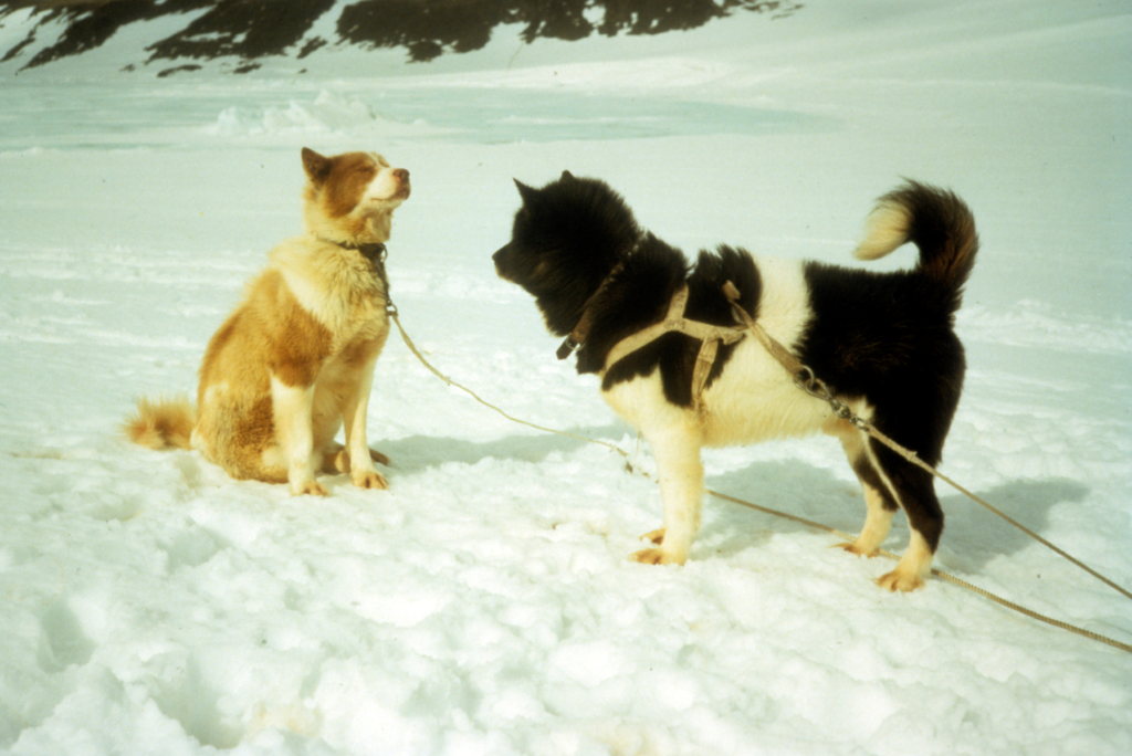
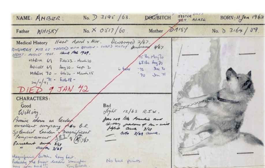
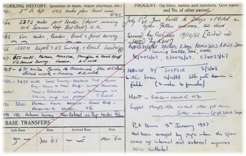
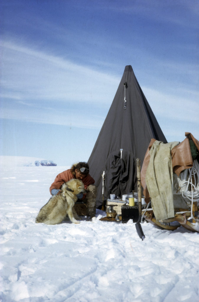
Amber and the Komats – Geoff Renner
Amber could not have long been in the Komats when I took over in mid-1964 at Stonington. Her previous driver was John Cheek at Hope Bay. John was the radio-operator at Stonington in 1964 having come down from Hope Bay with Noel Downham. It was warming to see Tony B’s comments regarding Amber “Magnificent Bitch. Very fast. Probably the finest leader Stonington has ever had”.
(Photo: Geoff Renner)
(Photo: Geoff Renner)
Geoff Renner, Geophysicist, Stonington 1964
More Tales – Noel Downham
Two of us were sledging off the Jason Peninsula with two teams. Because of the pending ship survey we were ordered to get back to base immediately. There was a steady wind and ground drift blowing off the plateau and l was the second team. We were heading north and my partner‘s team kept veering to, the east, away from the wind. The wind was so strong that he was having great difficulty using his whip to get them back on course. Then in desperation he stopped, tied the end of the whip onto the handlebars of the sledge and started hurling the heavy handle to leeward to try and get the team to turn up wind.
From my viewpoint the vision of a bloody great whip handle, (we were still using the 40 ft. Bingham style whips) hurtling through the air and the string of unrepeatable expletives that followed it made my day.
We were sledging off Cape Lachman on the Gustav Channel side of James Ross Island. It was an area where seals often congregated and sun-bathed. There were inevitably many seal breathing holes and you can imagine the pandemonium when a seal shot right up in the middle of my team, smack hang in the middle of the centre trace.
Drama and Death in Bill’s Gulch – Geoff Renner
The Terrors and the Komats shared much. They had originated at Hope Bay, trained and travelled many miles in one another’s company, moved to Stonington by ship then returned oversnow to Hope Bay. They also shared a family – a litter of five ‘semi-precious stones’. Whilst Amber, Jasper and Agate ran with the Komats, Jade and her brother Onyx pulled with the Terrors. Cain was a leader of the Terrors backed by the centre-trace pairings of Jade and Nick, Kelly and Jet, Onyx and Bryn, then nearest the ‘cowcatcher’ the powerhouse duo of Mac and Coll. Where Coll lacked in IQ he made up for in grit and spirit. He was also one of the first Antarctic huskies to undergo major surgery. This was to remove a seal bone critically lodged in his intestine. The operation was successfully completed during his sea passage from Hope Bay to Stonington Island in early February 1964 – on board the RRS John Biscoe. Unfortunately, Jade was never able to realise her full potential as a sledge dog for she was killed in a harrowing accident during her maiden journey out of Stonington Island.
In the early to mid sixties the scheduled field area for Stonington Island earth scientists was the east coast of Graham Land. The area bordered the Larsen Ice Shelf north of latitude 68° 30′ S. With aircraft support committed elsewhere personnel had no alternative but to travel and lay depots overland. A choice of two routes were known.
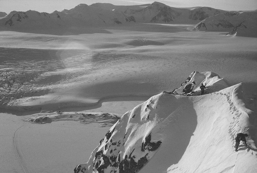
(Photo: Roger Scott)
The safest, though longest, lay across Neny Fjord then up the long incline of Snowshoe Glacier to descend the gradual contours of Gibbs Glacier on Mobiloil Inlet. The disadvantages were the short but demanding ice foot and cliff fronting Snowshoe Glacier, and prerequisite of reliable sea ice to blanket the open and windswept waters of Neny Fjord.
The more direct route lay inland from Stonington via Northeast Glacier, then by a long and difficult haul up Sodabread to attain the plateau at almost five thousand feet. Separating the plateau from Trail Inlet on the East Coast was Bill’s Gulch. Only the foolish did not fear it….
The Terrors – Noel Downham
Some notes written in 1963 (to help the driver taking over his team, the Terrors, when he left).
The Terrors started life at Hope Bay for a season, were shipped to Marguerite Bay for a second season during which they returned to Hope Bay along the East Coast and back again to Stonington.
1965
Base Commander – Mike Cousins
| Cousins, M.J. (Mike) | BL, GA |
| Gardner, J.L. (Jimmy) | GA |
| Holmes, K.D. (Keith) | Geologist |
| Marsden, N. (Neil) | Surveyor |
| Matthews, D.W. (Dave) | Geologist |
| Parnell, D.S. (Don) | Radio Operator |
| Rider, A.H. (Tony) | Surveyor |
| Steen, J.W. (Jim) | GA |
| Tait, J.E. (John) | GA |
| Thomson, M.R.A. (Mike) | Geologist |
| Thornton, E. (Edwin) | GA |
| Todd, D.T. (Davy) | GA |
| Vaughan, D.N. (David) | Tractor Mechanic |
Topographic Survey
Marsden and Rider
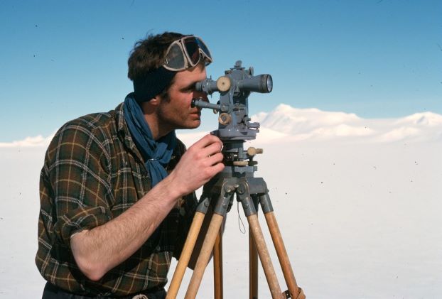
The primary task for Neil Marsden and Tony Rider was Tellurometer traversing to link the earlier triangulation schemes from Detaille and Horseshoe, this was recced in the winter of 65 but work was held up when sea ice problems marooned the party on Detaille Island (see story below).
Mike Cousins made a “sketch” survey of the Bingham Glacier on a geological trip, heights obtained using an erratic aneroid barometer.
The 1965 field season was supposed to based on Adelaide, Base T. However shortly before the relief ships arrived at Adelaide one of the single-engined Otters landed heavily and one strut was pushed through into the cockpit thus rendering the plane inoperable.
As a safety measure the remaining plane was only permitted to fly to places where there was already a presence, such as a field team.
Earth Sciences
A Year of Geologising in Northern Marguerite Bay – Dave Matthews (Stonington, 1965 and 1966)
The Landing at Horseshoe
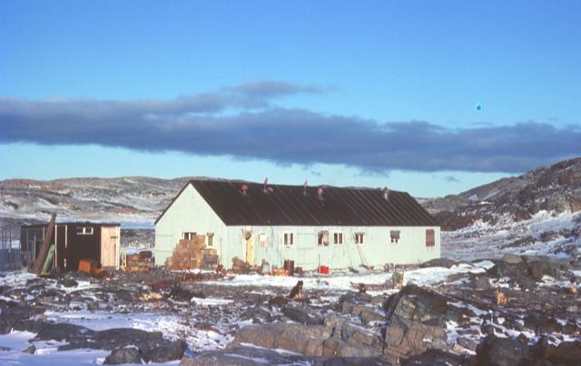
(Photo: Dave Matthews)
I arrived at Stonington on “John Biscoe” in late February 1965 after the usual four months of pent up inactivity, to be greeted by two bits of news.
1) Jim Steen was to be my field assistant on an ambitious field programme sledging in southern Palmer Land.
2) One of the two old Otter aircraft had just had an accident and would not be available to support such a long range project, which was therefore cancelled.
Jim and I were instructed to return to UK on the “Biscoe“; a plan that did not appeal to either of us.
In the end, new plans were proposed and accepted by BAS HQ in London; some of the field teams to sledge down the east coast of the Peninsula, and myself to do geological survey in northern Marguerite Bay. Jim decided to go along with the latter and be my ‘gash hand’ for the bulk of the work, rather than go back to the east coast where he had been with Garrick Grikurov the previous season.
For the autumn, though, I was to start by basing myself on the old Horseshoe Island hut (Base ‘Y’) with Soopsey Vaughan as assistant and Noel Downham’s old team – the ‘Terrors’.
Soopsey and I and some basic supplies were to be dropped off at the old base on 1st April, extremely late for the “Shackleton” to be so far south, and it gave me only a few hours to discuss the work on the ground with Garrick who was on his way back to Russia. When the day came, we were onboard overnight as the ship moved from Stonington Island, across northern Marguerite Bay and into Bourgeois Fjord.
Working for the Autumn and Summer from Horseshoe Base – Dave Matthews
Due to poor sea ice, Soopsey and I were still at Horseshoe for midwinter. A ‘rescue’ party of Keith Holmes and Jim Steen sledged over from Stonington in early July with more dogs to lighten the loads and help us for the 35-odd miles back to Stonington on thin ice.
The journey was eventful. In the winter darkness, Jim broke through a newly frozen and nearly invisible lead off Beacon Head and, following him, I could see three heads bobbing in the water; Jim’s and two seals.
We managed to pull Jim out and get the sledges across by charging the lead at a narrow point but it was my first experience of Jim’s toughness and obstinacy. Bearing in mind our precarious situation on thin sea ice off Beacon Head with no more land to the west of us, he refused to hang around putting up a shelter and changing clothes, insisting on battering on to Stonington (approx 25 miles) in clothes which were frozen rigid almost immediately. He survived with no more than extensive chafing and severe chill.
Our Return to Stonington – without Claire – Dave Matthews
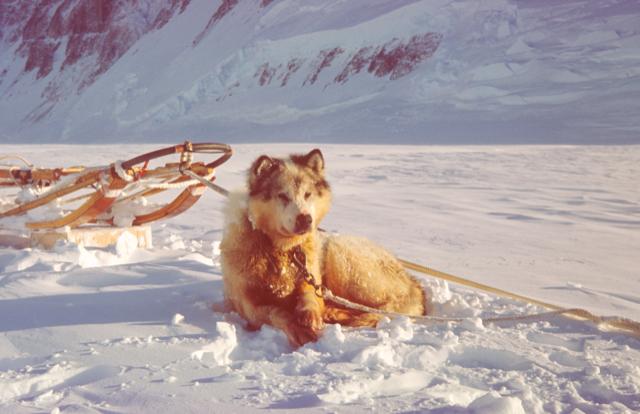
This part of the story really belongs to Claire, a ten year old bitch with several fine litters to her credit and a sledging career longer than that of most dogs in the harsh Antarctic conditions. She was born in 1957 at Hope Bay (Base D). By the time of this story, in 1965, Hope Bay had closed and Claire transferred, along with several teams, to Stonington Island a thousand miles or so further south (a journey, incidentally, that can never be repeated now that the Larsen Ice Shelf, along which the sledge route lay, has completely broken up and disappeared).
July 30th – Winter Survey Journey to Horseshoe and Detaille
On July 30th, 1965, a three-man party departed Stonington with three teams, for the purposes of establishing a topographical survey connection between Bases W (Detaille Island), Y (Horseshoe) and E (Stonington); to lay depots for the Summer Survey; visit Detaille Island Base; and if possible to visit Adelaide, to pick up “certain items” necessary to the survey.
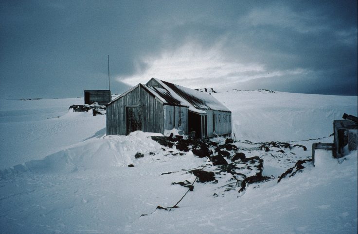
BAS Archives Ref: AD9/1/1996/14/27)
Tony Rider (Surveyor) was driving the Spartans, Jimmy Gardner (GA) the Vikings, and John Tait (GA) the Komats. The Journey had remarkably good surfaces and mostly excellent weather during the first half of August, enabling the party to lay all the necessary depots and reach Detaille Island (Base W) three days earlier than expected. The Sledgers established five (5) survey stations in preparation for the Summer Survey. Little did they expect what happened after that… Read On…
The Eternity Range
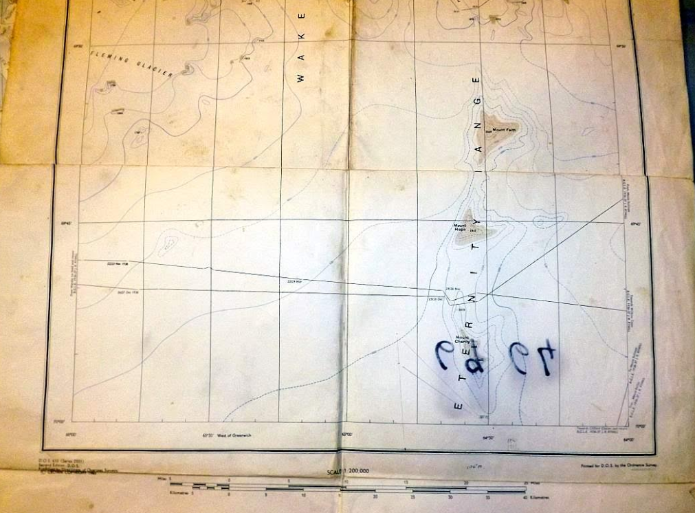
The Eternity Range, comprised of three mountains: Mt. Faith, Mt. Hope and Mt. Charity, was first visited by Rymill and Bingham during their Southern Journey during BGLE. Rymill’s book “Southern Lights” describes their journey to and through the range.
The three peaks are a long way from anywhere, and climbing them needed a reason to go there for geology, geophysics or survey, and so they remained unclimbed until 1965.
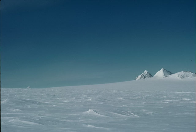
Mt. Hope, recently boosted in height from 2,862 m to 3,239 m (9,380 to 10,627 ft) and now the highest peak in the British Antarctic Territory, was first climbed by Keith Holmes and Mike Cousins on 25 December 1965; Mt. Charity, 2680 m (8,793 ft) first climbed by Tony Bushell, Rod Pashley and Ian Rowe on 23 January 1970; and Mt. Faith, 2,650 m (8,694 ft) first climbed by Ali Skinner, Brian Hill and Steve Wormald on January 7th, 1971. Individual stories are below.
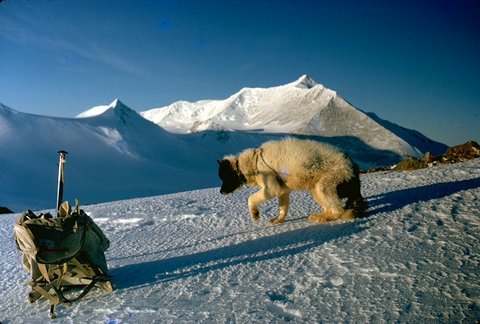
December 22nd, 1965 – Eternity Range – Mt. Hope – First Ascent – Keith Holmes
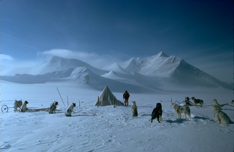
We left our depot at Mount Sullivan at 11:00 hours on a whitish day, and proceeded to the col between Mounts Hope and Faith. It was a stiff climb to the crest, at a height of 9,500 feet according to the barometer, and some of the dogs were foaming at the mouth. We camped happily at 20:00 hours, having travelled 18.5 miles in temperatures ranging from minus 8º C to minus 16º C.
1966
Base Commander – Terry Tallis
| Allan, T.J. (Tom) | DM |
| Bottomley, A. (Alec) | GA |
| Boulding, R.A. (Dick) | Surveyor |
| Doyle, K.C. (Ken) | GA |
| Holmes, K.D. (Keith) | Geologist |
| Horley, D. (Dave) | GA |
| Marsden, N. (Neil) | Surveyor |
| Matthews, D.W. (Dave) | Geologist |
| Noble, J.R.B. (John) | GA |
| Noel, J.F. (John) | Radio Operator |
| Ross, J. (Ian) | Geologist |
| Tallis, T.H. (Terry) | BL, GA |
Topographic Survey
Marsden and Boulding
Between Oct 66 and Jan 67 when neither aircraft or Tellurometers were available Neil Marsden and Dick Boulding carried out exploratory surveys in the Bingham Glacier and south to 71S.
Details were mapped by plane table either side of the Eternity Range and south to the Eland Mountains.
While the surveyors were in the field the US Navy began flying Trimetrogon photography eventually covering 22,000 sq. miles of BAT which was to be a game changer in how BAT would be mapped and the topo surveying required.

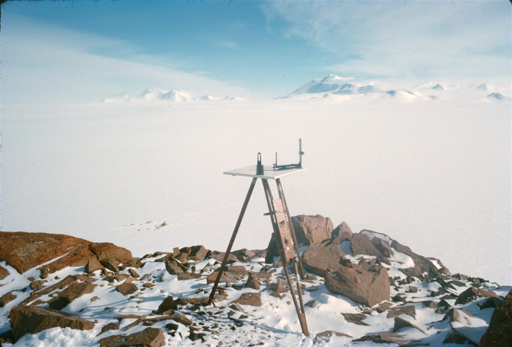
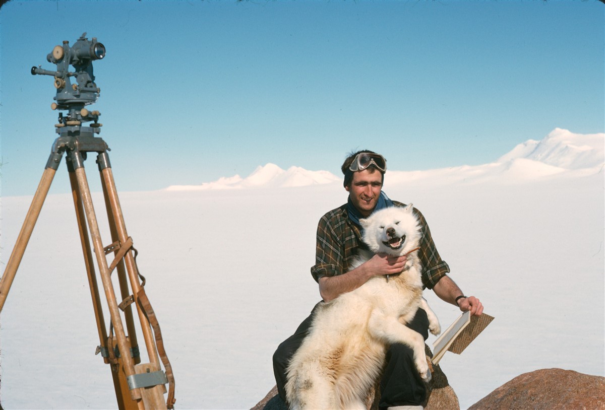
Earth Sciences
A Second Year – Dave Matthews
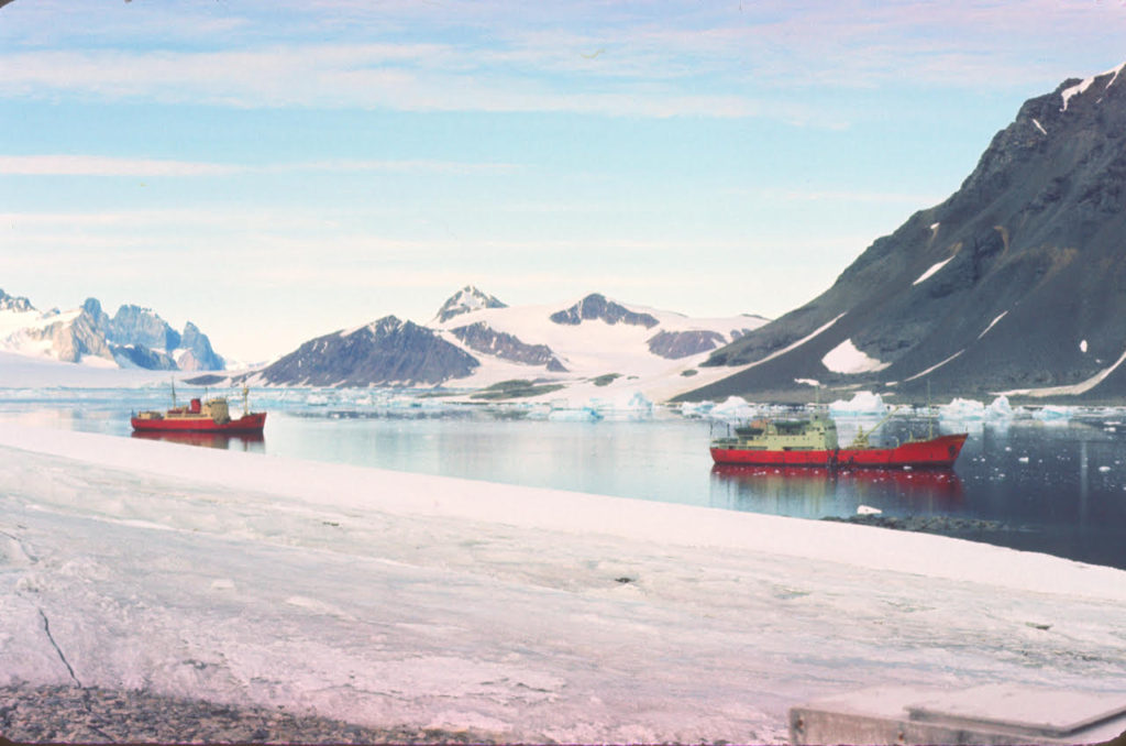
The rumbling of the ship’s main engine, clattering of the anchor cable and bells ringing all impinged on my consciousness. Not sounds of the ships arrival – she turned up some days ago and was anchored off the the corner of Stonington island. No, it was sounds of a hurried departure from a difficult anchorage as the wind rose rapidly to storm force, catching them unprepared in a dangerous situation. A summer storm was certainly a little unusual but we at the base had seen the signs, the snow drift obscuring the mountain edges, the.drop in temperature. and knew roughly what was coming.
Once things had calmed down, after a couple of days or so of storm, life on base settled down to the usual summer routine. Tons of cargo to unload for the coming year (mostly fuel and food, of which the base had to have enough for two years in case of difficult ice as in 1959); sacks full of mail to read and answer; new faces to meet and goodbyes to say to friends starting their journey home.
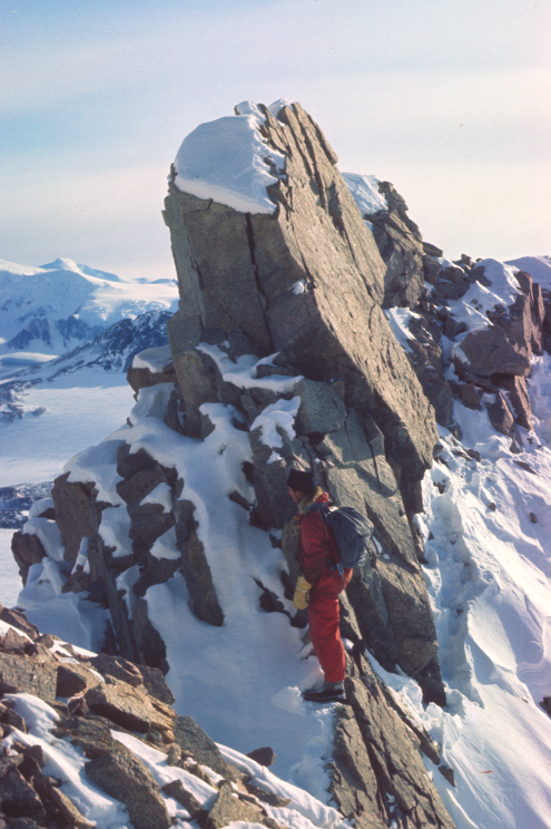
In March, as the summer drew to a close, and after all the hard work and rushing around were finished, it was time for the ships to leave before they risked getting frozen in, and for us to start the autumn’s programme of survey work. I was given a lift back to Horseshoe Island on the ship on her way past, to carry on survey work with John Noble as GA. All routine stuff, but this year with a definite plan to get back to Stonington on the sea ice before midwinter. However, as always, things didn’t work out to plan. The first task on opening up the old hut was to take the boards off the windows, light a fire, see if the generator and the main radio would work and, once the ship had left us to head for the UK, get started on survey work and pick up the threads of where we had left off the previous year.
This mostly involved day trips out from the hut, especially as the autumn days became shorter, but in spells of good weather, we could harness the two dog teams and set out on short journeys to visit new sites. This was wildly exciting for the dogs who would be in a mad rush to go somewhere new and see new country; very like us for that matter. Life in the hut was comfortable compared to a tent, but cabin fever could set in after a few weeks.
A Sledging Fatality – Terry Tallis
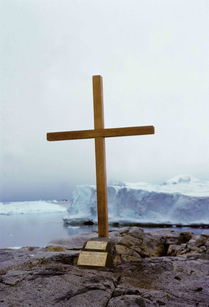
More than 50 years have passed since the tragic sledging accident at Stonington involving John Noel and Tom Allan. As Base Leader (Commander) at the time, I and most of my colleagues on Base in the winter of 1966 have decided to make this a first-hand account and put right some inaccuracies written by others who have interpreted official reports incorrectly or for whatever reason strayed from the facts. We started out a team of twelve at Stonington in 1966 and now, in May of 2020, sadly there are only six of us left. It’s time to hear from the men involved.
It has generally been accepted over the years that static base personnel need a holiday break away from base due to the nature of their jobs. This certainly applied to staff at Stonington maintaining generating plant and radio communications. Those were John Noel and Tom Allan’s job on Base.
As Base Leader I agreed with HQ Stanley to cover John and Tom’s official duties to allow them to get into the field for a well-earned break after the rest of the sledging teams had returned to base for the winter. I had already spent 3 seasons maintaining diesel generators and Alec Bottomley was also a very competent engineer. I had an Amateur radio licence and experienced in using the radio equipment. John and Tom’s planned ‘holiday break’ was fairly short and they were experienced and well equipped to undertake the journey away from base.
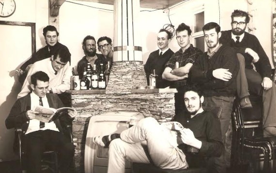
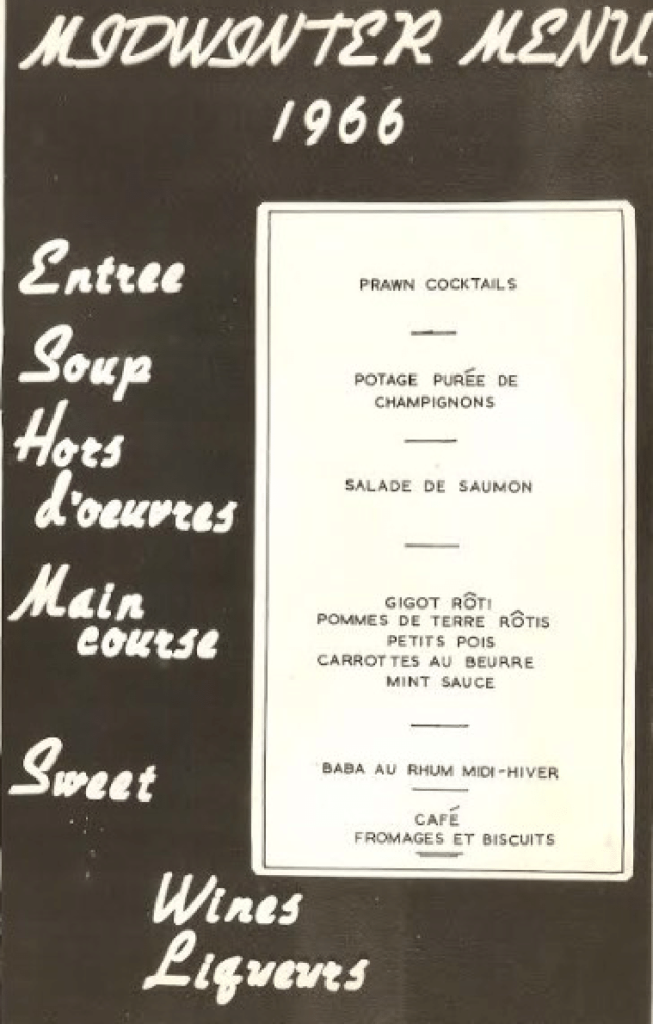
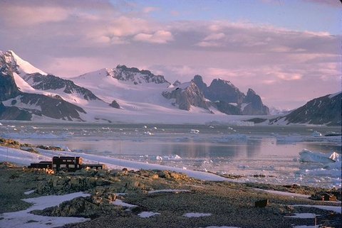
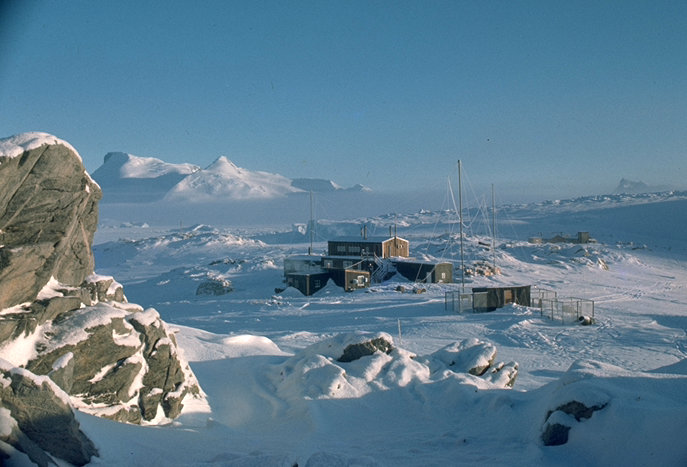
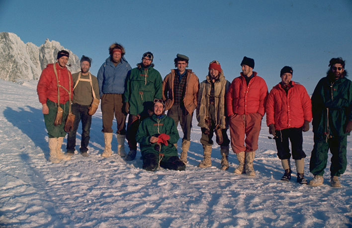
(Photo: Keith Holmes)
Earth Sciences
Palmer Land Geology – Keith Holmes
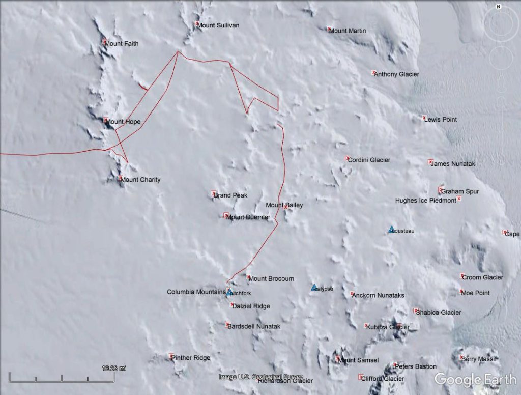
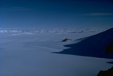
Clifford Glacier in the distance (Photo: Keith Holmes)
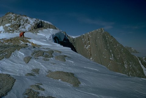
(Photo: Keith Holmes)
Meet the Komats – A Eulogy in Doggerel – Neil Marsden
(Written during a lie-up on the Plateau – January 29th, 1967)
(All Photos: Neil Marsden)
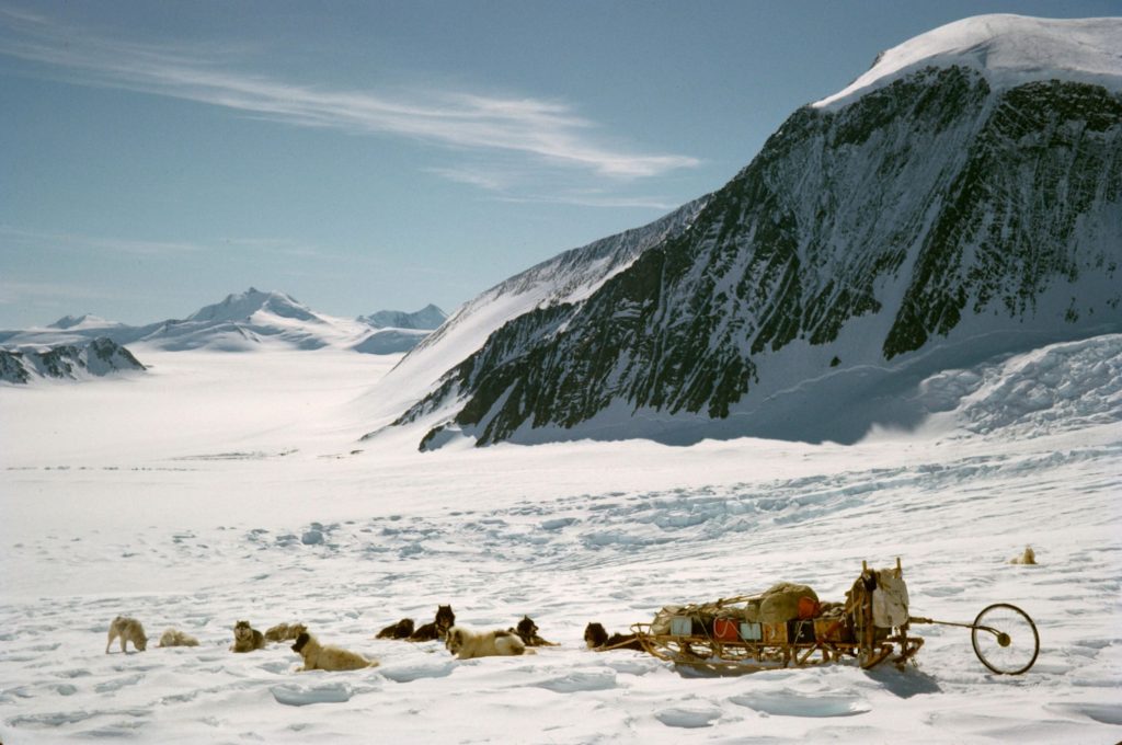
A strong tradition exists down here, when writing reports at the end of the year,
That one should cite one’s team of dogs as far and above the other hogs
And who am I tradition to belie, and anyway falsehoods I do decry’
So disregard other false report and follow this I do you exhort.
(Although perhaps it should be stated in some quarters as biased I’m rated.)
Doggy Traits – Ken Doyle
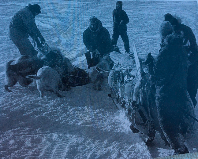
During the summer of 1967/68 Andy Bellars, a vet, came around the bases giving very useful advice on breeding and treatment of dogs, etc.
I had newly taken over the Giants and was running some boxes up to the hut. Andy wanted to give Neddy an injection and decided to do it when I had stopped the team. Andy stuck the needle into Neddy’s rear end; Neddy yelped in great surprise and Snurdley (Neddy’s arch enemy) that if someone was going to attack Neddy he would help. Within seconds the whole team was enjoying a good scrap with Andy Bellars underneath. Andy always reminds me of that time that he learnt how not to break up a dog fight.
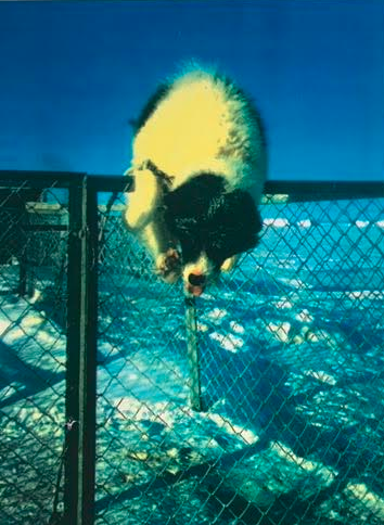
On Adelaide in the late 60’s we used to span the dogs up on the ice piedmont above base. Bitches on heat were brought down to a cage near the huts. When a mating was planned, the lucky dog was released from the span and timed with a stop watch to see how long it would take him to run the 200 yards to his ‘intended’. I don’t recall what sorts of times or speeds were recorded but the dogs certainly wasted no time.
Ken Doyle, GA – Stonington 1966 & 1968
(Note: The “Escape” photo is typical of a penned bitch deciding to take such matters into her own hands).
February, 1967
Pilatus Porter 619 at Stonington Island – Keith Holmes
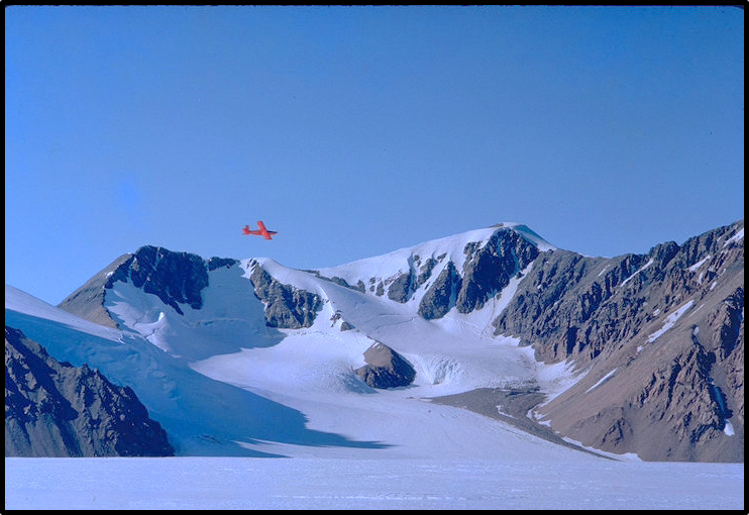
NERC bought the new Pilatus Porter for the Survey in 1966, and on January 26th, 1967, it arrived at Base T, on Adelaide Island, piloted by John Ayres.
Its first flight to Stonington Island was on February 8th, to take some essential spare parts to Base E, and to move Alec Bottomley from there to Base T.
The Porter did 67 hours of flying during that first season, primarily shuttles between Adelaide and Fossil Bluff, but also on radio echo sounding traverses, and in support of Neil Marsden’s heighting survey of the Fuchs Ice Piedmont.
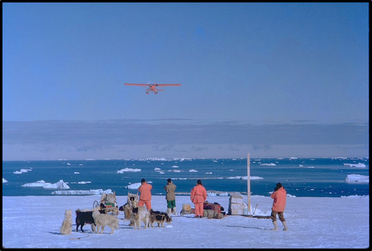
(Photo: Keith Holmes)
Douglas Rough noted that the Porter was never formally registered by the Falkland Islands Registrar of Aircraft, and all references to it being VP-FAN are wrong.
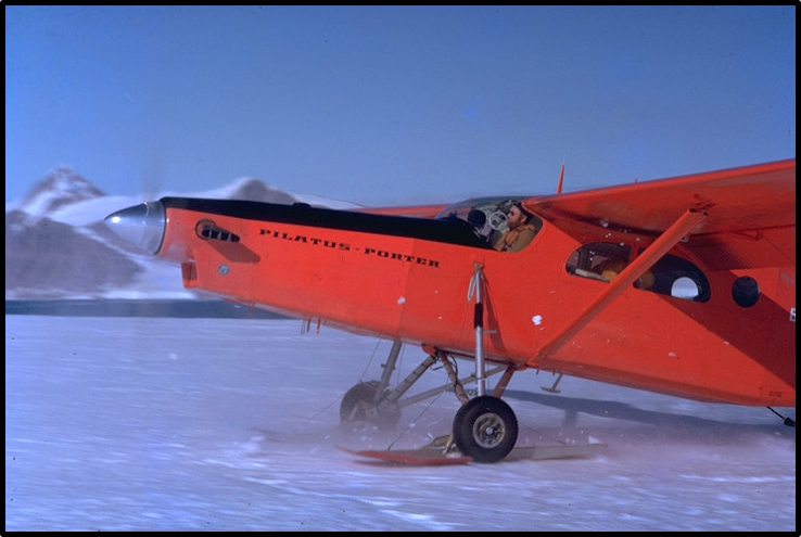
(Photo: Keith Holmes)
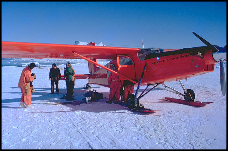
KOMATS . . . . KOMATS . . . . KOMATS . . . . KOMATS – Team Report 1966 – Neil Marsden
All Photos by Neil Marsden
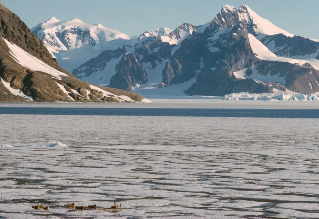
The seven dogs and two bitches I took over from John Tait at the beginning of last year have managed to stay alive, kicking and together all year. However time of partial disintegration is near. One is due for retirement to the Decrepit Huskies Home at Argentine Islands, his ‘kicking’ is no longer all it might be, and one for ignominious deportation to the same place, she’s useless.
Two of last year’s pups have been commandeered to take their places and so next year the 7:2 ratio will adhered to.
This leaves me, at present, well up with the current trend now seeping the Grahamland Plateau and associated areas of collecting as many dogs as possible into your team- I have 11. One of whom I have not yet run I must admit.
February 1967 – An Erratic Homecoming – (There is Life after BAS) – Dave Matthews
Much has been written over the years, and in many of the BAS Club magazines, about the experiences of Fids and others returning from lengthy absences on polar trips. It is undoubtedly less of a problem within BAS now that rapid transport to and from Antarctica is a matter of routine. As a small contribution to the debate (if there is one) my own experiences were slightly more eccentric than usual.
In late February 1967, I was on the point of leaving Stonington and my dogs for ever, heading north on RRS John Biscoe via various places and including a short stay at Wordie hut to run generators for the ship’s Hyfix survey. I was blissfully unaware of events taking place at the opposite end of the earth which were later to involve me.
At that time (1960’s), many Fids were allowed to plan a return home via south America, leaving the ship at Montevideo and making their own way from there. Not a bad opportunity to start readjusting to the world. Scientists such as myself, however, were permitted no such luxury and were expected to report within a month to Birmingham (in the case of geologists) to begin working up results. That meant a long long time on John Biscoe after leaving the Falklands, slowly trundling up the Atlantic; 22 days from Monte with nothing much to do. Not a good experience after two years of sledging and base life and perhaps not such good psychology by BAS.
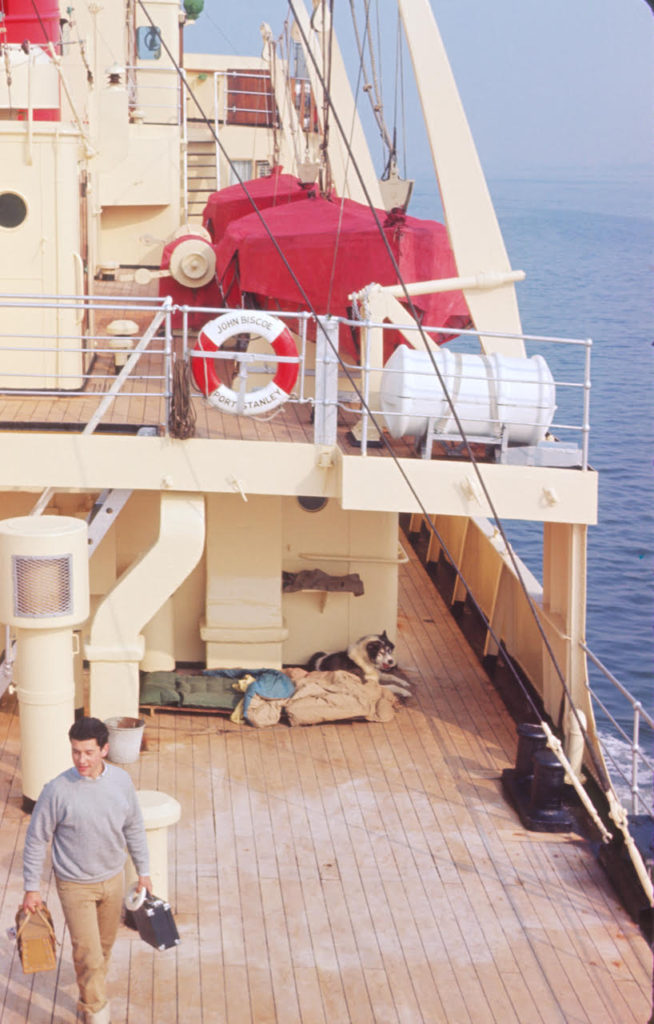
My journey was already a bit out of the ordinary since leaving Stonners in that I had a dog with me; one of my team, the Terrors, for return to UK for breeding, sanctioned at the last minute by the director. No good keeping the dog in my cabin obviously, and left on deck there was sufficient ‘anti’ feeling for me to be in no doubt that he would mysteriously disappear overboard one night. The solution therefore was that I slept on deck with the dog, on a duckboard under the overhang of the boat deck. Not a bad idea really, apart from one rough night when we were both washed into the scuppers by a particularly large wave. Most of the time, the fresh air was greatly preferable to a stuffy cabin, and through the tropics it was bliss; I had company then from below decks. No heat and noise from the engines either.
Feed for the dog wasn’t a problem since I could buy masses of steak in Monte for pennies. Strangely though, the food quality for us personnel on the Biscoe went downhill steadily so that as we approached UK there was very little left; no beer, no fresh veg, etc. As luck would have it, we had a tail wind and a very smooth fast crossing of the Bay of Biscay, meaning we arrived in Southampton a day early on 17th May. To our dismay, however, we were not allowed to dock until our appointed time on 18th. Imagine then, a shipload of fids, tired, disgruntled and disoriented after 2 years down south, followed by 2 ½ months at sea, within sight of the lights of Southampton, condemned to swing round the hook in Southampton Water for 24 hours with no beer and no permission to go ashore. It was a mutinous 24 hours.
The Stonington Medal – Lew Willey
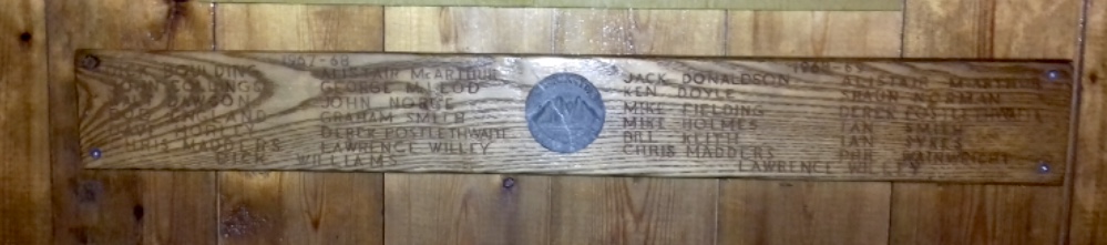
1967
| Boulding, R.A. (Dick) | Surveyor |
| Collings, O.J. (Owen) | Carpenter |
| Dawson, W.M. (Walter) | DEM |
| England, R. (Bob) | GA |
| Horley, D. (Dave) | GA |
| Madders, E.C. (Chris) | Radio Operator |
| McArthur, A.H. (Alistair) | BC |
| McLeod, G.K. (George) | GA |
| Noble, J.R.B. (John) | GA |
| Postlethwaite, D. (Derek) | Surveyor |
| Willey, L.E. (Lew) | Geologist |
| Williams, R.A. (Richard) | MO, Bacteriologist |
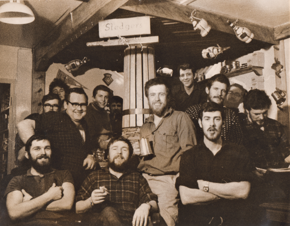
Standing Bill Dawson; Ali McArthur; Dick Williams; Bob England
Front Row Lawrence Willey; George McLeod; John Noble (Photo: Lew Willey)
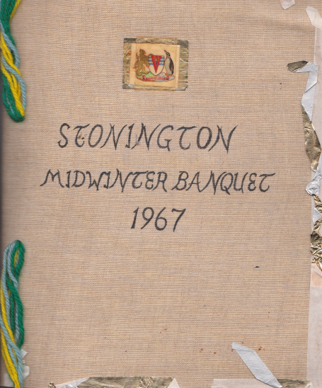
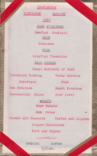
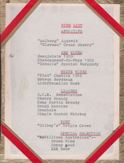
Topographic Survey
Boulding and Postlethwaite
Dick Boulding and Derek Postlethwaite were flown to Fossil Bluff in Oct 67 and with dog teams and two Muskegs worked north to 70.2s and a Tellurometer traverse measured up the west side and across the Sound. The 1963 stations on the east side were checked but could not be measured because of flooding.
Return from the Wordie Ice Shelf – John Noble
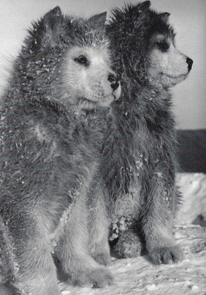
We had been in the field for nearly a month, laying depots of food and fuel for the following springs’ season of work. Autumnal days in these latitudes do not offer the best of weather, nor daylight hours, for safe travel over a recently frozen sea yet our group of four dog- teams and four men continued into the oncoming night determined to reach our base, still ten miles away, that night.
By now we were heading into vicious katabatic winds flowing down from the coastal mountains and plateau and across the frozen and jumbled sea ice that we were travelling over. The drifting snow and hard sastrugi slowed us down and the cold of darkness began to bite. To save energy for both men and dogs each team would take their place in front to break trail, changing every hour or so. Tonight there was little moonlight to aid our travel and no sparkle of reflected light from the ice-scape to help us on our way.. We were navigating entirely by compass and sledge wheel and perhaps memory of various sculptured icebergs that we thought we recognised. As for our safe arrival and at what hour – so much depended on the dogs.
Signy’s Last Journey – John Noble
We had been travelling for months, having left Stonington base early in September 1967. We had sledged down the west coast crossing over the Wordie Shelf ice in differing weather then climbing through the Eternity Range that lies in the main spine of the Antarctic Peninsula. Mapping in this area we travelled southward towards Mount Andrew Jackson taking in the various peaks and nunataks that pierce the ice-cap before making our return journey northwards along the polar plateau before turning westward to find our way back to Stonington Island and home.
Breaking Through – George McLeod
Three of us and three teams had been out of base for several days on bad sea ice. It was short]y after the lads from Horseshoe Island had gone missing, and we were all a bit nervous. Well, it happened. Ken Doyle and his team broke through into the water. We managed to drag him and the dogs out but it took us two hours, running all the way, before we reached firmer ice and were able to stop. By that time Ken’s legs and feet had really frozen up and he was in a bad way. The tent erected, we thawed him out and he immediately lost the skin off both legs and feet. In our haste we had just picketed the dogs, and all of a sudden we heard a big fight erupting outside. A couple of us rushed outside and found the 30 dogs had pulled the pickets and were all scrummaging down. Once we got them sorted out, we found “Ruthie’s” stomach so torn that her insides were hanging out. I pushed everything back in, roughly stitched her up and got ready to head home.
That was a hell of a journey, still on poor sea ice and with three days back to base. I led out front with two dog teams (18 dogs), two sledges, two men – Ken could just about walk – and then Ruthie following the sorry caravan procession behind me. That night when we pitched camp, there was no sign of Ruthie. Ken was in agony and none of us could sleep. Suddenly the dogs began barking. I jumped out of my sleeping bag to investigate. It was Ruthie. dragging herself into camp. I thought I ought to put her out of her misery. But no, she’d made it this far, blood loss and al1. We got back to base two days later and it took Ruthie almost another full day – but she made it. In time her belly healed and she was back to work as if nothing had happened.
George Mcleod – GA 1957 – Anvers, GA/Base Leader – 1958 Prospect Point – GA in 1962 Hope Bay, Stonington GA – 1963 and 1967
1968
Base Commander – Ali McArthur
| Donaldson, J.T. (Jack) | GA |
| Doyle, K.C. (Ken) | GA |
| Fielding, H.M. (Mike) | Surveyor |
| Holmes, M.J. (Mike) | MO, Physiologist |
| Keith, W.A. (Bill) | DEM |
| Madders, E.C. (Chris) | Radio Operator |
| McArthur, A.H. (Ali) | BC |
| Norman, S.M. (Shaun) | GA |
| Postlethwaite, D. (Derek) | Surveyor |
| Smith, I.F. (Ian) | Geophysicist |
| Sykes, I.A. (Ian “Spike”)) | GA |
| Wainwright, P. (Phil) | GA |
| Willey, L.E. (Lew) | Geologist |
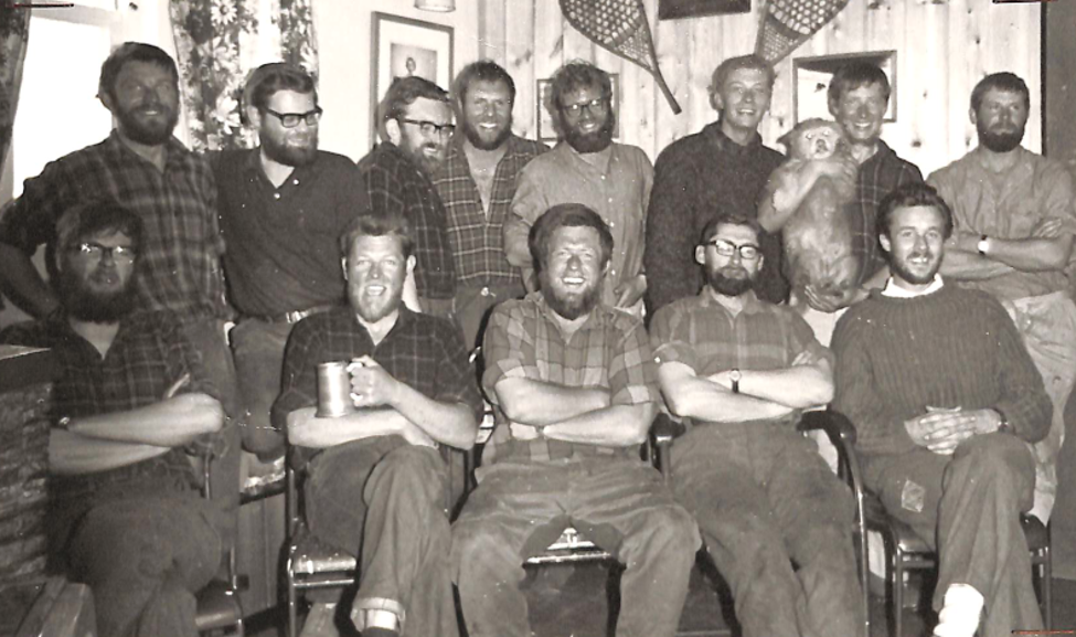
Front, L to R: Chris Madders (Radio Op); Bill Keith (DEM); Alistair McArthur (BC); Ken Doyle (GA); Mike Fielding (Surveyor)
Or this one, after they’d all had a wash….
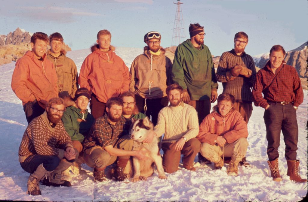
Front row: Ian F Smith, Mike Fielding, Derek Postlethwaite, Jack Donaldson, Lawrence Willey, Alistair McArthur
(Photo: Phil Wainwright)
Topographic Survey
Postlethwaite, Wainwright and Fielding
In March 1968 John Biscoe transported three parties and dog teams to Blaiklock Island to continue the work began by Tony Rider in 1965. They set up 4 stations and measured 3 lines getting back to base in July.
Mike Fielding and Derek Postlethwaite worked from the sea ice to extend Tellurometer trilateration to the Terra Firma Islands latterly assisted by RN helicopters.
Phil Wainwright used hand-held helicopter photography and pre-marked control to compile large scale maps of several of the islands for the geologists.
In 1969 American engineers began to establish survey control east of 65w and between 73s and 75s for geological mapping of the Lassiter Coast.
Earth Sciences
Pups – Ian “Spike” Sykes
During the winter of 1968 my lead bitch “Jenny” suffered serious problems while giving birth. The was no vet on base that season and in in typical Fids fashion the base doctor attempted a Caesarean section and managed to save two of the pups. Jenny survived the operation but never fully recovered and died a day or so later.
No other mother seemed to want the new pups “Spike and Eccles”, so we came up with the idea of the “Omnitit”. Plans were high at the time that this wonderful invention would be the start of a thriving export business but strangely there were only a few takers. When they were old enough, the pups joined the Vikings team – they were the only man-reared dogs we found in the records.
Ian “Spike” Sykes – Stonington, GA, 1968 & 1969
Spring – The Cape Jeremy Affair – Shaun Norman
In September 1968, after six months around base, four of us set off southwards towards field base Fossil Bluff for a summer’s work. Alistair would work with Ian Flavell-Smith on a geophysics trip whilst I was to accompany geologist Lew Willey who did not have a dog team.
We left Stonners with heavy – 1200lb/550kg – loads. The lead team – which changed each day – carried less and blazed trail whilst teams two and three carried larger loads. Juggling loads between teams was a constant process and if a team was having a hard time and holding up progress, the others would come and take a food box to help out. Every team had its off days as well as its lively days.
All went well for the first days and we travelled south over good sea-ice past the Terra Firma Islands and other island groups, picking up supplies from depots as we used up man and dog food and kerosene.
It is perhaps interesting to note here that communication with UK did exist, but only in a very basic form. Intercontinental voice (telephone) connection did not exist and the favoured form was Morse code, received and sent by our radio operator. All of our monthly reports to ‘London’ were reduced to the most concise and woe betide any Base Commander who got too wordy!
The Great Puffballs Rescue/Jolly – Ian “Spike” Sykes
Stonington had a couple of bad years for accidents and incidents in 1965 and 1966.*** As a result, our Base Commander, Ali McArthur, very rightly, was scrupulous on safety. Sledge parties were reluctant to travel in bad weather and long ‘lie-ups’ were the order of the day.
On my first sledging journey we had terrible, mild weather. We had been landed on Blaiklock Island by the ‘Biscoe’ and had a 16-day lie up and two 11-day lie-ups on the Heim Glacier. As a new-boy, this I assumed to be quite normal.
The poor sea-ice made it impossible to get back to Stonington in time for Midwinter. It rained heavily on Midwinter’s day, which we spent rather miserably, camped on the beach on Blaiklock Island. In fact my sledge broke through the ice on the way home to Stonington a couple of weeks later.
*** – The first was when a survey party was stranded on Detaille Island after the sea-ice blew out (see here). Fortunately, they suffered no harm, but in the following year two men lost their lives during a storm in what is informally known as ‘the bypass’, a tributary valley on the northern side of the upper reaches of the Northeast Glacier (see 1966 – Sledging Fatality above – ).
Dogs of the Sledge Trail – by Ken Doyle
Somewhere to the Southwest in the grey lonely emptiness of the Bellingshausen Sea a weather system was developing, producing an ever-increasing wind which swept up the glaciers descending down from the central Plateau of the Graham Land Peninsula. The mountain ranges which formed a jagged rampart along the West coast guarded a remote and, but for the moaning of the wind, a silent land.
Already the wind was strong enough to pick up loose snow and carry it along as low, fine, drift that hissed and swished a foot or so above the surface of the Plateau, twisting in little white whirlpools of ghostly mist before breaking out into a curving gusty path into the distance. It was a place never intended for men – for life and living things – for growth and fullness. It was as a planet somewhere in the coldness of space might be before it felt the warming energy of the sun – or as it might be at its death. It was a lonely place – a place where even death is absent – for there is nothing to die – at least nothing born of this forbidding land.
1969
Base Commander – Shaun Norman
| Bentley, P.I. (Paul) | Surveyor |
| Burns, F.M. (Mike) | Geophysicist |
| Bushell, A.N. (Tony) | GA |
| Donaldson, J.T. (Jack) | GA |
| Feenan, A. (Tony) | Radio Operator |
| Fielding, H.M. (Mike) | Surveyor |
| Gargate, B. (Brian) | GA |
| Keith, W.A. (Bill) | DEM |
| Norman, S.M. (Shaun) | BC |
| Pawley, M.R. (Mick) | GA |
| Rowe, P.J. (Pete) | Geologist |
| Sheldon, E.B. (Brian) | GA |
| Skinner, A.C. (Alistair) | Geologist |
| Smith, I.F. (Ian) | Geophysicist |
| Sykes, I.A. (Ian “Spike”) | GA |
Winter 1969 – Shaun Norman
In late February, with the ship gone, I opened the sealed instructions and found an extremely challenging programme laid out for us in 1969-70. I also found new one-time code books especially supplied for very private communications with London. In addition I was appointed a JP – Justice of the Peace – and local magistrate for Marguerite Bay. Fortunately I never had to perform any of the duties incumbent on such officials.
I did however have the key to the arms locker and signed out .303 and .45 ammunition for seal kills and sledge parties. Most teams would carry a .45 and a few shells on the chance that they might get a seal or, sadly, have to put down a badly injured dog.
Topographic Survey
Fielding and Bentley
In July 69 with good sea ice Paul Bentley and Mike Fielding sledged to Horseshoe Island and and measured a Tellurometer traverse from their previous work to connect with Searle’s work at Horseshoe in 1956 and Marguerite Bay work.
Bentley and Fielding ran a closed Tellurometer traverse to the Mushroom Islands and southeast across the Wordie Ice Shelf to Triune Peaks. An inconveniently positioned ice berg prevented the measurement of one line and the break up of the sea ice saw the surveyors depot the survey equipment in the islands and beat a hasty retreat to the coast. (see Steve Wormald’s tale of recovering the gear below)
Earth Sciences
Winter geology/geomorphology party working on Porquois Pas Island, put ashore by John Biscoe in March to work through to July and sledge back to Stonington over the sea ice.
Read on or Download Report…
My Stonington Dogs – Mick Pawley
Droopy
After 2 months working in the field the men started to crave for fresh bread or for that matter any bread. We considered that we deserved 2 or 3 days break from work and so decided to make a trip to the old Horseshoe lsland base – where could make bread, and sample some of the other goodies stored there i.e. tinned foods, rum etc.
A recce was carried out to see if there was a route to Horseshoe via Nemo Cove. 2 teams with empty sledges (Giants, Mick Pawley and Vikings, Mike Burns) made their way to the top of the Cove. 2 miles from the sea, heavy crevassing was encountørød and a number of the dogs in the Giants (lead sledge) broke through small holes.
The crevassing steadily got worse and it became apparent that we would not be able to gain Horseshoe island from Nemo Cove. Just at that time the 2 middle paris of dogs disappeared leaving the leader Lola and the front pair Snurdley and Fey on one side of the crevasse and the sledge and the back pair on the other side of the crevasse.
Snurdley was an ‘escape artist’ and was not happy with the weight of the 4’ dogs down the hole pulling on his harness. Snurdely was more or less looking straight into very large dark hole. This was not for him and he escaped by slipping out of his harness. While all this was going on the sledges had been secured by pickets and overturned.
Lola and Fay were recovered from the opposite side of the crevasse. Now came the task of retrieving the 4 dogs who were hanging like puppets on a string.
July 22nd – Jones Ice Shelf and The Man in the Moon – Ian Sykes
Added with the Kind Permission of Ian ‘Spike’ Sykes from his book “In the Shadow of Ben Nevis” (available on Google Books).
In 1969, on my second year working for the British Antarctic Survey, four of us reopened the old disused base on Horseshoe Island. Myself as the General Assistant with my dogs (The Vikings), Ian Flavel Smith (Geophysicist) with his team (The Komats) and Mike Burns (Geophysicist) and Pete Rowe (Geologist) were taken by the ‘RRS John Biscoe’ from our main base on Stonington Island to spend the winter doing geophysics before setting out south for the spring journeys. Horseshoe Island is in Marguerite Bay, about halfway down the West side of the Antarctic Peninsular just south of the Antarctic Circle.
The ‘Biscoe’ left the four us waving goodbye from the beach among a pile of boxes. Ali MacArthur Read on….
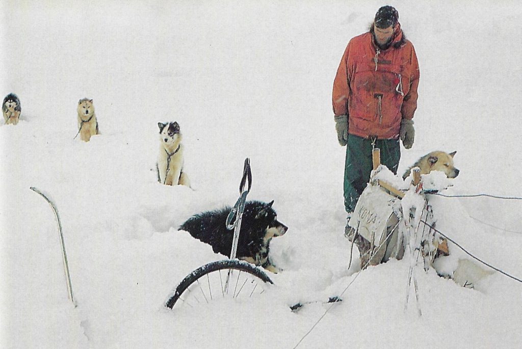
Steep Slopes, Mabel and Pati
The Vikings and the Ladies on the Heim Glacier between Blaiklock Island and Detaille Island in a typical moment in a day’s travel. This is hard going. The lead sledge has been lightened to ease the trailbreaking and a man has gone ahead to encourage the team who are having a struggle in snow up to their bellies.
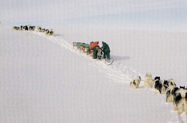
Alastair Skinner and I travelled together for 5 months with only one team, the Vikings. Mabel, the lead bitch, had only one eye, the other having been lost in a scrap when she was only a pup. She was a splendid leader, always totally biddable, she slowly went blind in the other eye but proved so reliable that in difficult terrain where an exact compass course was required she would still be used. Probably the only blind leader ever; she certainly did not recognise the term ‘whiteout’. The other bitch in the team was Pati. When she was on ‘heat’ she caused more disruption than any bitch I knew and I moved her right out of the way where I could keep an eye on her.
Ian Sykes, Stonington, GA – 1968 & 1969
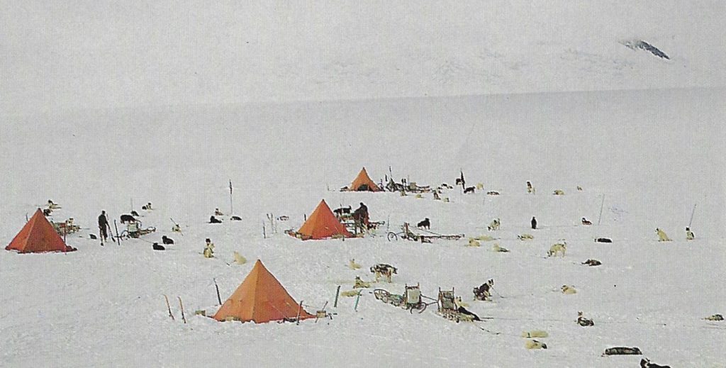
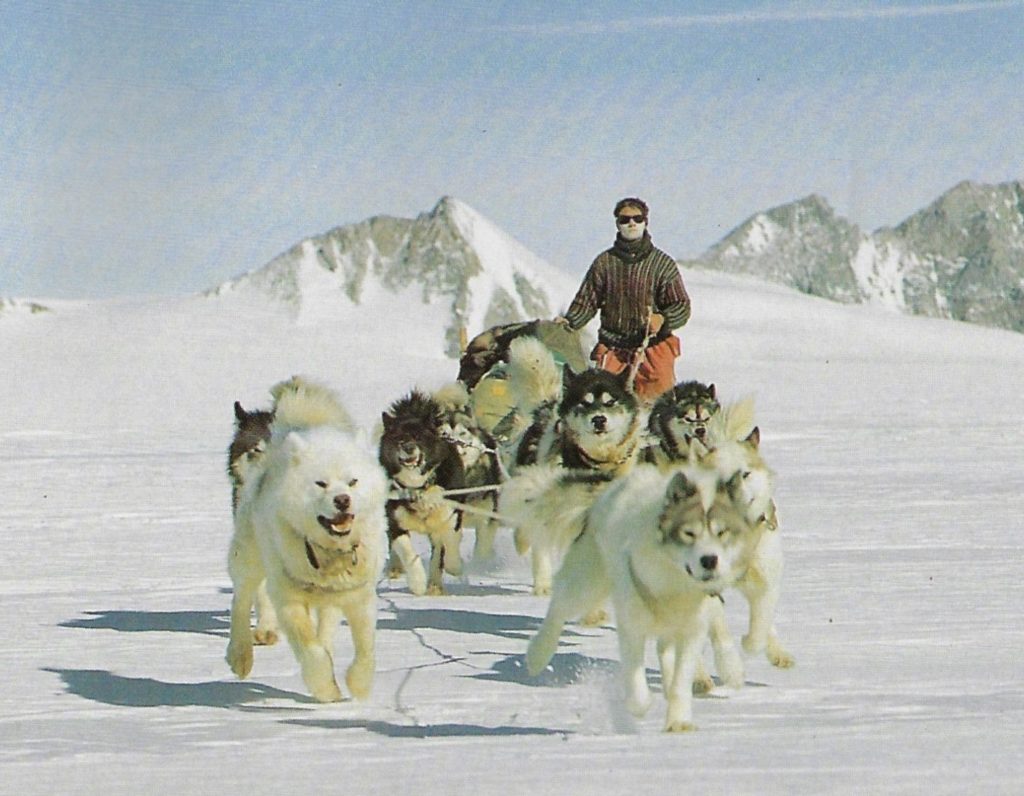
(Photo: Ian Sykes)
October 6th
Titania Peak
Coordinates:71°32′S 69°25′W) is a rock peak, rising to about 1,250 m, lying near the head of Uranus Glacier, 11 nautical miles (20 km) west-northwest of Mount Umbriel, situated in the central portion of Alexander Island
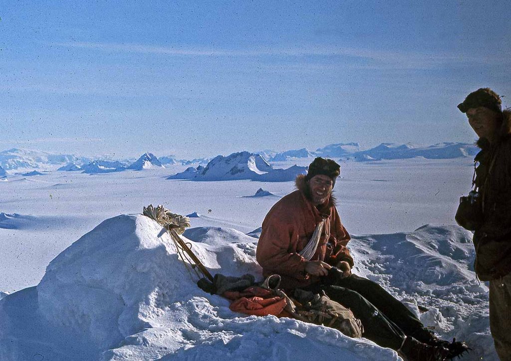
Climbed by Tony Bushell, Ian Sykes and Rod Pashley
October 7th
“The Tick“, Alexander Island
Climbed by Tony Bushell, Ian Sykes and Rod Pashley
20th December
Mount Courtauld
70°21′S 67°28′W) , 2,105 metres (6,900 ft) high, 9 nautical miles (17 km) east of George VI Sound and the rocky ridge marking the north side of the mouth of Naess Glacier, on the west coast of Palmer Land, climbed by Tony Bushell, Ian Sykes and Rod Pashley.
Late Summer 1969-1970 – Shaun Norman
By now, high summer – 21st of December – had been and gone and the days were very warm. My dogs were mainly black so in order to give them a cooler ‘day’ we simply shifted our day 12 hours and ran at night. It made little difference to us but the dogs enjoyed the day’s higher sun, resting in the warmth, and ran more briskly at night. Another bonus here was the long light from a low sun to the south, making beautiful shadows and different mountain colours. Some of my best pictures came from this time – particularly in late January when the sun would descend to the horizon then turn into an orange sausage as it slid along, apparently horizontally, for ages before rising again into a new day.
Eternity Range – Mount Hope
Jack Donaldson and Ian Sykes 3rd ascent by West Ridge 1970
Eternity Range – Mount Charity
Tony Bushell, Rod Pashley, Pete Rowe, attaining the N. Summit (higher of the 2 summits)
Mount Jackson
Sean Norman, Mike Burns, Mick Pawley attempted Mt Jackson.
Home to Stonners – 1969/1970 – Shaun Norman
Reading my sledge diary now, I note many poor visibility – fog and storm – days whilst we made our way along the spine of the peninsula. None of this bad weather sticks in my mind as do the glorious hours we enjoyed as we passed the Eternity Range. Mounts Faith, Hope and Charity standing against the blue; the absolute embodiment of timelessness. No wind and plenty of sun made for the perfect day at 5000 feet and we travelled slowly, reluctant to leave such glory. In many ways that day embodied all the very best of sledging, allowing us to forget the drudgery of rough sea ice and white-out days.
1970
Base Commander – Tony Bushell
| Bentley, P.I. (Paul) | Surveyor |
| Blakley, H.J. (Henry) | GA |
| Burns, F.M. (Mike) | Geophysicist |
| Bushell, A.N. (Tony) | BC |
| Butler, P.F. (Pete) | Geophysicist |
| Christie, T.J.C. (Tim) | Surveyor |
| Davies, T.G. (Gwynn) | Geologist |
| Linn, A. (Alastair) | Geologist |
| MacAllister, N.R.D. (Neil) | GA |
| Newman, J. (John) | DEM |
| Pawley, M.R. (Mick) | GA |
| Skinner, A.C. (Alister) | Geologist |
| Smith, R.P. (Ron) | Radio Operator |
| Woodhouse, J.I. (Jim) | GA |
| Wormald, S. (Steve) | GA |
May 14th – Overland to Square Bay, Pourquoi Pas and The Gullet – Steve Wormald
The sea-ice had gone out from the Stonington local area so with vague ideas of reaching the ‘good ice’ in the fjords, we decided to try to reach Square Bay, overland from Stonington, using the McMorrin Glacier outlet into Square Bay. Having succeeded in doing this, the whole world was open to us. We joined the party of geologists and geophysicists that had been left by the ship on Pourquoi Pas Island and helped them complete the work on the interior of the island. John Newman (DEM Stonington) then joined the Geology Party so he could go to Horseshoe Base and fix the generators. Mike Burns (Geophysicist) joined us and we headed north up Laubeuf Fjord . Keeping to the East on the on the way we got through The Gullet, not without incident, but were eventually stopped three miles up Gunnel Channel by open leads.
We then south keeping to the Adelaide coast and met up with Adelaide Sledge Whisky (Hesbrook, Bird and Scoffam) with the Huns and The Rabble. This party came with us to PQP and helped move the remains of the winter depot, some 2500 lbs, over to Blaiklock.
All through the trip we had the most marvellous weather and sledging surfaces were near perfect all the time.
Tony Bushell, Stonington – GA 1969, BC/GA 1970 – Journey Report K4/1970/E
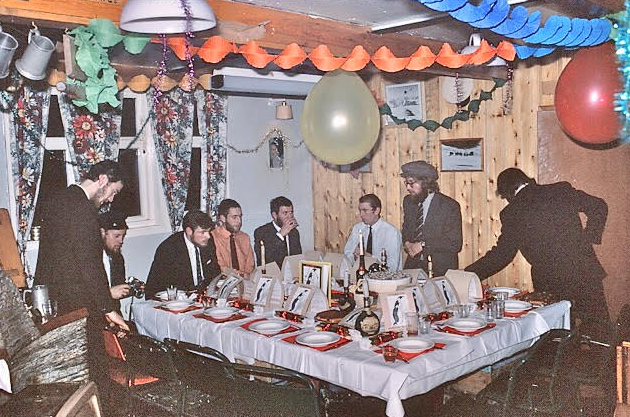
Jim Woodhouse, Paul Bentley, Mick Pawley? (Photo: Gwynn Davies)
Earth Sciences
July 3rd
The Arrowsmith Peninsula – Winter Reconnaissance – Steve Wormald
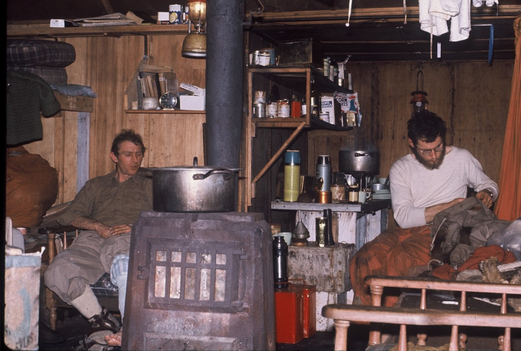
The purpose of the journey was to head to Lallemand Fjord and then recce the Arrowsmith Peninsula glaciers and recce routes from the fjords for the future Arrowsmith geology and geophysics programs.
Sledge Charlie (Gwynn Davies – Geologist with the Ladies, Steve Wormald – GA, with the Admirals), travelled from Stonington to Horseshoe in company with Sledge Alpha (Jim Woodhouse – GA and Ali Linn – Geologist).
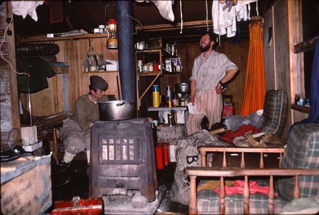
We then moved on to Blaiklock Refuge hut and met up with Sledge Zulu travelling from Adelaide (Mike Bell – Geologist, Richy Hesbrook – GA and Rod Pashley – GA).
Rod Pashley with the Picts joined us from Adelaide – (an ideal party – 3 teams, one tent) and we left Blaiklock with the primary aim of finding a sledgeable route up the Heim Glacier from the Jones Ice Shelf.
Topographic Survey
Bentley and Christie at Stonington, Gurling from Fossil Bluff
Terra Firma Survey Gear Recovery via Sea Ice
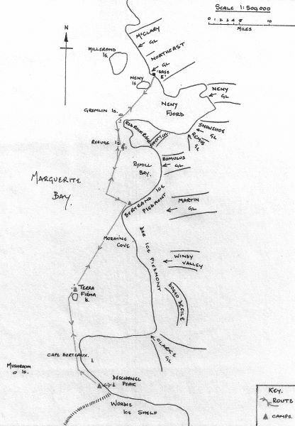
In November 1969 the Summer Survey party had been threatened with the possibility of being cut off from Stonington by open water, so it was decided to leave the survey gear on the Terra Firma Islands and sledge south to Fossil Bluff. En route it was decided that they should recce the Mt. Edgell area and both sides of the King George VI Sound. Unfortunately the John Biscoe was unable to reach Terra Firma during the 1969/70 relief due to heavy ice, and it was therefore left to Stonington’s sledge teams to attempt recovery of the survey gear in 1970.
As sea ice had been poor all year it was decided in the winter to try and uplift the survey gear and depot it along with as much manfood and dogfood as possible somewhere on Cape Berteaux, from where access could be gained overland from Stonington via the Plateau, using the depot put on the Plateau via Sodabread.
The party spent 10 days in the field, including 2 days of lie-up, covering 120 miles, and comprised 5 dogs teams and six men:
Sledge Echo: Tony Bushell with the Komats, Mick Pawley with the Giants, Tim Christie – Surveyor
Sledge Kilo: Rod Pashley with the Picts, Steve Wormald with the Admirals, Neil McAllister with the Debs
After recovery of the survey gear, Paul Bentley, Tim Christie and Paul Gurling made a survey connection between Stonington and Fossil Bluff with a 200 mile long closed tellurometer loop which involved three nearly 50 mile long tellurometer lines across the Wordie Ice Shelf, ten lines south from Mt. Edgell on the east side of King George VI Sound, and two lines across the Sound to link up with the five lines along the western edge of Sound that had been measured in 1967. This traverse effectively connected the survey stations in Marguerite Bay with the Marcello Loop running south down the Sound (from Fossil Bluff to Buttress Nunatak at 71.45S) which had been measured in 1962/63 by Bob Metcalfe and Howard Morgan.
The Cross-Wordie Lines – Tim Christie
When we arrived at Stonington in March 1970 the main task we had been given by the DOS was to make a survey connection between Stonington to Fossil Bluff with an unbroken chain of tellurometer lines. Up to that time, although some survey had been done from Fossil Bluff, this was a ‘floating” survey with no connection to the survey network on the rest of the Antarctic Peninsula the surveys from Stonington having only come as far south as the Wordie Ice Shelf at Latitude 69 deg S.
We thought that measuring the first three tellurometer lines across the Wordie Ice Shelf might cause us some problems, partly because of their length, partly because of the logistic difficulty of getting the two survey teams on the opposite side of the ice shelf at the same time and partly because the north and south sides of the Wordie were in different weather systems. What we didn’t expect was the crisis that arose every time we were about to measure the lines.
Earth Sciences
Summer Surveys in Palmer Land – Steve Wormald
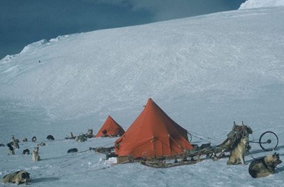
Due to the generally unstable sea-ice during the Winter of 1970, it was decided that all the journeys to the southern work areas would take place via the Antarctic Plateau. This meant using the only viable access route to the Plateau, the infamous Sodabread slope, 3,000’ feet of snow, ice, and known for its katabatic winds that could spring up, even on clear days, in a matter of minutes.
Our 1970/71 Geology party, using radio call signs Sledge Sierra (Gwynn Davies and Rod Pashley) and Ali Skinner and myself as Sledge Tango, planned to travel overland to Quintin Depot, established the previous summer. The first step was to establish a food depot, 28 days of manfood and dogfood, at the top of Sodabread on the Plateau edge, which was accomplished over three days without any serious incidents, in good weather.
1970 Palmerland Geology – Gwynn Davies
Following arrival at Quintin Depot in company with Sledge Tango, Sledge Sierra (Gwynn Davies with the Ladies and Rod Pashley with the Picts) left on 1 October with 28 days supplies to commence work near Mount Edgell.
Whilst the weather was poor, a reasonable amount of work was accomplished, with Gwynn travelling to the various rock outcrops and Rod making the Plane Table maps of the area. After a month we returned to Quintin Depot to restock and returned to the Mount Edgell work area. Unfortunately, the weather for this period was atrocious with only 3 days worked and we returned to Quintin short of both man food and nutty.
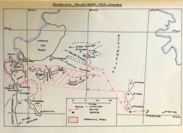
At Quintin, we met up with Sledge Tango, when Ali Skinner and Steve Wormald kindly assisted us in laying a depot in the Kinnear Mountains to save us returning to Quintin as we worked further eastwards. The weather greatly improved in December and together with the planes’ arrival to provide additional supplies, the work continued apace.
We were joined for Xmas by Sledge Tango, their work having been completed. During this time Mount Leo was climbed but a steep step with rotten ice prevented reaching the summit (see below).
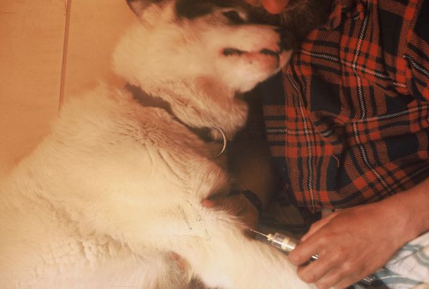
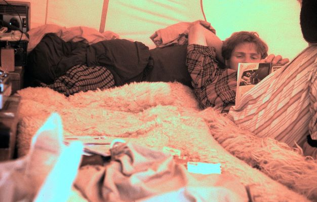
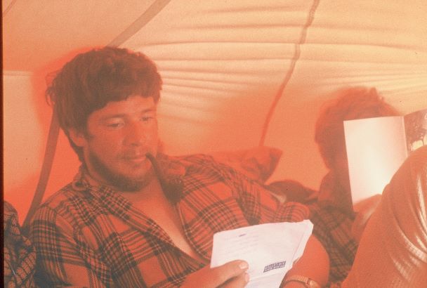
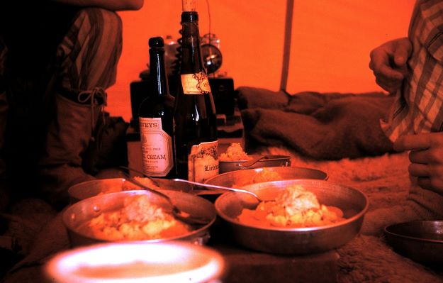
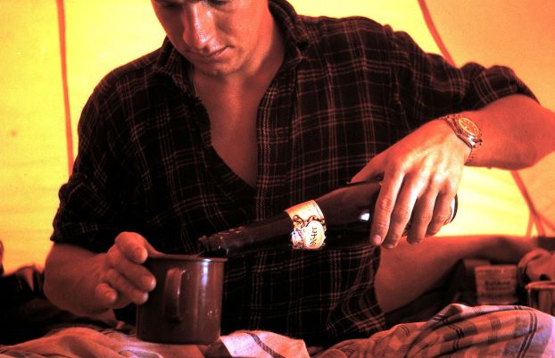
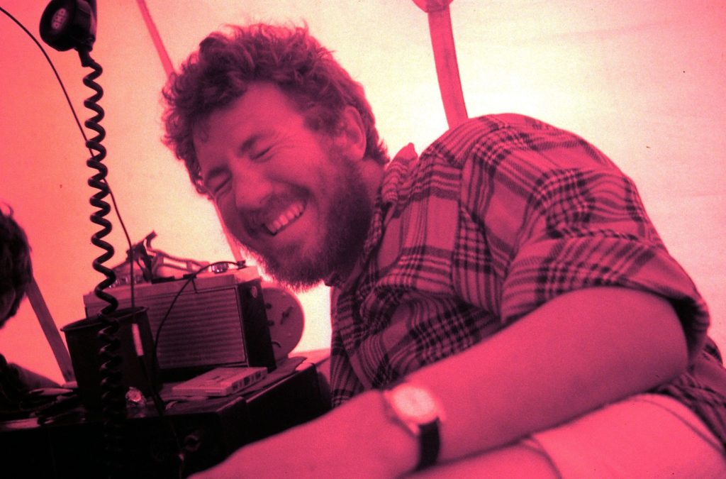
After the festivities the mapping in the work area was completed and Sledge Sierra headed east to Mount Duemlar where a depot was established for the following season. Sledge Sierra then sledged 57 miles in 3 days to the Mount Castro/Wordie area and were flown out on 10 February.
December 27th
The Un-ascent of Mt. Leo (Brian Hill)
The Un-Ascenders: Gywnn Davies, Brian Hill, Rod Pashley, Ali Skinner, Steve Wormald
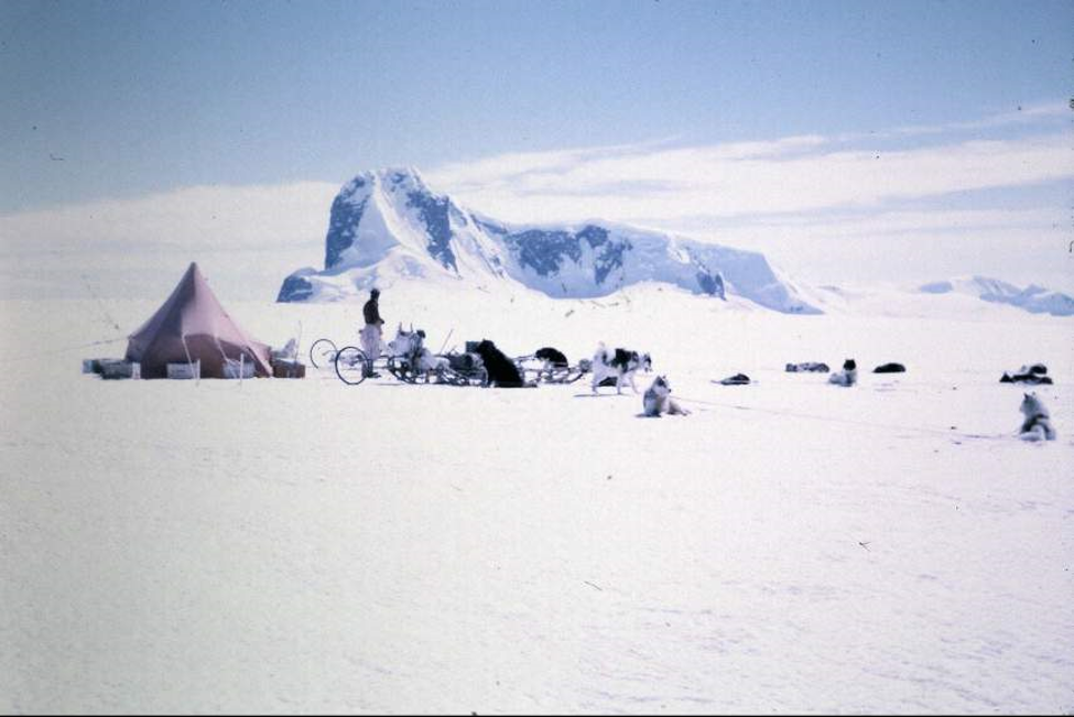
Mount Leo is an imposing looking mountain on the south side of the Fleming Glacier which flows from the inland plateau into the now disintegrated Wordie Ice Shelf. At 1,270 metres (4,170 ft) Leo is not spectacularly high but dominates that part of the landscape. It is aptly named for its distinctive profile, from the east at least, of a resting lion with snow covered back and flanks rising to an ice covered mane and head surmounting sheer cliffs of a thousand feet or more.
Eternity Range – Mount Faith
January 7th, 1971
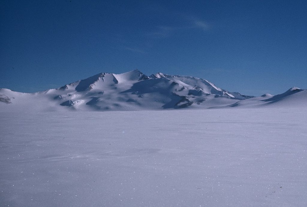
With the dog teams “The Admirals”(Steve Wormald) and the “Gaels” (Ali Skinner) and myself as an incoming driver after wintering at Fossil Bluff, forming Sledge Tango. We had just finished geologising in the Traverse Mountains area, and via the Fleming Glacier had arrived at the Eternity Range to continue the geology work there.
Mount Faith at 2650 m (8694 ft) remained unclimbed.
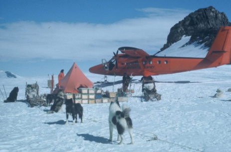
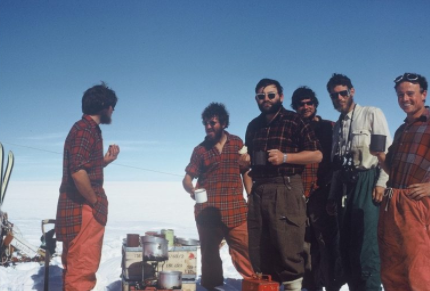
End of the Season – Brian Hill
Wednesday 3 Feb. The Twin Otter flew into us at 4 am with half the depot. It was a pleasant sunny morning but cold. We had prepared a 500 yard long runway. The Otter, later on the day flew towards Sierra at Deumler Depot but when weather manked in there, Dave, the pilot decided to fly to us having on board almost the other half of the depot. He landed about 2 pm & took away Ali & his team back to Stonners.
Steve & I then shifted this part of the depot up to the site with the Admirals, in 2 journeys finishing at 9 pm. Bed ~ 11 pm. Almost a 40 hour day – lovely & sunny too but cold. 15 miles travelled.
4th. Feb. Radio scheds. all morning, then AO arrived at 1745. Off loaded the remainder of the depot, then waited while the Admirals ran the final load up to the depot, accompanied by Robin Walker, Stonington’s RAdio Op. on a jolly. Returned to the aircraft by 1945, quickly loaded on the unit and team as thick mank rolled down the glacier. Arrived Stonington at 2100.
Maps & Reports Produced:
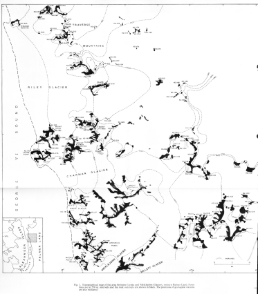
Read on Or Download Report….
End of the Line – for Now
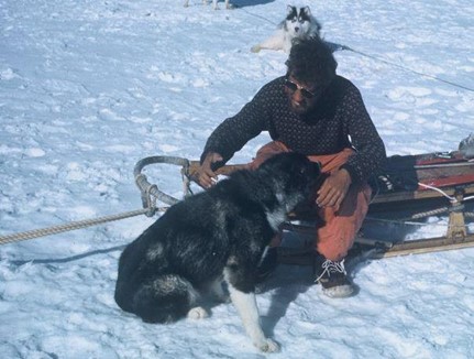
It was time to hand over The Admirals to Brian Hill, who was to drive them in 1971. I had to say goodbye to them all: My steam engine back pair, The Brothers Dai and Waldo (named after characters in Dylan Thomas’s ‘Under Milk Wood’); brainless but hard-working Hamish; Sam and Kirstie, that I had helped rear from birth; ‘Big Jim”; timid Wear; and Lurky Kovik.
Almost all dog drivers know that feeling, and several have written about it on this website.
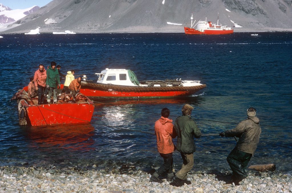
1971
Base Commander – Phil Wainwright
| Christie, T.J.C. (Tim) | Surveyor |
| Collister, R.J. (Rob) | GA |
| Culshaw, N.G. (Nick) | Geologist |
| Davies, T.G. (Gwynn) | Geologist |
| Finigan, S.P. (Paul) | GA |
| Gurling, P.W. (Paul) | Surveyor |
| Hill, B.T. (Brian) | GA |
| Holmes, M.J. (Mike) | MO, Physiologist |
| Keith, W.A. (Bill) | DEM |
| MacAllister, N.R.D. (Neil) | GA |
| McArthur, M. (Malcolm) | Geophysicist |
| Meades, N. (Nick) | Radio Operator |
| Mosley, M.V. (Miles) | GA |
| Small, D.B. (Drummie) | GA |
| Wainwright, P. (Phil) | BC/GA |
| Woodhouse, J.I. (Jim) | GA |
| Wyeth, R.B. (Bob) | Geologist |
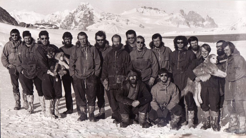
Front Row, L to R: Neil McAllister, Phil Wainwright.
Earth Sciences
Arrowsmith Geology & Geophysics Program 1970 & 1971 – Steve Wormald
At the end of the 1970/71 Relief, as Bransfield headed North, a Geology Party was landed on the Jones Ice Shelf. This was the fourth year of the Arrowsmith Geology & Geophysics Program, which formally started in 1971, after the reconnaissance journeys in 1970; and prior to that, the survey and geological work done all the way back to Derek Searle (Surveyor) and Jim Exley (Geologist) from Horseshoe starting in 1955, and Tom Murphy (Surveyor), Mike Orford (Surveyor) and Paul Wright (Geologist), from Detaille starting in 1956, and then in 1965 and 1966, Dave Matthews and Keith Holmes (Geologists) working based between Stonington and Horseshoe.
Other Geologists, Keith Holmes, Pete Rowe and Ali Skinner also worked in the area.
In 1970 and 1971 Autumn Geological and Geophysical programmes were carried out in Pourquoi Pas Island and the Arrowsmith Peninsula respectively.
Arrowsmith Geology & Geophysics Program 1970 – Gwynn Davies
Following arrival of the R.R.S. John Biscoe at Stonington in early 1970, a party of five comprising two geologists, Gwynn Davies and Ali Linn, two geophysicists, Mike Burns and Pete Butler and one general assistant, Mick Pawley, were dropped off by the ship at Dalgliesh Bay, Pourquoi Pas Island on 21 February.
Sledge Bravo comprised Mike Burns with the Terrors and Gwynn Davies with the Ladies, and Sledge Charlie comprised Mick Pawley with the Giants, Pete Butler with the Spartans and Ali Linn. Supplies and equipment were included to keep the party until the sea ice formed to allow the group to sledge back to Stonington. On 9 March Alpha-Mike the Turbo Beaver landed on the Moider Glacier to bring in additional supplies and equipment and Mick, Mike and Gwynn were taken on an air recce of the island which was very useful to determine sledging routes and access to outcrops.
The island was found to be fairly easily travelled for the geophysical surveys and rock outcrops were very accessible from the glaciers. A lack of snow cover and good light conditions helped greatly in recognising rock types and relationships on the steeper rock faces; consequently, it was possible to map the geology of most of the island in the three months spent there. Coastal work from the sea ice was left until last but was hampered by lack of time and lessening daylight.
Mick, Mike and Gwynn took time out to successfully climb Mount Arronax.
The sea ice formed in late April, and following a recce of the sea ice in Dalgliesh Bay by Mick and Mike where the ice thickness was 7 inches, Sledges Bravo and Charlie sledged to Blaiklock Island. The sea ice was accessed from the Swash Reef ramp and while the ice thickness at the ramp was 5 inches it increased northwards.
The geology and geophysical surveys of the PQP area continued through May until 2 June after which preparations were made to return to Stonington. During May the group were joined by additional sledges from Stonington and some changes of personnel occurred.
The system of being put ashore by the ship was successfull in providing an extra two months work in what turned out to be good weather with longer daylight hours. Total days on PQP were 103 with 16 lie up days. The dog teams travelled an average of 500 miles.
The success of the PQP venture led to the reconnaissance of the Arrowsmith in July 70 and the planning of the 71 Autumn Arrowsmith programme with the Bransfield.
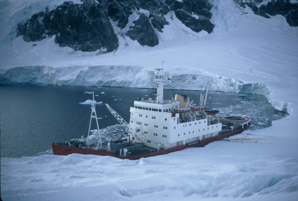
Arrowsmith Peninsula Geology & Geophysics – 1971 – Brian Hill
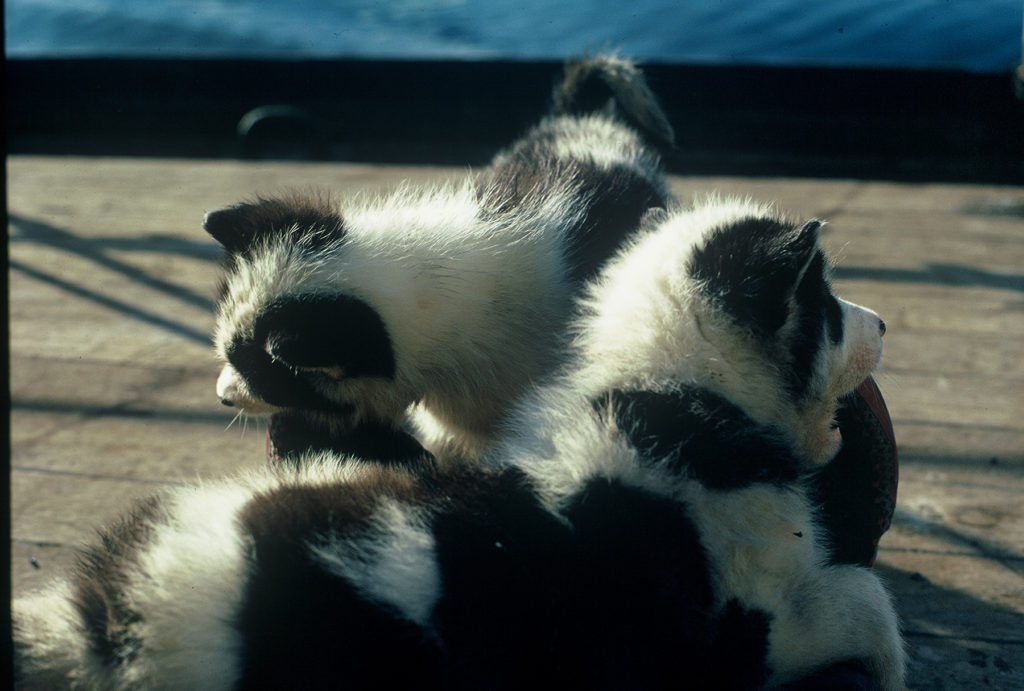
(Photo: Steve Wormald)
Six of us were landed on the Jones Ice Shelf from the Bransfield in March 1971. This was the autumn party of four teams plus two pups, with Nick Culshaw & myself, Neil MacAllister and Gwynn Davies, and Malcolm McArthur & Rob Collister which was to return to Stonners over the sea ice by mid-winter. We were plagued by the foot-lurk, and mild conditions so the sea-ice never safely formed. We spent some time at Blaiklock and Horseshoe waiting for conditions to improve.
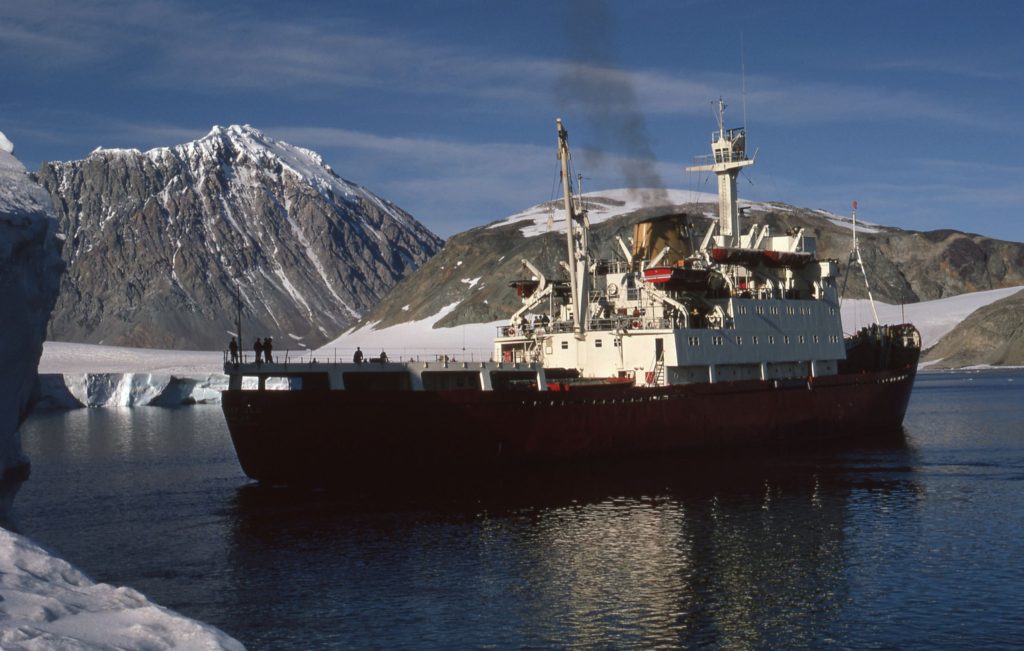
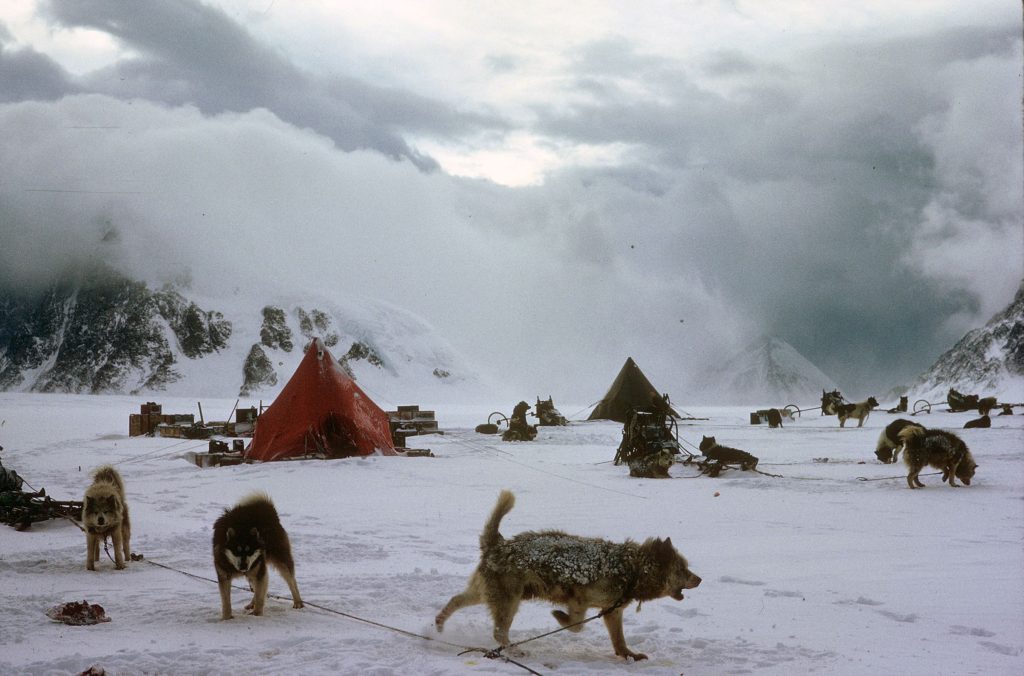
Arrowsmith Climbs – Rob Collister
Sledge Sierra (Gwynn Davies and the Ladies, Rob Collister and the Picts)
Diary Extracts
(Photo: Rob Collster)
May 9th – Nearly climbed a mountain today! We are camped on the west side of the Reid glacier by the depot and the weather wasn’t good enough for plane-tabling this morning so we decided to give it a go. We are right at the foot of a spur which is the obvious line so from the tent we only had to cross the floor of the wind-scoop, jumping a couple of small crevasses, and we could start up the first slope of steep, soft snow. Several hundred feet of this, sweating in too many clothes, and a short awkward section where rock and hard ice lay under the snow, brought us onto the actual spur, having by-passed an initial rock buttress.
From there the line was beautifully inescapable. On one side plunged an icefall, a mass of white gouged and chiselled with blue, deep gashes sweeping right up to the crest of the ridge in places. On the other, rock walls dropped away abruptly to a hanging glacier, another chaos of ice. We tiptoed between the two, edging along unstable arêtes and up and down unexpected notches, experiencing no real difficulty but always conscious there was no room for error. Two hours of steady climbing, spoiled only by descending cloud which shut off any view, and our spur joined the broad summit ridge. We moved along it cautiously in decreasing visibility, suddenly exposed to the full blast of a vicious wind.
Arrowsmith Diary – Rob Collister
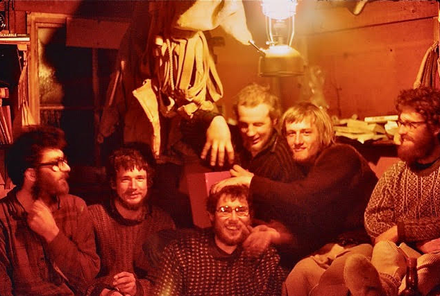
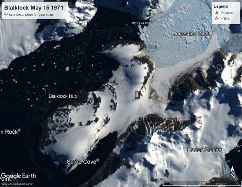
6th June – All six of us are ensconced at Blaiklock hut. It is crowded but cheerful with plenty to talk about since we have not all been together for several weeks. A lovely smell of wood and food greets you as you enter the hut, like an alpine chalet. At least it did – it has quickly become submerged beneath other, less pleasant, smells! The nearest equivalent to its cosy squalor that I know of is the CIC hut on the Ben. The weather is bad and the sea-ice is slushy and melting, showing every sign of leaving us stranded. A holiday atmosphere prevails, however, and there are plenty of repairs to sledge equipment and odd jobs about the hut to be done. After living in a tent it is luxurious to be able to stand, sit and move about inside. This evening we had a huge meal of tinned steak and peas with real potatoes which have somehow survived prolonged freezing since I bought them in Stanley, followed by Christmas pudding. At the moment Malcolm is playing his mouth-organ, between tunes helping Brian with a crossword, Nick is splicing a side-trace, Gwynn is mending a harness while Neil is busy making doughnuts to stonker us even further.
Return to Stonington – Brian Hill
Neil, Gwynn, Nick and myself recced and made a route up and over the Swithinbank, the first traverse I believe, to the NE Glacier and back to Stonners.
Malc and Rob tried to force a route over the ice.
That’s the short version….
Return to Stonington over the Sea-ice – Rob Collister
In 1971, two weeks after Midwinter’s Day, Malcolm McArthur and I, with the Picts and Spartans teams, were making our way back from Marguerite Bay across the sea ice to Stonington. We had camped 20 miles from base on Reluctant Island, glad to have solid gravel under our feet, closer to the larger, steep sided Horseshoe Island. It had been a still and bitterly cold night, with a full moon. Our isolation was complete, but we had no sense of loneliness sledging with dogs, whatever other emotions you may experience – and they range from love and admiration to fury and despair – you are never lonely.
When we broke camp in the early hours of the morning, the brilliant glow of the Tilley lamp caused the blackness to close in like a threatening crowd. The dogs were shadowy forms, stretching and shaking the snow out of their coats, and beyond them was outer darkness. By the time I gave the command “Up dogs, huit” smoky pinks and yellows were creeping up the sky behind the tumbling peaks of Pourquoi Pas Island. The surface of the sea ice was good and the dogs pulled with enthusiasm, perhaps sensing that we were homeward bound.
The first setback occurred when we reached a patch of newly frozen ice, smooth as a pane of glass and without wrinkle or blemish. It was impossible to stop the skis and sledge and the dogs could gain no purchase whatsoever.
Midwinter 1971
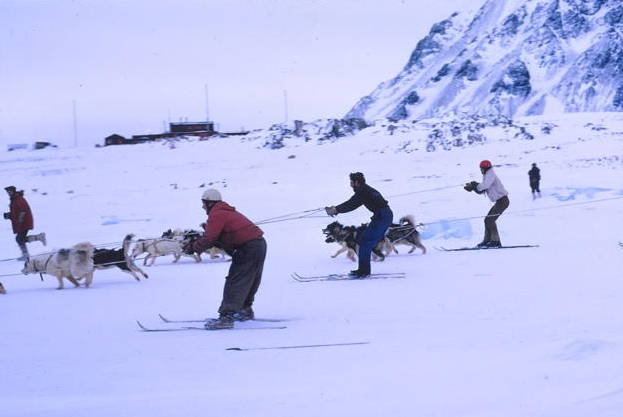
(Photo: Gwynn Davies)
Pup Breeding
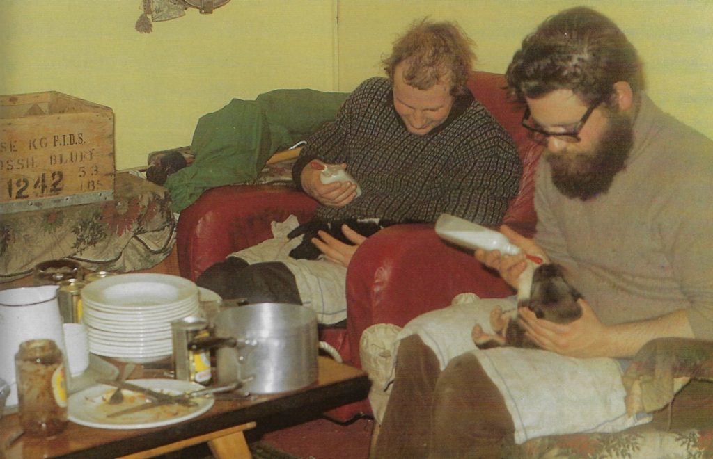
(Photo: Rob Collister)
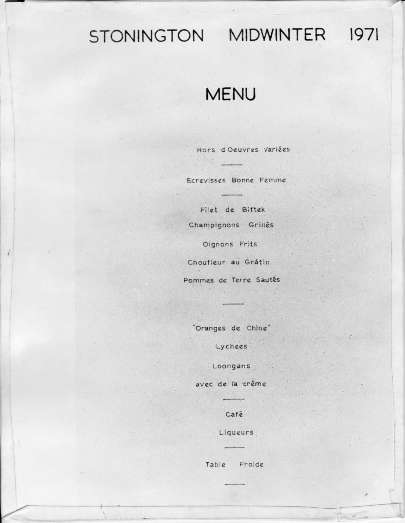
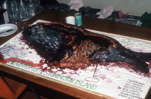
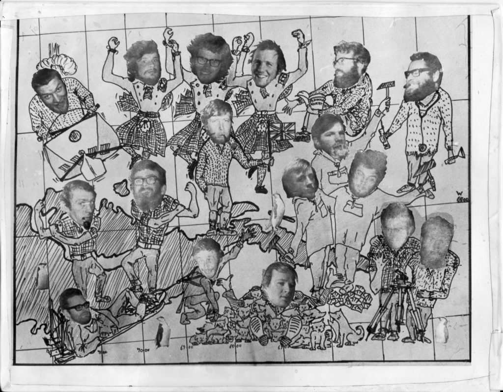
2nd back row: Phil Wainwright, Bob Wyeth
3rd back row: Jim Woodhouse, Neil McAllister, Nick Culshaw, Gwynn Davies
Front row: Paul Finigan, Miles Mosley, Nick Meades, Paul Gurling, Tim Christie.
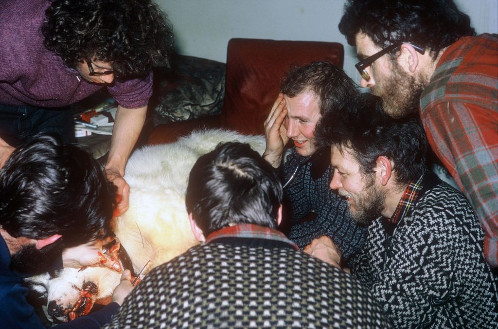
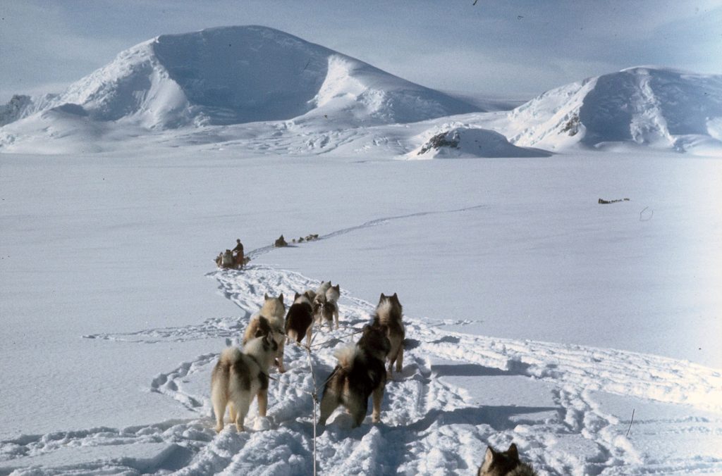
Topographic Survey
1971-72 Christie and Gurling at Stonington – Spring & Summer Survey
Once the Stonington to Fossil Bluff connection had been made the surveyors were able to measure the five tellurometer lines needed to close the ‘floating’ traverse to Mt. Andrew Jackson which had been measured in 1964/65 and to link it to the Stonington-Fossil Bluff Marcelo tellurometer networks. While one party (Gurling) was lying up in bad weather waiting to measure the final angle on the Mt. Jackson traverse, the other party (Christie) made an exploratory journey on to the top of the Palmer Land Plateau to find potential rock-based survey stations from which trigs on both sides of the Plateau could be seen.
The Coromandel Journey – Tim Christie
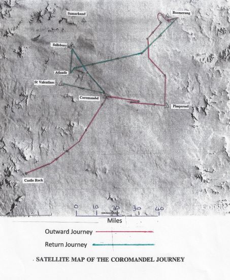
In spite of the fact that I had accidentally dropped my tellurometer over a five hundred foot cliff at Carse Point and that my fellow surveyor, Paul Gurling, had lost all his survey equipment (worth probably at least E30,000 at today’s prices – 2017) when it was blown away by a ferocious katabatic on the Harriet Glacier, by Christmas 1971 we had completed the survey task assigned to us by BAS which was to provide an accurate survey link between Stonington and Fossil Bluff, thus linking Graham Land and Palmer Land.
It involved, amongst many other things, measuring three 50 mile long tellurometer lines across the Wordie Ice Shelf to an accuracy of a few inches and measuring a theodolite angle from Mount Edgell to a cairn which we had built on the summit of Butson Peak, near Stonington, the previous winter, which was 105 miles away!
Earth Sciences
The 1971 summer season geological programme in the northern part of Palmer Land was a continuation eastwards of the 1970 Season, which included Mount Edgell and along the south side of the Fleming Glacier to the Eternity Mountains.
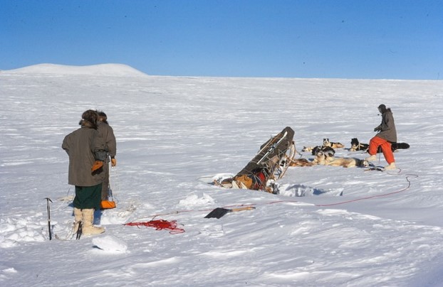
(Photo: Gwynn Davies)
Due to the very soft snow surfaces and slow progress on the plateau during the 1970 journey to the work area, a decision was made to travel to Palmer Land via the east coast. Sledges Delta (Nick Culshaw with the Terrors and Neil Macalister with the Debs) and Alpha (Gwynn Davies with the Ladies and Jim Woodhouse with the Players) set out from Stonington on 8 september 71 and travelled to the work area via Sodabread, the Beehive, Wyatt Glacier, Gibbs Glacier, Mercator, Larsen Ice Shelf, Hollick Kenyon Peninsula, and the Lurabee Glacier.
Read On or Download the Report
Doggie Memories – Brian Hill
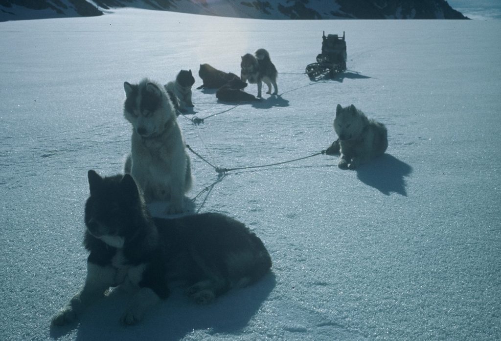
I took over the Admirals from Steve Wormald at the end of his summer trip in February 1971. It was an easy transition for I had been with Steve and Sledge Tango for the previous 7 weeks. Heading south on the Biscoe in 1969/70 there were 3 of us GAs slated for Stonners. As we neared base and virtually at the last minute a GA was requested at Fossil Bluff in support of the glaciology and survey program. Neil MacAllister was the one originally ‘volunteered’ to go but in the end I agreed to a swap and was assured by HQ that I would still have my second year at Stonners. So, nearing the end of the field program at the Bluff I was flown out via Adelaide and Stonners, picking up 2 new dogs, brothers Sam & Kursty, for the Admirals, and joined Sledge Tango on the plateau in mid-December ’70.
Climbing Mount Charity – Rob Collister
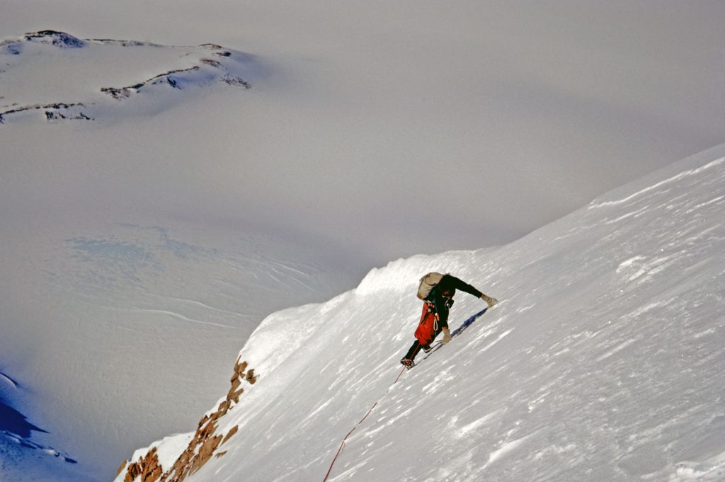
We approached Charity in a brief spell of clear, sunny weather after travelling on bearings through cloud for the best part of a fortnight. The southernmost of the three Eternities, it rises out of a 6000ft plateau without noticeable glaciers or foothills to twin summits of 9000ft. In the previous three months Malcolm McArthur and I had travelled a thousand miles with our dogs, the Spartans and the Picts, travelling from Stonington down the Peninsular to Fossil Bluff, through Alexander Island and back up onto the Plateau without managing to climb anything, despite plans. Charity had been climbed at least once before and with so many virgin peaks around it had not been one of our original ambitions. But fine days were few and far between and, as we passed by on our way north, the unclimbed east ridge of the higher summit became more and more enticing until, at last, we could resist it no longer.
1972
Base Commander – Mick Pawley
1972 Wintering Party
| Finigan, S.P. (Paul) | GA |
| Gurling, P.W. (Paul) | Surveyor |
| Hudson, B.D. (Brian) | DEM |
| Hudson, J.M. (John) | Geologist |
| Jones, B.G. (Brian) | Builder |
| McArthur, M. (Malcolm) | Geophysicist |
| McConnell, D.J. (Dennis) | Dentist |
| McNaughton, N.C. (Neil) | Geophysicist |
| Meades, N. (Nick) | Radio Operator |
| Mosley, M.V. (Miles) | GA |
| Pawley, M.R. (Mick) | BC |
| Singleton, D.G. (Dave) | Geologist |
| Small, D.B. (Drummie) | GA |
| Thomson, A.A. (Alistair) | Builder |
| Wright, G.K. (Graham) | GA |
| Wyeth, R.B. (Bob) | Geologist |
| Yates, J. (John) | Surveyor |
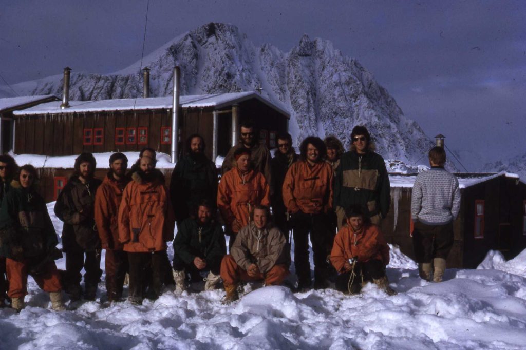
Front Mick Pawley (G.A), Ali McArthur (Geophysicist), Miles Mosley (GA)
(Photo: Dave Singleton)
January – Annual Seal Hunt and the Dog Food Chain
It was 19th January 1972 when I first arrived at Stonington Base E on the John Biscoe. It marked the beginning of my 2 year stay as a geologist on the doggy base. The stand out memory for me at that moment was the smell. Before we landed, one of the base FIDS (not sure who) came on board and all I can remember was the smell. It was rank and repulsive; it was I quickly discovered the smell of seal, something I would soon get to know so well. With around 150 dogs on base a lot of food has to come from somewhere and of course they are carnivores. It is no surprise then that seal meat and the attached blubber is their main food source for when they are on base. It is essential to help build them up ready for the next sledging trip.
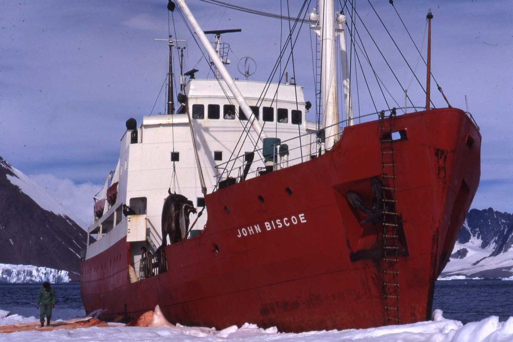
During the long summer trips, the last ones before the ships arrive to relieve the base, most of the dog teams lose weight due to exercise and their limited dry Nutrican (nutty) field diet. There are more details about what dogs eat for dinner in ‘Of Dogs and Men’ by Kevin Walton and Rick Atkinson to which many of us contributed. Even the drivers lost weight on their largely dried food diet. However, I eventually came to realise that this did not apply to me. The Ladies (my mainly all bitch dog team) never lost weight for some metabolic reason and neither did I thanks to some strategically placed chocolate depots. Even my one spayed dog, old Rocky, never lost weight and as an added bonus he also got to keep some very nice Ladies happy!
This story is about my experiences negotiating the dog food chain as a raw BAS recruit. It was quite a shock at first. The images are not for the squeamish or faint of heart! They have never been shared until now and these are the less gruesome of my photographic record.
July – Dogs – One of the Many Reasons I Loved Them
In 1972 when I was employed as a Stonington-based geologist, the first of my two years on that base, we made a number of geology and survey trips during the winter period into what we called the Trough. This was a short trip into the fjord areas behind Square Bay to the north of base. The route there was via the Northeast Glacier, along the By-pass at the top of the McClary Glacier and through what we called Swithinbank Glacier. The latter was notorious for containing some large crevasse systems. Sometimes it was good but it was mostly pot luck. Across all my journeys to the Trough I experienced both good and bad but on 6th July 1972 I was unlucky.
August – Depot Laying Trip to the Plateau (via Sodabread)
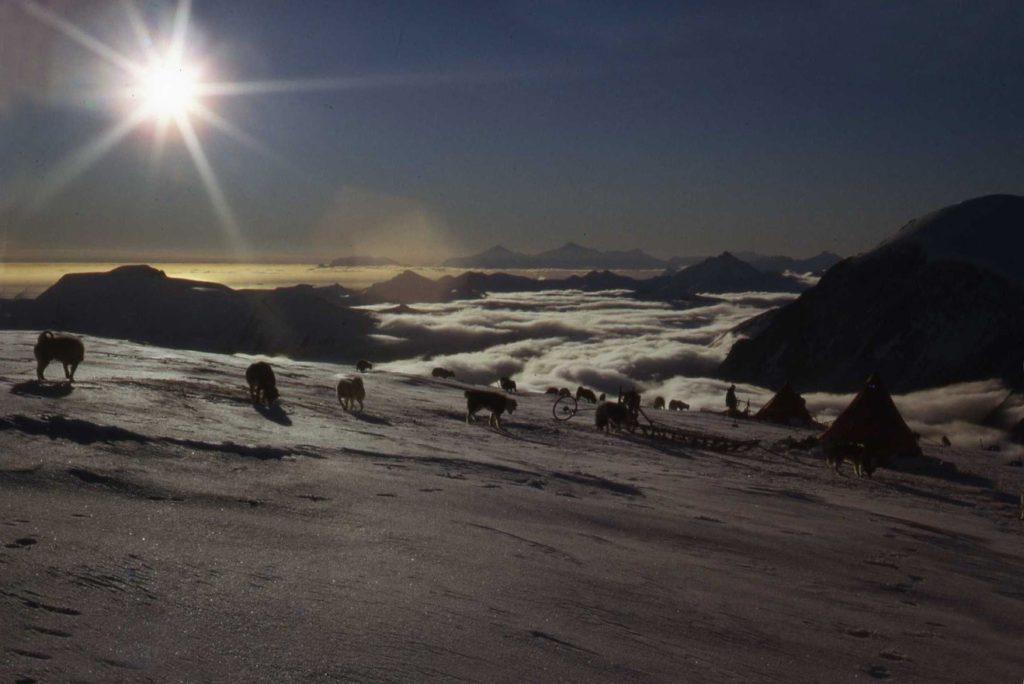
There are many stories to be told by people who have had the good fortune to spend time working and travelling from Stonington Base E with its 150 or so breeding population of dogs. Stories range from tragic to just plain adventure. This account lies somewhere between those two extremes and is told by me as a geologist working from Stonington in 1972 and 1973. It is about an unfortunate set of circumstances centred on what was probably the last time skidoos were used in the field from Base E. At the time it addressed again that age old question, “Are they better than dogs?” It also explored the boundaries of health and safety at work.
Topographic Survey
1972-73 Gurling and Yates at Stonington
Paul Gurling and John Yates occupied these stations and established a tellurometer network across the Peninsula between 70S and 72S (in a N-S direction), and between the Larsen Ice Shelf and King George VI Sound (in an E-W direction). Several stations on the East Coast that had been established in the 1960’s were occupied during this period. Much of the survey work was carried out in conjunction with BAS aircraft, with the surveyors being landed close to station sites in a leapfrog mode. In February 1973, Roger Scott was flown in to the field to replace Paul Gurling.
Beat Ram – John Yates
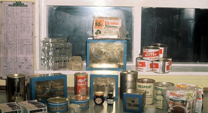
October – Another Dog Team Skidoo Rescue Story
Earlier in this year is my story about how, against all odds, during an epic Sodabread depot laying trip in evil plateau weather, 2 dog teams were strong and resilient enough to rescue two sledge units and two skidoos that had broken down. This rescue story happened later in the same year, 1972. Not a great year for skidoos but great for dogs!
The main FIDS involved in were:
Sledge Juliet Dave Singleton, Geologist, Ladies
Neil McNaughton, Geophysicist, Admirals
Sledge Tango John (Rock) Hudson, Geologist, Players
Graham Wright, GA, Komats
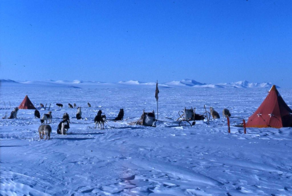
We had just arrived in our summer work area on the east coast of Palmer Land having sledged south overland for most of September. Travel had been tricky with bad weather, mank and many days in white out conditions. The various depots on route were navigated mostly blind using sledge wheel and compass. The last depot stop was Boomerang and my work area was south of there. At the end of the first day’s work on October 1st we heard some bad news. Graham (Sledge Tango) called us to say Rock was seriously ill so Neil and I sledged back north to re-join Tango the following day. The story begins at Juliet/Tango camp about 15 miles south of Boomerang at the head of the Clifford Glacier.
Rock Hudson’s Evacuation – Adelaide Island Perspective – Steve Vallance
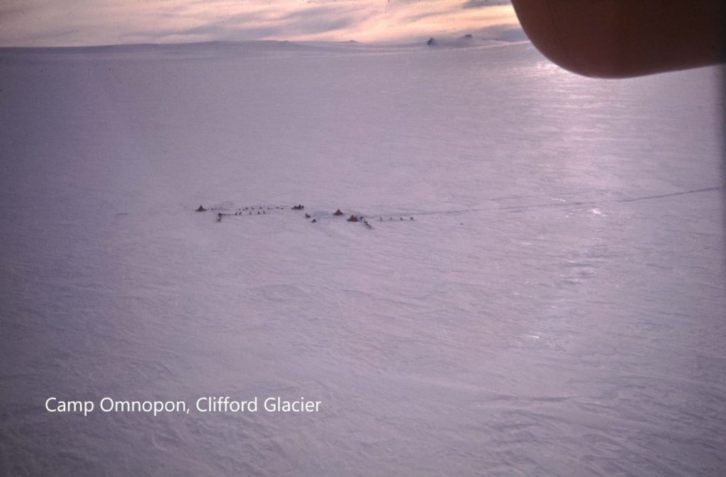
On the morning Sunday October 1st 1972 Graham (Genghis) Wright contacted Base T concerning John (Rock) Hudson. For 2 days he had been suffering increasing symptoms and signs of a small bowel obstruction. He had severe abdominal pain not helped by 100mg of oral pethidine. Genghis felt, correctly, that an Omnopon injection was needed but wanted medical approval. Rock had suffered intermittent stomach pains since his appendicectomy before leaving the UK.
Earth Sciences
The Stonington Fossil Scandal
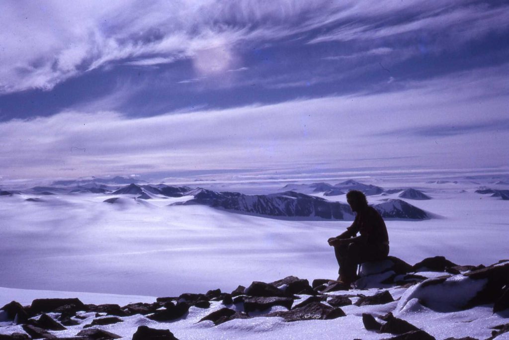
This is a short amusing story for the geo-scientists told via a thread of old telex messages between Stonington base and BAS headquarters. The key headquarters staff involved were Ray Adie (Head of Earth Sciences and geologist) and Sir Vivian Fuchs (Director of BAS and ex geologist). The story
reveals that those in authority do have a sense of humour sometimes and are occasionally game for a wind up – unfortunately at my expense
(Dave Singleton, geologist 1972 – 73).
The Ptolemy Incident – Malcolm McArthur
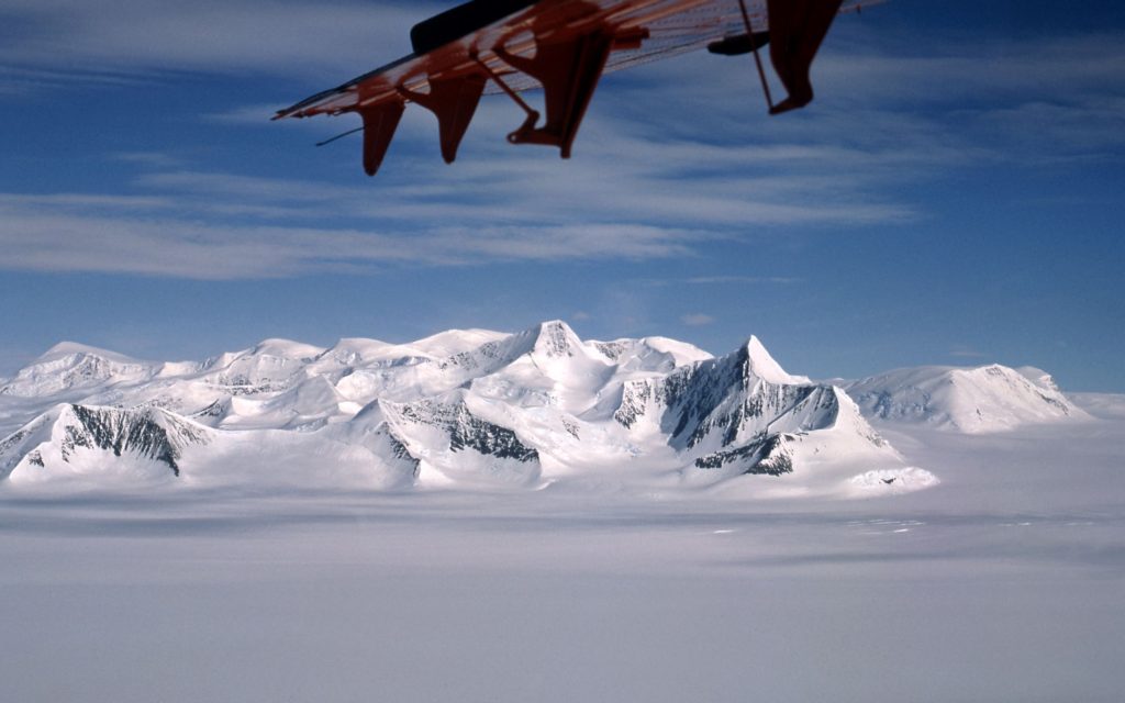
Dave Rowley (BAS Pilot) posted (Adelaide – 1973) that he was always very much “In Awe of Fids”. Another flight with Dave around that time was to do a gravity link with Ptolemy Depot. My photos also show that this coincided with a depot run, and we were accompanied by Pete Butler and Steve Vallance. The depot site and survey cairn are on a small spur running to the south east of the main peak and the usual landing site is in the Gibbs Glacier to the NE. This would however have involved a trudge up a long and steepish slope with all the boxes. Dave decided that he might be able to do better than that and flew over to the long snow slope leading uphill to the depot from the SW.
There was no ground party to check the landing so Dave did a very low level run up the slope to check for any issues. He then came round and did a second inspection run and finally a third. Half way through the third approach Dave turned to me in the co-pilots seat and said casually “Well were going to have to land now as I haven’t got enough speed to clear the ridge !”
1973
Base Commander – Steve Wormald
| Almond, A.A.J. (Adrian) | Geophysicist |
| Anckorn, J.F. (Fergy) | Geologist |
| Bostelmann, R.W. (Bob) | Vetinerary Officer |
| Burkitt, D.M. (Dave) | GA |
| Butler, P.F. (Pete) | Geophysicist |
| Edwards, C.W. (Chris) | Geologist |
| Gannon, A.E. (Tony) | Builder |
| Lawther, E.G. (Eric) | GA |
| MacAllister, N.R.D. (Neil) | GA |
| Macrae, M.D. (Malky) | DEM |
| Newman, J. (John) | DEM |
| Scott, R.J. (Roger) | Surveyor |
| Singleton, D.G. (Dave) | Geologist |
| Walker, C.R. (Chris “Twiggy”) | Radio Operator |
| Wormald, S. (Steve) | BC |
| Yates, J. (John) | Surveyor |
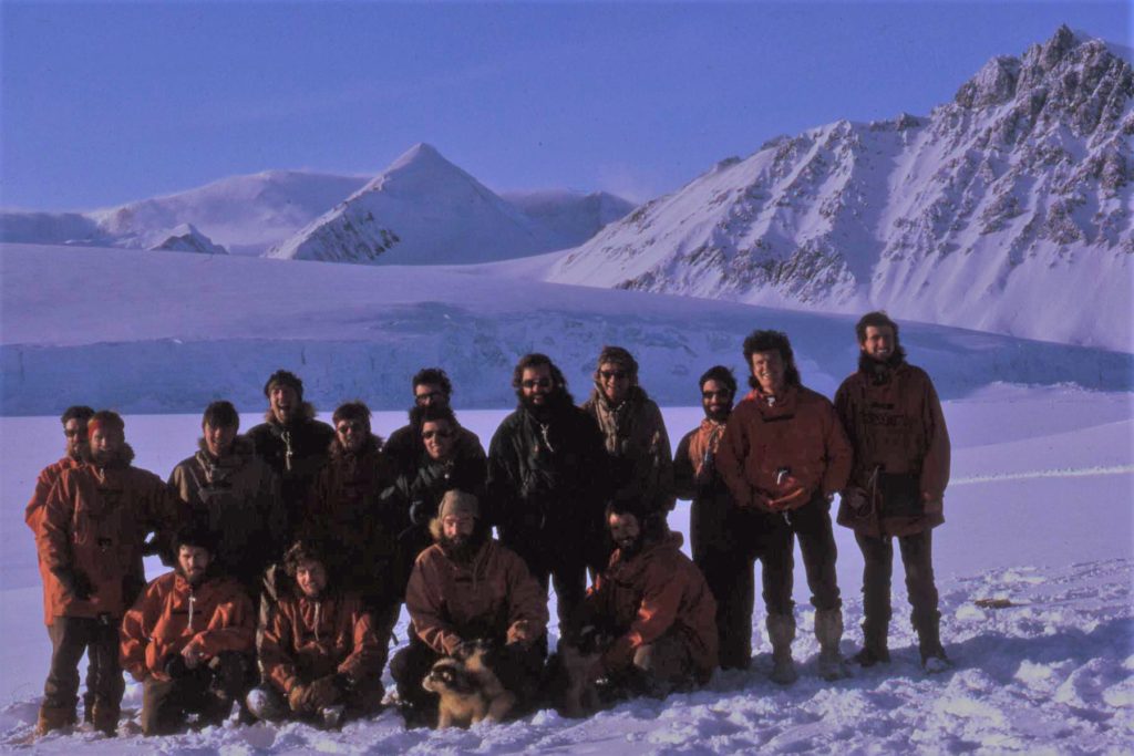
Kneeling: Pete Butler (Geophysicist), Dave Burkitt (GA), John Yates (Surveyor), Steve Wormald (GA/BC)
May 21st – A Tale of High Winds – Dave Singleton
This was just meant to be a routine winter trip to the Trough area north of Stonington Base E.
A number of sledge units were involved. The plan was to carry out survey work, geological reconnaissance and geophysical surveys. However, the wind had other ideas. One thing it did do was answer that question, “How many men can you sleep comfortably in a pyramid tent”?
High winds can be a real danger especially if you are camped in the wrong spot. This story is about the worst part of the trip and explains why in the end it was more about gaining experience of field techniques than doing any actual work. 11 lie-up days, 3 work days and 7 travel days out of 21 gives you some idea.
Steve Wormald (BC and GA), Chris Edwards (Geologist), Eric Lawther and I had managed a few days work and then on 21st May the wind started to make itself felt. By the 25th wind speeds reached up
May 27th – A Crevasse incident – Swithinbank Glacier – Roger Scott
A memorable day. It was less than a month from mid-winter so with limited daylight only a few hours of safe travel was possible each day. On this occasion there were two of us with two sledges and two teams. We started the day with a long, fast and very bumpy descent down a long slope leading on to the Swithinbank Glacier. I was riding on the back of the sledge and well remember the sledge wheel breaking loose from its frame and passing me at high speed. It was last seen rolling off into the far distance and was never seen again.
Also the dog Sheerkahn can be seen strapped to the back of the sledge as he was very weak and and ill and had to be physically restrained from taking his place in the team which would have weakened him even more. The glacier we were crossing was known to be badly crevassed so, after working our way to the middle, both sledges were stopped to assess the next part of the route. The day was dull and overcast, poor weather for working among crevasses. I was standing on my skis to the left and slightly behind my sledge when suddenly there was a noise – wooomph – and I was left standing on the edge of a deep hole with the tops of my skis over the edge of what seemed a wide and bottomless crevasse.
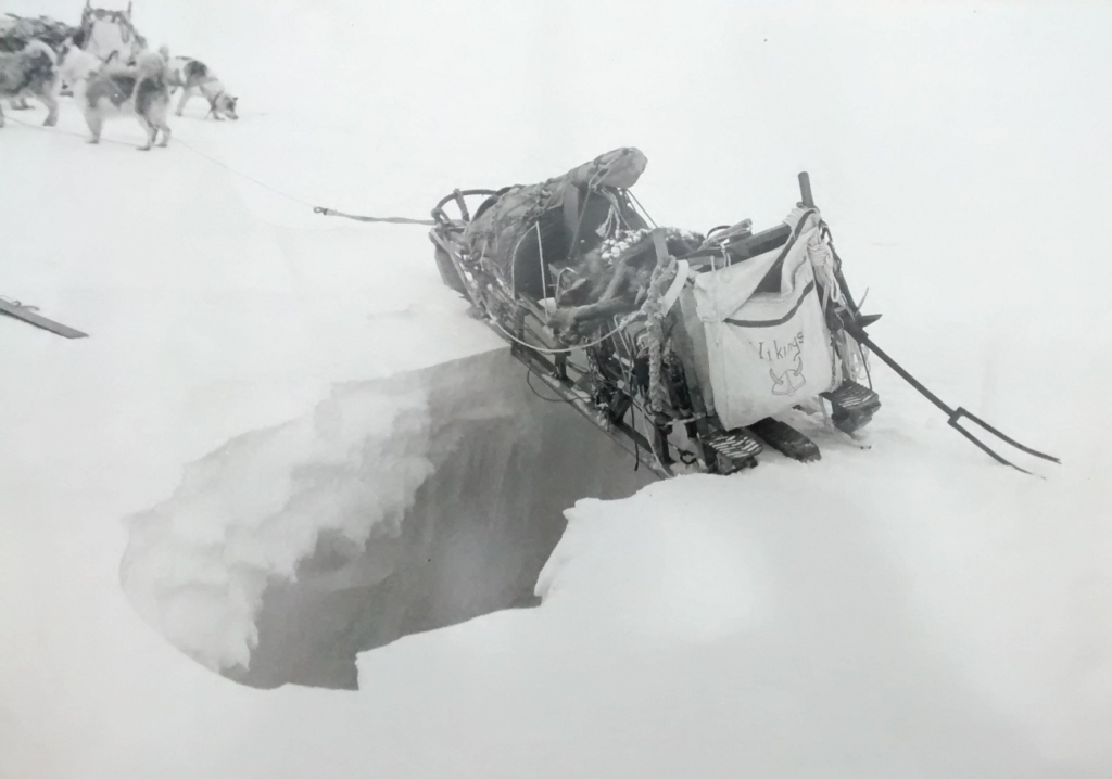
The centre of the bridge had fallen away leaving the sledge supported at its front and rear only. For the time being it did not look as if the sledge would fall further which gave us time to work out a method of retrieval. This was not easy as if the sledge were to be moved a foot or two forwards the rear would fall in and opposite would happen if we moved it backwards. There was no way we could get closer to the sledge to reduce it’s load. We decided that the only solution was to start the sledge with such power that it would clear the crevasse before the back end had a chance to fall in.
To give ourselves a chance of success we let the dogs rest for a while and the driver of the leading sledge walked out a short way ahead of my dogs. On the command to go the other driver called to them. I gave a strong push from the rear and with an uncertain lurch my sledge cleared the crevasse. A truly memorable day and one I would not like to repeat!
Topographic Survey
Yates and Scott at Stonington
In the Winter, John Yates and Roger Scott completed the W-Y-T-E link through to ARCH, more Stonington local survey and the extremely hazardous difficult GRANDSTAND – SENTINEL link (see “Another Near Miss on Sodabread” below).
The summer programme completed the control of the American aerial photography working north from 70 00S to 68 00S right up the Palmerland Plateau and linked back to Stonington. This included 2 cross plateau traverses to EDGEHILL and SICKLE either side of the Wordie Ice Shelf. Superb air support and good weather enabled rapid potential station reconnaissance and the establishment and measurement of linked survey control northwards along the east coast peninsulas from Cape Boggs to Mobiloil Inlet. 40 stations were established/visited and 40 tellurometer lines completed 1042 km of survey traverse.
Field Repairs to Mercury – Roger Scott
It was a short winter trip to complete some survey measurements in glaciers just to the north of Stonington. We left base on 11th May 1973 and with short days and temperatures down to -29 Deg C we made slow progress. On 23rd May four sledges were to move together onto the McClary Glacier. The snow was soft so I was leading with the Vikings and an empty sledge. I got a quarter of a mile away from the camp and with the dogs still pretty lively stopped for the other sledges to catch up.
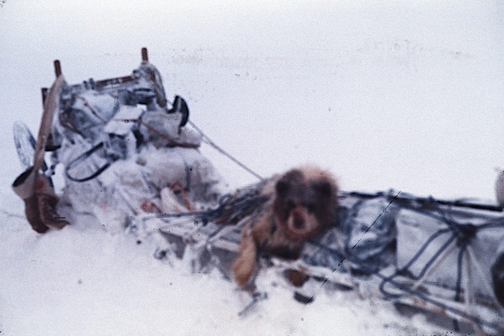
Mercury, one of my back pair, then decided to make himself better known to the one bitch in my team, Penny, who was on heat. This attracted the attention of the other dogs and a brief scrap started. It stopped pretty quickly but I then realised that there was a lot of blood around. Blood was spouting from Mercury like a small fountain. There was a wound just below the eye and it was clear that an artery of some sort had been punctured. Blood was pouring out in jets up to 6” high. It was clear something had to be done quickly as Mercury would not have survived for long with that sort of blood loss. I was travelling with Paul, the radio operator, who was on a short break so I got him to put his hand over the wound whilst I got out the medical kit and looked for the suture set. I found the needle and thread but the problem was that the temperature that day was -18 deg and manky (low cloud). It was not possible to do any needle work with gloves on so I had to take them off. Because of the temperature I could not work for more than 30 seconds or so at a time before I had to put my gloves back on and warm my hands up. Paul was holding Mercury down and my diary recalls that it was ‘a cold and bloody business’. After a considerable time I managed to get four stitches into the wound and stop the bleeding. There was blood on our clothing and the snow and it appeared that there had been some sort of massacre. Mercury was completely unfazed by the whole experience and had put up little or no resistance to a very amateur vet sticking a needle in just below his eye.
We then strapped Mercury onto the sledge as I was not sure what condition he was in and Paul sat on the sledge with him as we made our way back to the camp. I took several photographs of the final scene but from recollection I was so cold and my fingers were so frozen that I was unable to focus the camera and all the photographs were out of focus. Needless to say Mercury was fine after his ordeal and the next day pulled as well as he always did.
Roger Scott, Surveyor, 1973 & 1974
June 5th – Another Near Miss on Sodabread – Steve Wormald
With most teams having arrived back two days earlier, on June 5th a message was received at Stonington, via Sledge Zulu traveling on Adelaide Island, that Stonington’s Sledge Lima – John Yates, Surveyor with the Picts, and Dave Burkitt, GA with the Admirals, had traveled that morning on the Plateau to Sodabread, after a lie-up, and had encountered heavy sastrugi. They had been trying to get in touch with us at Stonington, with no success, to advise us that an accident had occurred, and that they had camped in The Amphitheatre, with Dave in some pain, and his sledge having lost its brake and both handlebars.
All the remaining Fids at Stonington worked all evening and into the late night to prepare for a run up the NE Glacier to Sodabread, and in the morning, Sledge Delta (Pete Butler with the Spartans and Bob Bostelmann (Vet – closest we could get to a Doctor) with the Gaels), and Sledge Bravo (Neil McAllister and the Debs, Steve Wormald and the Terrors), left Base early with the aim of meeting Sledge Lima at the foot of Sodabread, or if possible, sledge up to The Amphitheatre and avoid Dave having to sledge down. As we arrived at the foot of Sodabread, we saw the wondrous sight of the Picts and Admirals careering down the final slope! Dave takes up the story….
My Introduction to Dog Sledging – Dave Burkitt
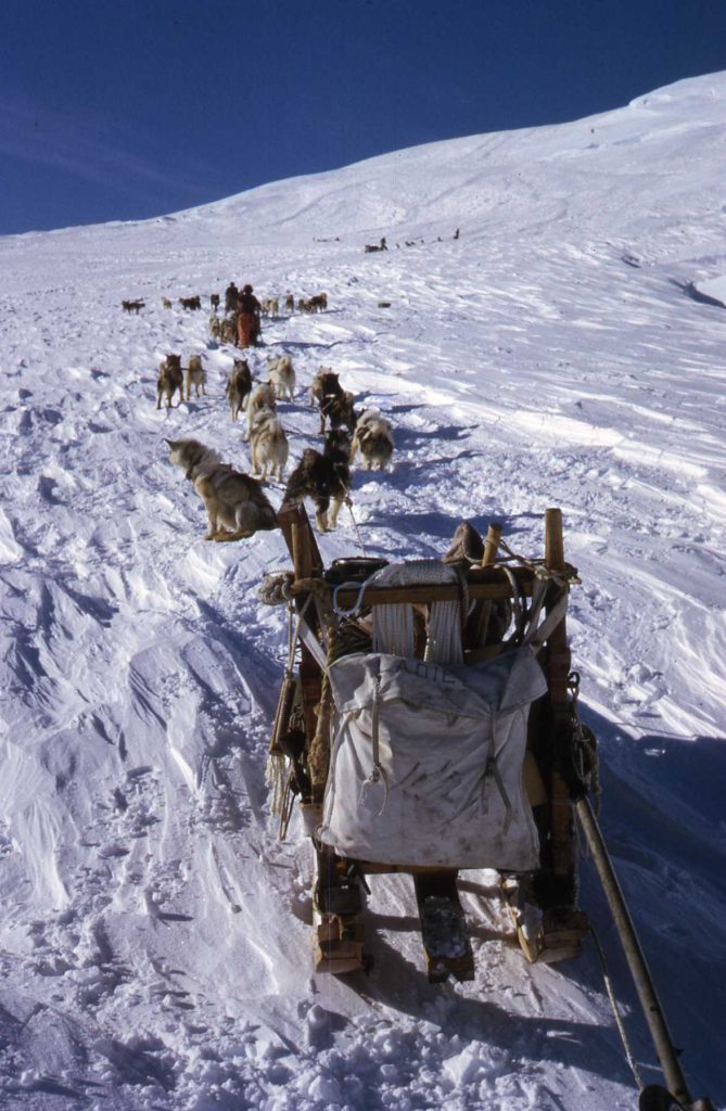
On the 23rd of April, 1973, eight teams set out from Stonington in an impressive looking convoy up the N.E Glacier. For half of the drivers it was their first taste of Antarctic dog sledging, for all of us it proved to be a memorable one.
It was Autumn, the days were getting shorter and the weather more unsettled, long periods of temperatures in the minus 20’s, whiteout and drifting snow from the strong winds which constantly blew down off the plateau. The work to be done was geology, geophysics and for four of us , to tie in the final angles and measurements of the mapping survey.
All of us spent the first period of 14 days to the north of the N.E. Glacier, the route which took us from Stonington Island and eventually to reach the Plateau via the Sodabread route. The surveyors during this time managed to get one day when the wind and snow eased sufficiently to allow us to work – the rest of the time was spent travelling and lying up waiting.
Midwinter 1973
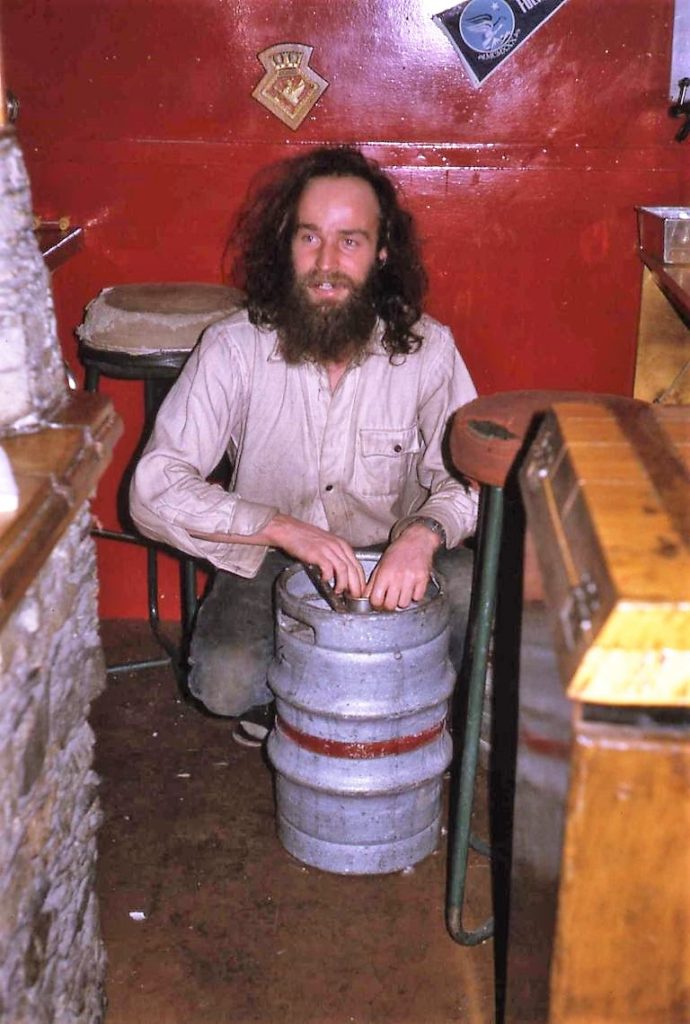

Buried in the Snow – Eric Lawther
A winter surveying trip had been planned to attempt to fill in a few remaining gaps in the local area with about 6 survey stations requiring distances and angles measured. Two 3-man units, each with their own dog teams, left Stonington base only a few days after mid-winter on the 10th July.
Sledge Delta; John Yates with the Picts, myself with the Huns, Chris Walker (Twig) with the Guards, and Sledge Echo; Roger Scott (surveyor) with the Vikings, Neil MacAllister with the Debs, Malky Macrae with the Players.
Since mid-winter the weather on base had been very cold, mostly around -36C but relatively gale free, marvellous in fact.
As soon as we started travelling the weather turned for the worse; poor visibility, whiteout and deep soft snow. After a few days of better weather we had our first glimpse of the sun for two months when we reached Sunset Col at the head of Todd Glacier.
A Fid without a Camera!
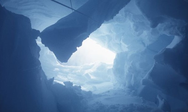
8th January 1974 – 1315 hrs. During the summer survey programme we were travelling north up the western side of the peninsula and had just crossed from the Seller Glacier to the Airy Glacier at around 69º 15’ south. My diary records that we had slept through our morning alarm (a bad omen?) but it was a fine day with good sledging surfaces. I was leading with the Vikings but as we moved across onto the side of the Seller Glacier the surface deteriorated and became very uneven and lumpy. This is not easy to travel over wearing skis so I had taken them off, stowed them on top of the sledge and continued on foot alongside the sledge.
Earth Sciences
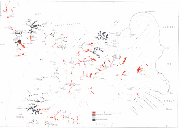
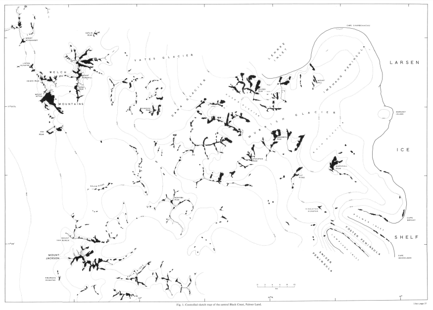
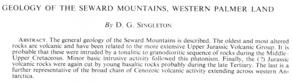
Read On or Download the Report…..
The Huns – Eric Lawther
I was lucky enough to overwinter as GA at Stonington in 1973 with 15 other FIDS. The ‘Huns’ were my team.
Initial trials and tribulations included trying to create a team from a bit of paper which showed a list of 15 or 16 dogs tethered on a span on the glacier at the top of the ramp. There was no personal hand-over, the outgoing dog driver having left some weeks before I arrived. Going down the ramp empty onto the island for the first time with dogs that had not been exercised for five weeks was horrific; suffice to say that I survived the first half of the journey down to Base with the sledge on its side and me hanging on somehow, quite determined not to let go. Oh the joys of sledging!
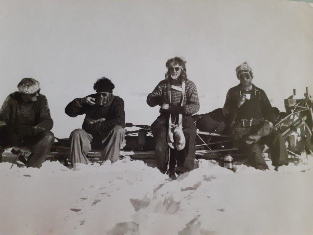
However, with 400 miles of local sledging and a short break over Midwinter’s Day we were ready in all respects for the long summer season ahead of us. I was lucky, boy was I lucky; I sledged as far South as Mount Jackson on a field geophysics programme extending to over five months, sledging 1200 miles in great company.
By the end of the season, on several occasions, without my having to command, my clever dogs would “park” my sledge alongside the other team, with the correct spacing for the pitching of the tent.
I was indeed very, very lucky for it was the next year that all the field work using dogs was to end. The ramp from Stonington to the glacier has now gone. Base E hut was closed and the dog era for all the main field work virtually ended.
Eric Lawther, Stonington – GA – 1973 – Twenty years ago (now almost fifty!) and I still miss my team.
In Awe of Pilots – Dave Singleton
Dave Rowley asked the question on this website (In Awe of FIDS story – Captain Dave Rowley) “How did we think of them? “ So, casting my mind back almost 50 years here are my thoughts and feelings. Think I actually flew in one or other of the Twin Otters about 5 times. In addition, I did have some ground contact when they supplied us in the field. Preparing field airstrips and assessing local weather for flying was all part of the job. So, here are one or two memories of meeting Dave Rowley and Bert Conchie – our pilots for the two years.
Memory 1 – First Flight 1972
When I arrived at Stonington in 1972 I had never been inside a plane let alone flown in one. So, at that time I was a bit apprehensive about flying and the pilots initially were the last thing on my mind.
What worried me was that in previous years there had been a number of incidents and crashes.
Life on Stonington Base – Dave Singleton
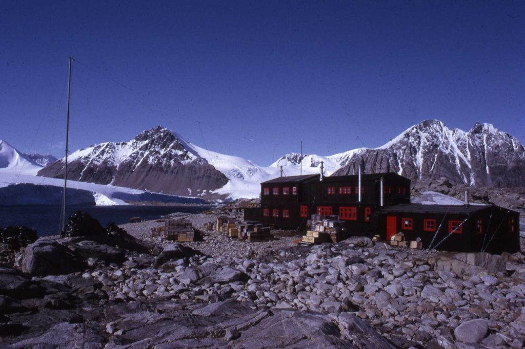
For about 9 months of each of the 2 years I was at Stonington I lived in a tent. It was from this primitive but adequate base that all our field work (geology, geophysics and surveying) took place. The remaining 3 months of each year covered the winter period when the light faded and also the relief period at the end of the summer work programmes when the ships arrived.
This is my illustrated record of what happened during those 3 months. The images paint a picture of what life was like at our base during 1972 and 1973. Our home was effectively a large double skinned insulated wooden shed, big enough to sleep 16/17 fids. At the back it was surrounded by various stock piles of food, coal, sledge rations etc. The front looked out towards Neny Island and Marguerite Bay. A weather station sat at the high point close to the base and the other side of the island was taken up by old and derelict buildings left from previous American and British expeditions. Some were still used as a workshop, tent and seal store.
Looking back now it is interesting to see by 21st Century standards how basic life was.
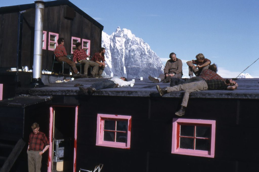
“The Vets Corner” –
Finding A Little Bit of Marguerite Bay History
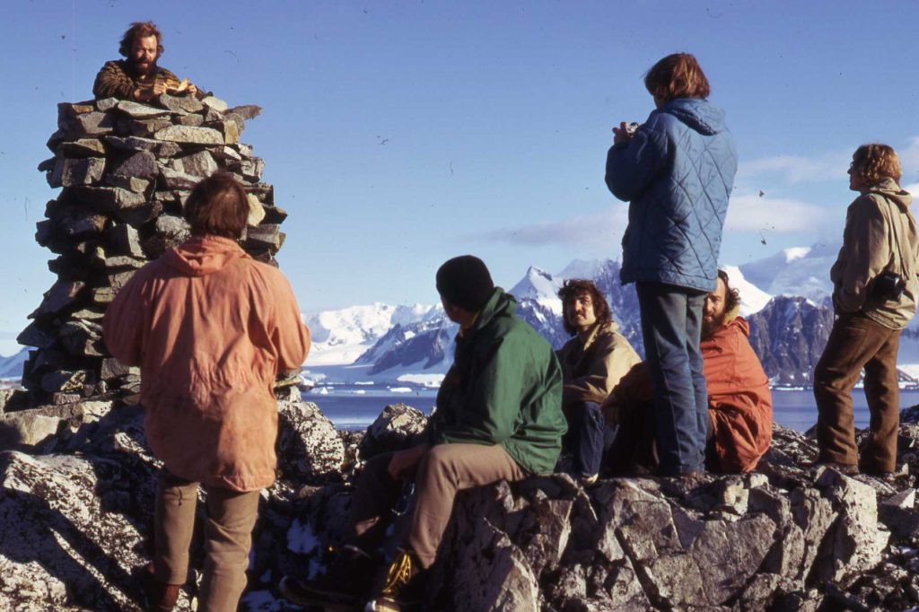
In April, 1974, the “Bransfield” visited Rothera Point when leaving Marguerite Bay on the last task of the season, to review the possibilities, from the relief ships’ point of view, of Rothera Point becoming the next BAS Air Support Base. Outgoing Fids went ashore to stretch their legs, and noticed this cairn, and the note below, signed by John Rothera, Surveyor in 1957.
John Rothera surveyed much of the Fjords area while based at Horseshoe Island (Base Y) in 1957, and Detaille Island (Base W) in 1958. John was accompanied on this trip by Len Maloney (Met.) at Horseshoe.
See John’s contribution to this website here.
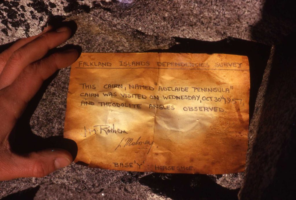
(Photo: Dave Singleton)
See John Rothera’s contribution to this website here.
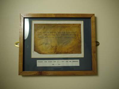
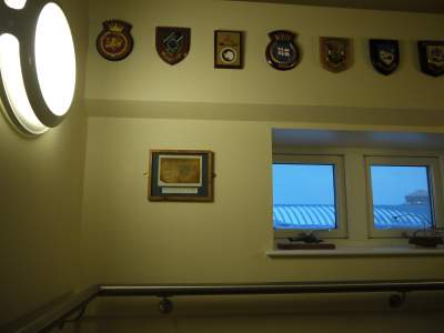
With a note on the backing sheet ‘Recovered from Rothera Point by a party from RRS Bransfield 2 April 1974, the framed note is now (2013) on the stairwell of New Bransfield House, Rothera Station
The Telex of Doom
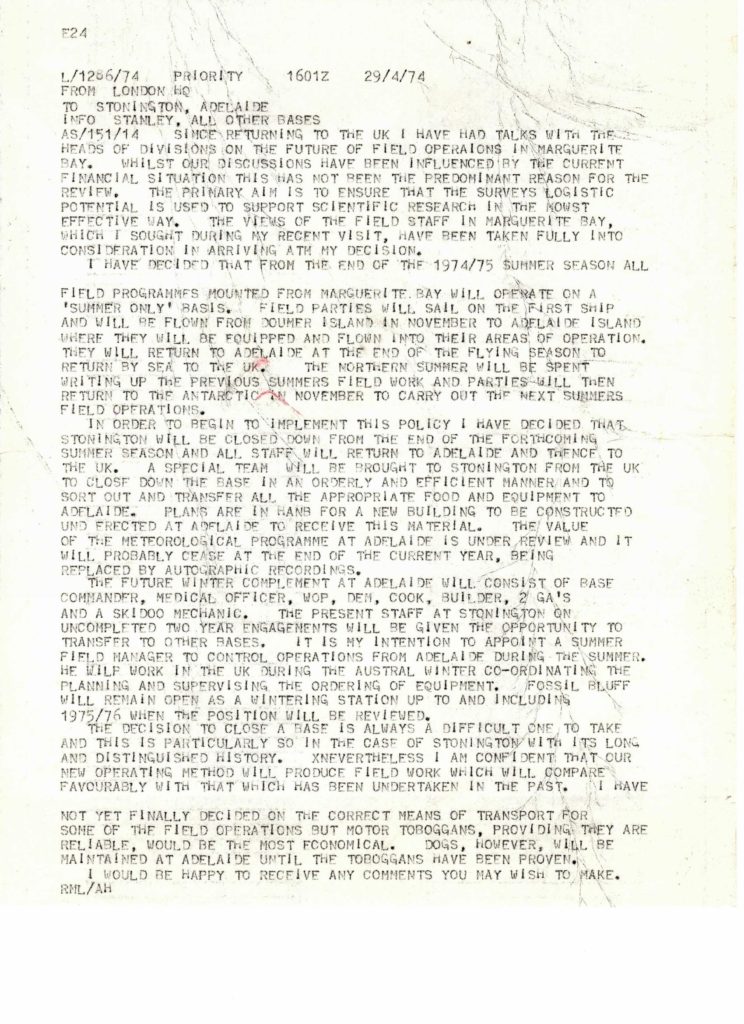
1974
Base Commander – Graham Wright
| Anckorn, J.F. (Fergy) | Geologist |
| Barrett, R.G. (Richard) | Surveyor |
| Care, B.W. (Bernie) | Geologist |
| Edwards, C.W. (Chris) | Geologist |
| Gannon, A.E. (Tony) | Builder |
| Holden, G.A. (Dog) | GA |
| Kirby, P. (Paul) | Radio Operator |
| Knott, C.E. (Chris) | GA |
| Scott, R.J. (Roger) | Surveyor |
| Wellington, S.R. (Steve) | DEM |
| Wright, G.K. (Graham Wright) | BC |
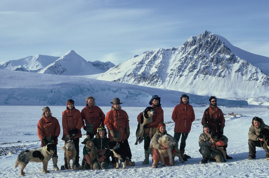
Kneeling: Richard Barrett, Roger Scott, Chris Knott, Chris Edwards (Photo: Roger Scott)
(Submitted by Mick Pawley and Malky Macrae)
Culinary Art at Stonington – 1973-74 – Roger Scott
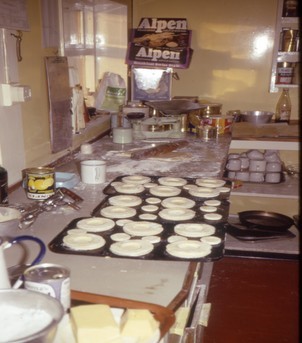
All FIDS at Stonington had to take their turn a rota basis cooking for the whole base. One day cooking was followed by one day gash (cleaning the base, keeping fires going, washing up etc) the frequency depending on how many were on the base. There were certainly different attitudes to the day cooking. Some would essentially ‘grin and bear it’ not being enthusiastic with anything to do with a kitchen. Others would welcome the day with more enthusiasm and get out the limited range of cookery books to see what they could do. The only cooking I had done before was catering for myself or occasionally two in a bedsit at University. Hardly preparation for cooking for 14 hungry men on a coal fired AGA.
And So to The LAST Stonington Midwinter, 1974
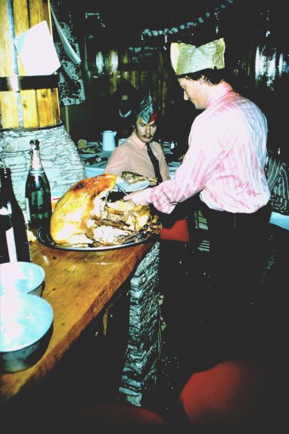
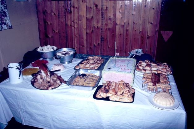
Topographic Survey – Scott and Barrett at Stonington
At the end of August 1974 a traverse with aircraft support was run out from the Plateau along the Joerg Peninsula (68 12′ S, 65 11′ W) to Three Slice Nunatak (where Fuchs and Adie’s party traveling south from Hope Bay had met the Stonington party in 1947).
After the Three Slice Nunatak project the survey parties were flown south to Buttress Nunatak at 71 45’S on the east side of King George VI Sound )some 20 miles south of Fossil Bluff to start the major task of establishing a survey framework and mapping across the southerly part of Palmer Land Peninsula between 72S and 73S – an area that no one had travelled before and which appeared to have few nunatuks in the middle of it. A tellurometer traverse was observed down the edge of the Sound and then across the Plateau to incorporate three U.S. stations at about 73S, and with vital aicraft support, a traverse was then observed up the East Coast to be linked to the surveys done in 1972. This work represented the final work based out of Stonington, which was closed in 1975.
Air Supported Survey from Stonington – Roger Scott
Each year the survey team always relied on the support from the two Twin Otters for help with the summer survey. It speeded up the survey many times over compared to sledge travel between stations and more importantly it enabled lines to be measured that could either be difficult or maybe impossible to measure using surface travel. This year was no different.
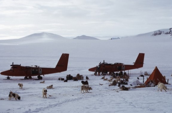
Some air support had been provided near the start of the summer season when the survey teams were working over on the east coast in the area of Three Slice Nunatak however the main support was required to measure survey lines on the east coast of the peninsular between 72° and 73°. For the integrity of the survey it was important to get a traverse up the east coast from a US station, Aileen, on the plateau to tie in with a previously established station, Hotel, just on the north side of the Hilton Inlet at 72°.
USAS Territorial Claim Note
During October 1974, Sledge Lima, while working from 3-Slice Nunatak on the Larsen Ice Shelf, found a territorial claim by the US, made by Darlington, Hilton and Knowles from the Ronne Expedition (R.A.R.E)
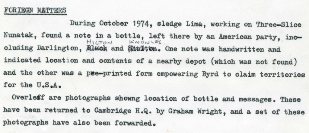
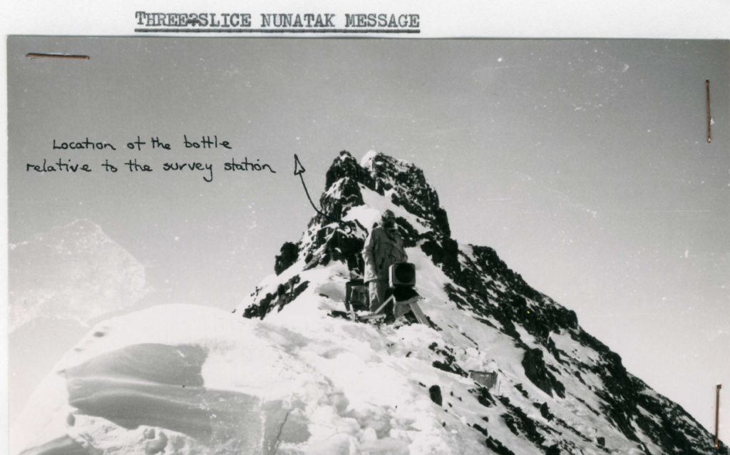
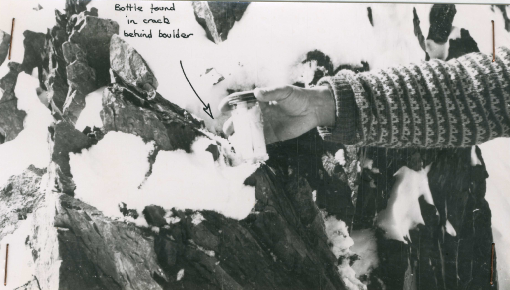
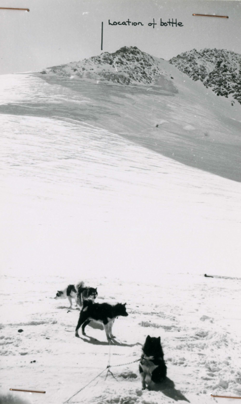
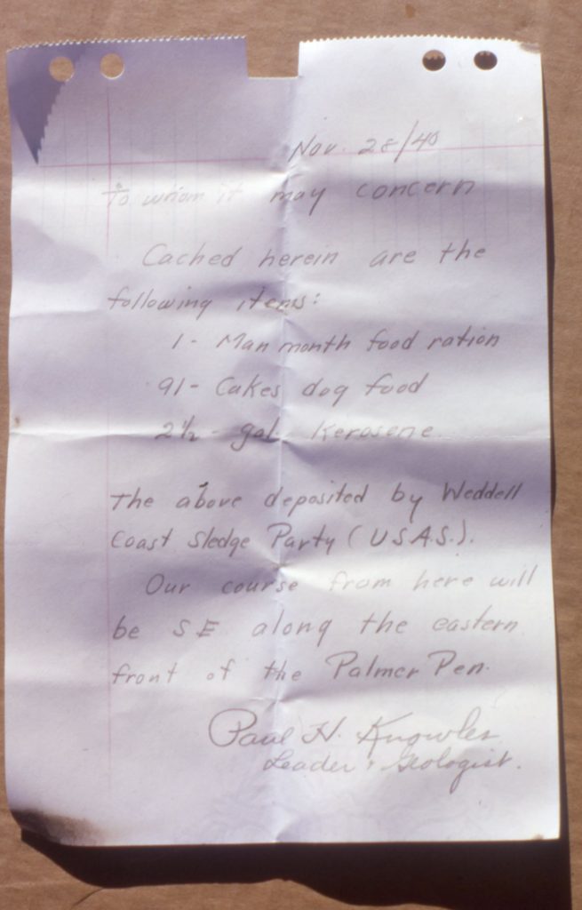
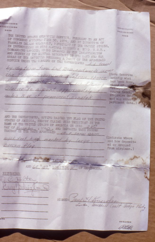
The Capture of Kovik – Roger Scott
Most of this story is taken directly from my diary and with contributions from Dog Holden.
In late October 1974 two survey teams and a geological party met up at the 3 Slice Nunatak depot, on the east side of the peninsular, at almost the same latitude as Stonington. One survey team of Graham Wright and Roger Scott had already arrived at the depot to join Fergy Anckorn and Bernie Care, both geologists. When the other survey team of Dog Holden and Richard Barrett arrived there was a loose dog, Kovik, running with the team. In fact, Kovik had ‘escaped’ earlier in the day when Dog and Richard were still at Cape Freeman having just measured a survey line. Dog was moving him from the night span to the main trace for travelling and got his unclip-clip sequence wrong. There was a brief moment when he was not clipped into anything. He looked up into Dog’s face and must have seen the look of horror as he realised what Dog had done (or not done), and was away like a shot!
As they sledged towards the rendezvous at 3-Slice that day Kovik ran in his place in the team but was not on the trace.
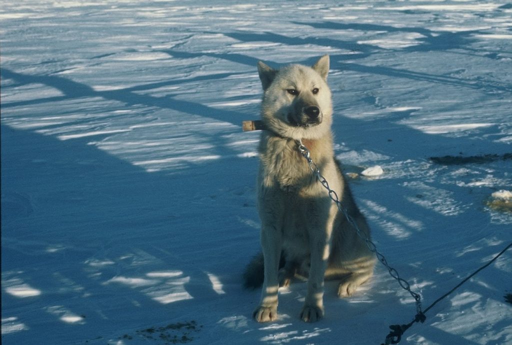
After the arrival at 3-Slice a method was devised to catch the errant dog. It is almost impossible to catch a dog such as Kovik who does not want to be caught so other ways must be tried. The main issue of having a dog loose is that he upsets all the other dogs. It is a case of ‘Look Boss he’s off and running around so why can’t we be off as well?’ So a pit was dug, covered with a Space Blanket then a light covering of snow and a piece of nutty (Husky dog food) placed into the middle of the blanket. Of course, Kovik had sat and watched all this preparation so didn’t go anywhere near the “trap” but instead nicked some food off one of the bitches.
The Old and the New – Chris Edwards and Jonathan Walton
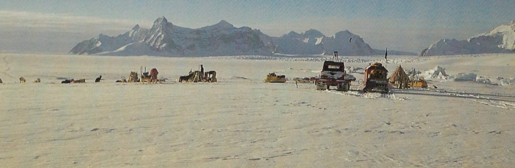
The Old – The Last Great Dog Journey from Stonington – Chris Edwards
The story really begins at Stonington at the start of the 1974-5 season with the departure of 8 sledges on the 29th August 1974 of the field parties of surveyors, geologists and geophysicists. It also marked the beginning of the end for Base E and also for dog sledging in Antarctica. My diary entry for the 28th reads “…:lunch then Doom! Had to put down 8 dogs – Rona, Nog, Zonda, Dianne, Belle, Rocky, Gareth and Castro.
However, things went smoothly and the whole nasty affair was over by smoko….. Not a good day – feeling very sad”.Many of these dogs I had had in my team and, as the doggy man, knew them all intimately. They were “surplus to requirements” in the overall scheme and it was a shameful, brutal thing to have to do.
At 0940 on the 29th, after a last poignant look around, I made my way to the dog spans and, with the other seven teams departing ahead of me, left Stonington, my home for the previous two years, for ever.
The New – A Historic Meeting – Jonathan Walton
In the 1960’s, small motorised vehicles were appearing on the various bases in Marguerite Bay. Scorned by most of the husky brigade at Stonington for (quite rightly) not being reliable enough for the unsupported long distance travelling that constituted most of the field work at that time.
However, Fossil Bluff, that tiny outpost of humanity away from the coast on George VI Ice Shelf did not have dogs – they relied on the 3 Muskeg tractors (named Blodwen, Aphrodite and Fred – don’t ask me why, I didn’t name them!!) and one or two rather clanky and unpredictable FoxTrac motor toboggans. Between these vehicles quite a bit of glaciological work was achieved on and around the ice shelf. By the early 1970’s the Fox Trac had been replaced by 399cc “Alpine” skidoos and later by some “Valmont” 440cc skidoos. By the time I arrived in 1973, the 4 of us (Jim Bishop, Rog Tindley, Graham Tourney and your scribe Jonathan Walton) had in our fleet a total of 5 skidoos and 3 Muskeg tractors. Our Mechanic for the 1974 winter was Roger Tindley who, with the help of a newly built and comparatively spacious and warm garage had got all 3 muskegs running (2 of them with major rebuilds) and the skidoos serviced regularly and becoming ever more reliable. Indeed, in March/April May 1974 the 4 of us had completed an unsupported trip of around 400miles to the seaward side of the Bach Ice shelf on the West Coast of Alexander Island – the first time that skidoos had been used within BAS for a journey like this. That trip is described elsewhere but we had proved that linked skidoos could operate relatively safely in difficult terrain. We finally got back to Fossil Bluff on 24th May, well after the sun had left for the winter, having had a week of temperatures around -45C.
However, that is not relevant to this tale – thankfully travelling up and down George VI ice shelf is very straightforward and pretty safe so single skidoo units were not uncommon.
The Final Dog Days of Sledge Romeo – Bernie Care
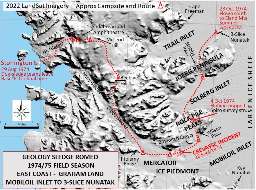
Eight BAS sledgers gathered in the Survey/GA office at Base E early on the morning of 29 Aug 1974 at the start of what was to be the final spring and summer field seasons on the Antarctic Peninsula for dog-team supported scientific parties. That past winter we had been informed by BAS management that Stonington Island Base would close at the end of the 1975 summer work season. Future science operations on the Peninsula would continue during the summer only, using skidoos for transport, with scientific personnel returning to Cambridge for the northern summer months to work up results and formulate plans for upcoming seasons. At 8am, after Tony Gannon returned from a favorable skidoo recce of conditions at the airstrip, all eight of us proceeded up to the dog spans with our P-bags:
The Results – Chris Edwards’ Bulletin
Read On or Download the Bulletin
My Story – Adrian Almond
Prompted by Chris Edwards’ report), this is my personal story of the event.
My last sledging day was a day out round Bristly Peaks from the depot on the Fleming Glacier. It was a lovely day, not perfect, a little too much wind, but great surfaces. The next day FAQ, pilot Bert, flew us to Adelaide with the 5 remaining dogs from the 2 teams.
When we were told that the dogs were to be shot at the close of the journey my initial reaction was to say: “Someone else can do that”. The arrangement that we were told on a sched was that if we did not do our own then someone would came out with the plane and do it in situ. The implication, at least, in the conversation was that it would be Steve Wormald.
The Sledgers Bar – Chris Edwards
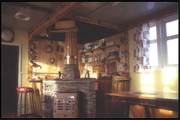
Chris Edwards – General Dog Report – Stonington – 1974-75
Transfers
Scott Base (N.Z.) requested two young animals for breeding purposes. On their arrival at Scott Base via VP-FAQ/Bert Conchie they were virtually put straight into the field! Shortly after ANTHE produced a litter of four bitches and three dogs.
The animals sent were: ANTHE T/0616/73 bitch and STUART E/4208/74 dog.
Dogs already transferred to Scott Base from Halley Bay (ex Deception) in about 1968 were LADY and TIFFY. Lady, 9 years old is still at Scott. No info. re. Tiffy.
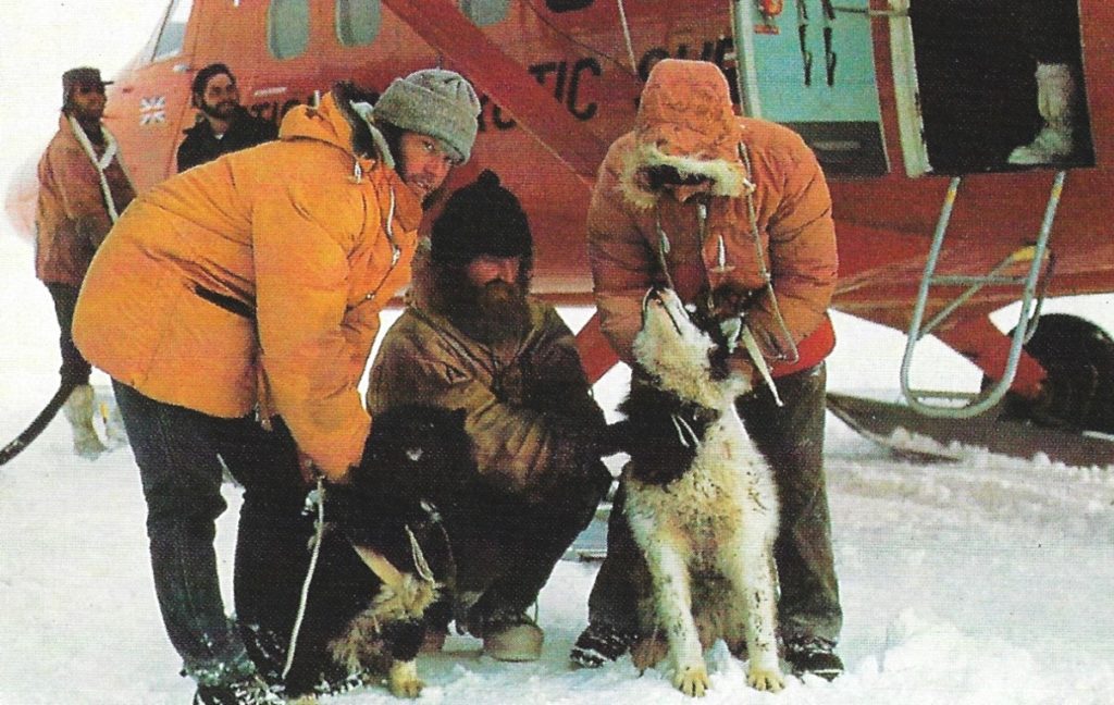
(Photo: Nick Round-Turner, Hedgehog House, New Zealand, from “Of Dogs and Men”)
To expand on this brief entry Bert Conchie was one of the BAS Twin Otter pilots (VP-FAQ being the aircraft call sign) and he was making the flight across to Scott Base from Adelaide because the aircraft was to be used as part of collaboration in the Ross Ice Shelf Project which included a series of radar echo sounding/sub-ice profiling. The opportunity was used to supplement the breeding stock at Scott Base.
It is uncertain when and by whom Anthe was mated. Her name makes more sense when combined with the other litter siblings: Lady, Anthe, Tramp. (Not the same Lady as referred to at Scott Base.)
The dog Stuart (one of a litter of three: Tom 111, Ella, and Stuart) was named after Stuart Lawrence, Master of RRS Bransfield, Ella was his wife, and Tom (Woodfield) was Master of RRS John Biscoe.
I could offer titbits here and there, about epic “this and that” but for me the saddest part of the whole situation was the culling of the bulk of the dogs which happened following the decision to close Stonington at the end of the 74-75 season and to introduce mechanical dogs thereafter. Have you ever tried to grease and service a skidoo with gloved hands, in the field, in -10degC or worse?
SIMBA, THE INCREDIBLE DESTINY OF AN ANTARCTIC DOG
(Translated from the original in Spanish, as best we could. This Story is from Miguel Acosta, Fuerza Area Argentina, mechanic, part of the crew of TA33 and TA05 planes, at the command of Mario L. Olezza at Matienzo. The story was sent to and submitted by Dog Holden. We will leave it to Fids to surely comment as to the likelihood of where Simba came from; and if able, to tell more of the facts of the story. So far, we have determined there was a Simba).
Read On….
I have been reading Andrew Taylor’s Two years below the Horn about Operation Tabarin, page 213
“We were each also supplied with a bag containing medical supplies, such as bandages and dressings, a set of surgical instruments and a good supply of Number Nines, which were never required.”
Does anyone know what Number Nines are? or is it too indelicate to ask?