Header Photo: Horseshoe Island and Base from the Summit of Mt. Verne (Photo: Dave Matthews)
Returning to the Work Area in the northern Fjords

(Photo: Dave Matthews)
After three weeks on base to prepare for a long season, build sledges etc, Jim and I set off for Horseshoe again, Jim with his team the “Ladies” and myself with the “Terrors”, and by now on slightly thicker sea ice. Jim’s plan (to avoid the risk of getting caught by unreliable sea ice on such a tricky journey, where only the inhospitable Camp Point afforded a possible refuge between Horseshoe and Stonington), was to recce an escape route from northern Marguerite Bay (Blind Bay) via the Plateau.

(Photo: Dave Matthews)
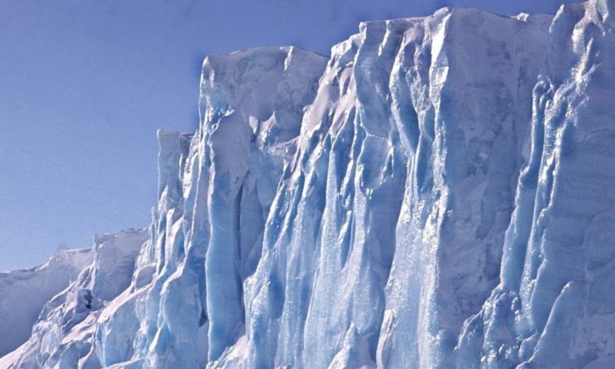
This meant laying depots up the Forel and Finsterwalder Glaciers from Blind Bay, which proved far from straightforward and was very time consuming, due partly to poor weather (including a record 16 day lie-up) and also avalanche dangers. The Forel Glacier was eventually “conquered” and the latter depot was eventually flown in, much later, to the upper Finsterwalder by the one remaining serviceable Otter.
With all the to-ing and fro-ing of building depots and so on, Jim’s great skiing skills were a big bonus and made me feel thoroughly inadequate, especially on the old wooden Fids skis. He could cheerfully ski down a steep slope with a food box on one shoulder and no sticks. That really pissed me off and I resolved to learn to do better.

up the left hand skyline
(Photo: Dave Matthews)
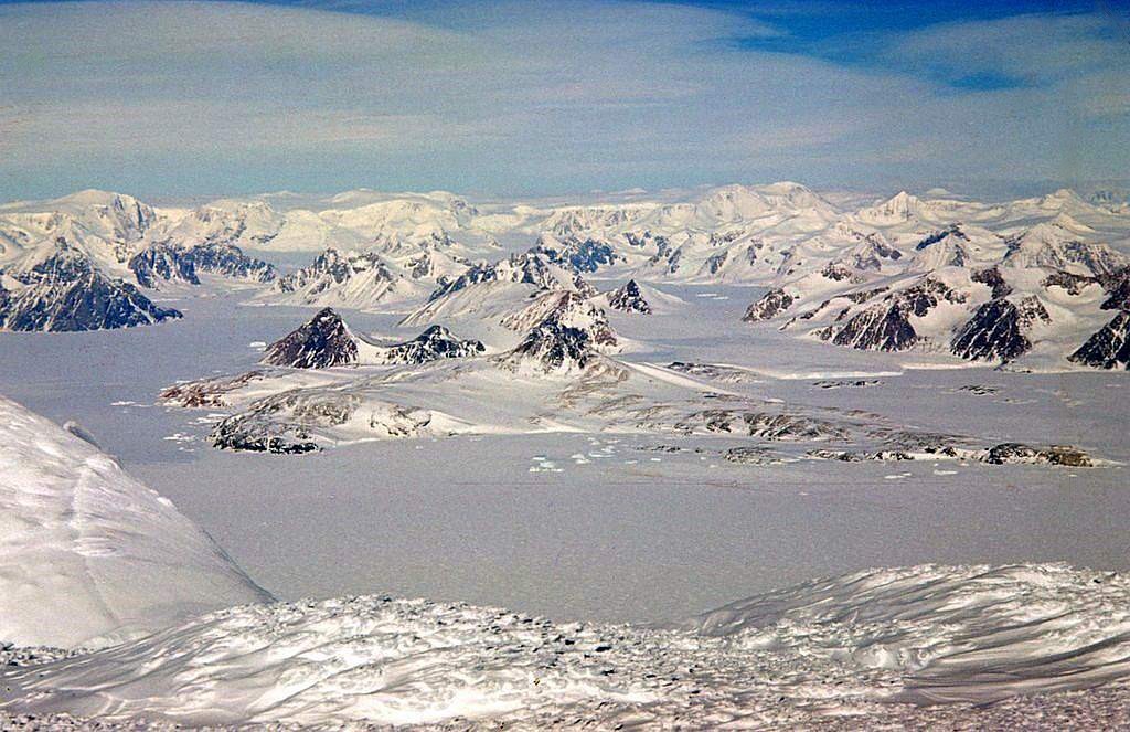
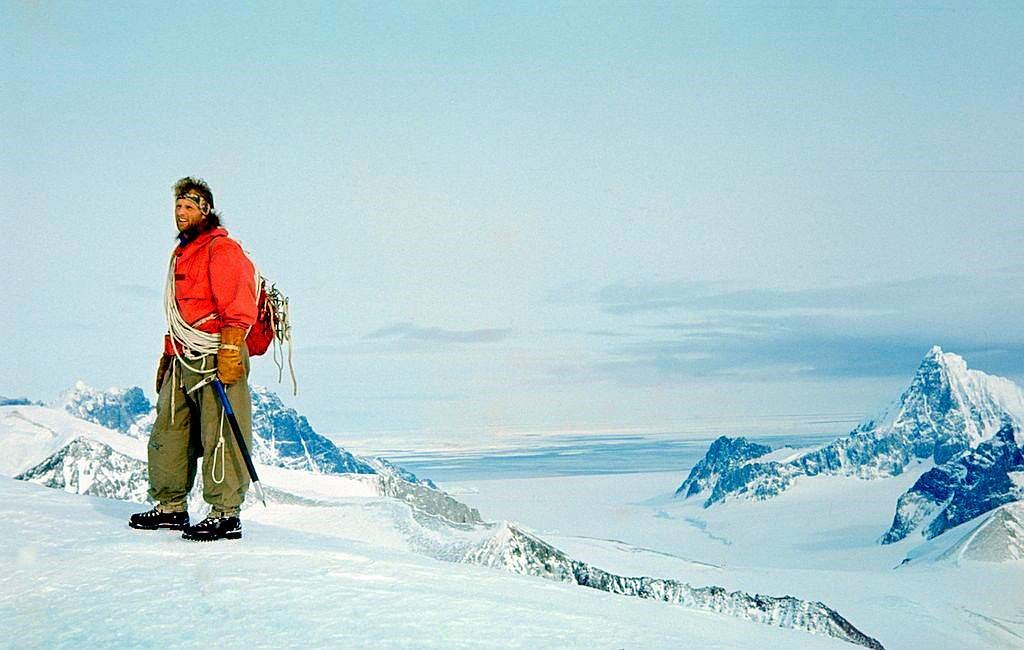
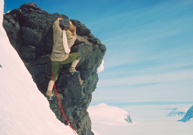
The plans worked out well and we were able to progress to doing field work on and around Pourquoi Pas Island by later in September. This included an opportunity to make a First Ascent of Mount Verne, the prominent peak in front of the old Base Y, which Jim led with casual skill. Sadly a first ascent was wrongly credited, in the Damien Gildea book, to ship-based tourists some years later, when in fact it should have read “Jim Steen and Dave Matthews on Wednesday 3rd November 1965, via the North Ridge”.
Eventually it came time to retreat from the sea ice; we had already had one scare when we both broke through unexpectedly thin ice in the Narrows between Pourquoi Pas and Blaiklock Islands, presumably where under ice currents had eroded it to almost nothing. Also a survey party had become marooned on Detaille Island (Base W) when all the ice blew out of Lallemand Fjord, and there was some discussion of possibly picking them up, but to get them to nearby Prospect Point (Base J) from Detaille Island would have been a challenge and the idea was dropped.
We managed the ascent of the Forel and Finsterwalder Glaciers up the route we had already scouted. With adequate supplies, Jim decided that we could then afford to sledge north from the head of the Finsterwalder along the Plateau towards where Wally Herbert had reached his furthest south on the Plateau in 1956-57.
We reached Slessor Peak which we climbed and collected volcanic rock samples, enjoying stupendous views out to the west, but by that time, a Detaille Island rescue was no longer a plan. The “Shack” had already done it. In spite of poor and intermittent radio contact, we gathered that the “Biscoe” had reached Stonington early for the annual relief, so decided that it was time for us to return south although I think Jim would have been quite happy to carry on up to the Catwalk and beyond. He insisted that we carry all our surplus supplies back south with us rather than waste them by dumping them, so it was heavy going but we were by now fit and used to adjusting loads between the two sledges to get maximum efficiency along the undulating plateau. Jim had to put down one of his old dogs who could no longer keep up and it was the only time I ever saw him in tears as he returned to the tent with a ‘smoking gun’.
We had both developed a tremendous bond with our dogs after six months of sledging.
At the Plateau Edge, we added our surplus supplies to the depot there before carrying on down Northeast Glacier under the threat of deteriorating weather, with Jim leading the way towards the fearsome Sodabread route so well known to Plateau sledge parties from Stonington.
Dave Matthews – Geologist – Stonington – 1965 & 1966