An Antarctic Holiday – Manhauling – Don Atkinson
(Originally written for the Fell & Rock Clmbing Club, and supplied by Rich Atkinson, Don’s nephew)
Travel in the Antarctic need not always be a grim fight or a monotonous routine. There are times in the spring, for instance, when skies are cloudless and blue for days on end and no breath of Wind stirs the air; one can ski almost effortlessly along with the sledge on superlative snow surfaces, and it is possible—even preferable—to travel in shirt sleeves, although the thermometer may insist that there are more than twelve degrees of frost. It is on days like these that the sensationally beautiful islands of multi-coloured rock and ice appear at their best when viewed across the intervening miles of frozen sea. The impregnable barrier of ice cliffs that flanks more than nine-tenths of the coastline of Antarctica, and the icebergs, still locked in the grasp of the sea ice, show off their incredible range of blues and greens. These ethereal colours illuminate the shadows in the depths of caves and fissures, and etch the outlines of towers, pinnacles and battlements of infinite variety and complexity, defying the memory to forget. Surely this carving of ice is the most wonderful of nature’s sculpture.
The departure of Malcolm, Cecil and myself on a five-day reconnaissance journey in early July was attended by the great promise that these conditions imply, even though this could scarcely be termed a spring journey. But, though the sun still lay a little below the horizon, we thought of this trip as our holiday from base routine and a welcome contrast to the sterner business of long sledge journeys.
Continuing from Horsehoe Page:
Fortunately we had some brawny assistance from the surveyor when man-handling the sledge up the steep ice slope opposite the base. Even so, it was a stiff pull to the top of the ridge, 500 feet high, which separated the base from Lystad Bay. As we went over the crest, a long howl of farewell drifted up to us from our thirty dogs at the base about a mile away. The mellow music of huskies will always be one of my most poignant memories of the Antarctic. Their concerted chorus of canine howls greets the rising moon or the return of the sun after a blizzard, bids farewell to a departing sledge and—long before it has been seen by humans—sings out a plaintive welcome to its return. This time they were sorrowful, of course, and singing of all the woes of the husky race because they had been left behind when there was sledging to be done. Dog-sledging, however, is not always the best method of travel in polar regions. Just two or three hours later we were lowering the sledge down a steep Ice wall which would have been impossible with dogs. I was thankful then, that on this trip at least, we were to be dependent on the power of our own feet.
This was the one breach in the ice cliff defences flanking the north side of Lystad bay. And difficult enough it was. The steep wall led down through a sort of labyrinth by the side of a rock nunatak cutting through the glacier snout. Once down this tortuous passage it was possible to step directly on to the sea ice. By the evening we had crossed the bay to make our first camp about two or three hundred feet up, at the foot of Lystarme Glacier.
Quite a formidable slope led to the icefield. I remember that the hauling up of half-loads the following morning was very strenuous work indeed. It is surprising just how long these manoeuvres take, and it was a shock to find that it was after midday before we had packed and were ready to move on.
The icefield itself was simple enough — just three or four hours of steady hauling up an even gradient of unbroken glacier. There were no crevasses, and only a few patches of sastrugi (wind erosion ridges) contrived to make us change our course from time to time. Plod, plod went our feet on hard wind-packed snow, the sledge following reluctantly on its three tight ropes. In the manner of most mountain summits the col was elusive and false crests appeared one after another to lure us on. But even the most strenuous and prolonged haul must eventually yield success; finally there were no more rises to surmount and we were the flat expanse of the col.
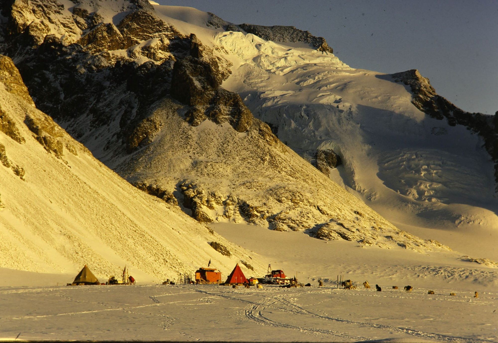
This place was to be our base camp and from here we hoped to climb as many of the island summits as possible. As we unlashed the load and pitched camp it certainly looked as though we should not be disappointed. On both sides of the glacier rose chains of peaks—not high to be sure, but of pleasing form, with lots of untouched ice and rock routes such as would gladden the most ardent pioneering spirit. Over the col a steep icefall led the eye in an uninterrupted sweep to the sea ice of Square Bay. The sky was clear, but the bay below had not seen the sun for the past two months and in the subdued light the sea ice lay flat and smooth as a billiard table.
Here and there a table iceberg raised its flat white top above the general flatness. A newly frozen lead connected the easternmost extremity of Horseshoe with a point on Broken Island— a dark winding ribbon across the intervening miles—reminding me vaguely of an arterial road. Over the leagues of ice rose the wall of the mainland supporting the Grahamland Plateau. Much of the credit for the great beauty of the Marguerite Bay area lies in the agreeable mixture of the two main ingredients of the Antarctic landscape—rock and ice. Though much of the wonderful colour of the rock was not showing at its best, even in the half light of the overall shadow we were still able to marvel at the form of the array of peaks and glaciers rising towards the Plateau. As the light failed and Malcolm cooked the dinner, Cecil and I disported ourselves on ski above the camp. Yes, it is possible to ski for pleasure quite often, and in this age of intercontinental rockets it is not fantastic to envisage such a place as a ski resort not too far distant in the future. The morning dawned as good, or better, than we could have wished, and ten o’clock saw us well above the camp on our way to the main range. A fairly easy route through a crevassed area above the icefall led very quickly to a gentle col separating a polished ice mound from the main group. From here two or three hundred feet of gently sloping smooth black ice led up to the foot of the final rock ridge. To a large extent the ice was overlaid by tongues of hard névé right up to the final fiftyfoot stretch before the rocks. Crampons were not enough on this steely surface, and a half hour’s step cutting was required before we could attain the rocks. We stepped on to the shattered ridge into the welcoming rays of the sun. What a grand instant that was. And a few minutes later, when we trod the summit, our happiness was complete.

We were doubly blessed. The base, a few miles away on the other side of the island, still lay in the shadow. It would have to wait another fortnight for the sun, but there seemed no need to worry unduly over that prospect and we lived then only for the moment.
The air was still, and each individual crystal of ice shone and sparkled as if for our benefit alone. We sat and lunched and photographed just as though this were the top of Helvellyn instead of a newly won and extremely lonely summit of an uninhabited continent. Eventually the photographic opportunities exhausted themselves and the thought occurred that we should perhaps move on. Tomorrow the weather might not be so kind. It would be best therefore to make the most of our heaven-sent chance to explore as much of the group as possible.
The ridge continued, a gently undulating highway, much like the ridge between Dale Head and Hindscarth in form. It was possible to move unroped provided we kept to the long ribbon of scree which led like a gravel path from the first saddle to the bulging ice cap of the next summit. All the way along, the eye could rove at will over glacier, ice sheet and rock ridge, right down to the ice cliff. This last intimidating wall may be an effective obstacle to physical access between land and sea, but the eye can clear it at a bound and cross the miles of sea ice to distant land where no one has set foot. Six or seven miles to the south lay Camp Point, marking the southern extremity of Square Bay. The bold rock ridge of serrated outline was supported by buttresses, 1,500 feet high, which fell so steeply to the sea as to bc almost devoid of glaciers and snow. Further south the rocky points of Cape Calmette and Red Rock Ridge jutted out also towards the Bellingshausen Sea. Both were equally bare of snow, and the latter, with its lovely descriptive name, conjured up visions of the huge Adélie penguin rookery which we knew would be starting the season s business in a few weeks’ time. Meanwhile, Red Rock Ridge pointed like a finger to the miles of ice which separated it from its summer population of penguins. The ice stretched apparently far beyond the serrated skyline of icebergs and immobilised pack ice, and certainly as far as Alexander Land, just faintly visible a hundred miles to the south.
The next summit after the ice cap had much rock showing through. Here and there small outcrops were evident and numerous boulders lay around embedded in the ice. This profusion of building material was significant because we had promised to build cairns for our surveyor’s triangulation scheme. We did not grudge him this cairn for was it not also ours? Our ridge led us finally to a narrow knife edge which, if anything, outclassed all the others as a view point. The last peak of the chain was not to be ours, as it seemed to involve about an hour on a fine rock aréte. It was an hour which we could not spare, for the light was already failing, and reluctantly we began to retrace our steps.
The return to the camp took us down to Lystarme Glacier via a steep icefall flanking the rock ridges of our first peak. The icefall was quite difficult enough in that state of twilight and more than one foot found its way into a crevasse. This would not have been too bad had not two legs of the same person fallen into the same crevasse. The victim was easily extricated, however, and we were soon down on the familiar and safe route up Lystarme Glacier.
We were a happy trio lying in our sleeping bags an hour or two later. Over our dinner—a mug of cocoa, biscuits and pemmican hash—we talked over the events of the day and tried to agree on names for the tops we had climbed. Now the business of naming mountains and other topographical features, like that of naming husky pups, generally led to prolonged argument and discussions of some considerable heat. But be that as it may, we were soon unanimous on the name for the peak with the cairn. It became Penitent Peak and, as far as I know, that is the name it bears now.
I will not dwell on the account of the following day’s climb. It was a less ambitious effort and not at all the summit that had been intended for that day. It was climbed as a sort of consolation prize after threats of bad weather had driven us off a more difficult neighbouring climb. Though only 2,000 feet high, it was a good peak, and as a recognition of its classical shape we named it provisionally and unimaginatively Matterhorn.
We should be expected back at base on the morrow and there seemed no good reason for extending the trip. On the contrary, the weather was now threatening, so, as it was still early in the afternoon, we decided to start down. Conditions were now very different. An overcast sky with a chill breeze ensured that we remained fully dressed and the stop for lunch was necessarily brief. A branch glacier funnelled an icy blast down to the junction place. Little ‘ drift devils ‘ which had played to and fro over the upper icefield, teasing us with their erratic wanderings, now gave way to a persistent veil of drift a few inches above the surface.
However, the weather apparently did not want these ominous warnings to be taken seriously, for lower down on the glacier the drift died away and progress again became a pleasure. The party had now arrived at the highest part of the glacier snout where the ice spills westwards to Lystad Bay and eastwards to Gendarme Bay. For the return journey we chose the eastward descent and the long haul round the north-east cape of the island via the sea ice.
I remembered a breach in the ice cliff which should afford access to the sea ice, but it soon became obvious that we could not reach it. As we travelled seawards, the surface became rougher and rougher until it was one complex maze of troughs and hummocks of black ice, and further progress was impossible. Slowly we retraced our steps to the even surface near the snout.
A short reconnaissance showed that at one point where the snout abutted against the north part Of the island there was a break in the ice cliff. Here the glacier ended in a steep slope down to the bed of a gentle trough not far above the sea. It seemed a practicable slope down which the sledge could be lowered, if only the rocks near the bottom could be avoided.
We resolved to try it.
It was almost dark by the time we had brought the sledge over and we were in a hurry to get down. Our haste in trying to get off the glacier before camping almost led to our undoing.
I descended to a ledge on the slope while the others started to lower the sledge towards me on a hundred feet of nylon rope. An ice-axe driven into a snowdrift served as a bollard at the top, and the rope was paid out round it, the principle being of course for the speed of the sledge’s descent to be checked by the friction of its rope round the ice-axe. What the pair at the top did not notice in the growing darkness was that the rope loop round the axe was steadily cutting its way down through the snowdrift. Inevitably it cut below the base of the axe, and before any of us suspected anything amiss, the rope had wrenched itself out of Malcolm’s hands and the laden sledge charged straight at me. I dodged to one side as it passed me, travelling at great speed, and made a futile dive for the tail rope. It was fortunate that I failed to catch the rope, for the sledge would certainly have taken me with it in its headlong course.
The sledge rushed on silently into the darkness.
Waiting helplessly for the rending crash that we felt sure must come when the outfit collided with the rock outcrops and boulders in the trough, I thought of the catastrophic results to food boxes, pots and pans, ski and, worst of all, my camera, which I treasured dearly. As the seconds dragged on, still with no sound from below, I dared to hope. Anxiously I cut my way down the ice. I walked carefully across the bed of the scoop and there, within thirty yards of the foot of the ice slope, the sledge stood tidily and on an even keel, its load undisturbed and intact. Miraculously it had passed within a few feet of two outcrops and, avoiding the deep eroded grooves further down the slope, it had run out over smooth hummocks to come to rest gently on the flat floor of the trough.
We had been spared the humiliation of having to explain away the loss of a sledge and equipment to our comrades at base, and I reflected that either a benevolent Deity was watching kindly over us, or that we were being reserved for a more spectacular fate than either starvation or exposure.
That was enough excitement for one day, so we camped forthwith.
The only thing to say about the rest of the journey home via the sea ice of Square Bay and Bourgeois Fiord is that it was a long, strenuous haul over bad surfaces. But what did that matter at the end of such a splendid and enjoyable Antarctic Holiday ?
Don Atkinson – DEM – Horsehoe Island – 1955 & 1956